Area Overview for PE32 1BW
Photos of PE32 1BW
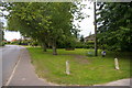
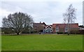
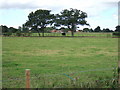
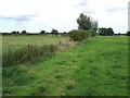
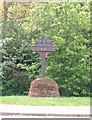
5 photos from this area
Area Information
Key information about the PE32 1BW including its size, population, and administrative classification.
- Area Type
- Postcode
- Area Size
- 46.5 hectares
- Population
- 1237
- Population Density
- 121 people/km²
House Prices in PE32 1BW
45
Properties
£204,786
Average Sold Price
£74,000
Lowest Price
£290,000
Highest Price
Showing 45 properties
| Address | Type | Beds | Baths | Last Sale Price | Last Sale Date | |
|---|---|---|---|---|---|---|
| The Brambles, 2A Vong Lane, Pott Row, PE32 1BW | Detached | 3 | 1 | £290,000 | May 2023 | |
| 8 Vong Lane, Pott Row, PE32 1BW | Semi-detached | 4 | 1 | £285,000 | Dec 2021 | |
| The Gables, 2B Vong Lane, Pott Row, PE32 1BW | house | 3 | - | £222,500 | Jun 2021 | |
| Chiquita, 48 Vong Lane, Pott Row, PE32 1BW | Bungalow | 3 | 1 | £230,000 | Aug 2019 | |
| Homefield, 25 Vong Lane, Pott Row, PE32 1BW | Bungalow | 3 | 1 | £255,000 | Aug 2019 | |
| 10 Vong Lane, Pott Row, PE32 1BW | Semi-detached | 3 | 1 | £235,000 | Apr 2019 | |
| Skylark, 46 Vong Lane, Pott Row, PE32 1BW | Bungalow | - | - | £250,000 | Aug 2016 | |
| 6 Vong Lane, Pott Row, PE32 1BW | Semi-detached | 3 | - | £162,500 | Sep 2015 | |
| 5A Vong Lane, Pott Row, PE32 1BW | Detached | 3 | 2 | £220,000 | Nov 2013 | |
| 17 Vong Lane, Pott Row, PE32 1BW | Bungalow | - | - | £158,000 | Oct 2012 |
Page 1 of 5
Energy Efficiency in PE32 1BW
Amenities
Schools
| Rank | School | Type | Entry gender | Ages |
|---|
Explore more schools in this area
Go to Schools tabDemographics
Household Size
Two person
most common
Accommodation Type
Houses
most common
Tenure
82
majority
Ethnic Group
White
most common
Religion
N/A
most common
Household Composition
N/A
most common
Age
47
median
Adults (30-64 years)
most common
Household Deprivation
N/A
with no deprivation
NS-SEC
31
in Lower managerial occupations
Explore more demographic insights in this area
Go to Demographics tabPlanning
Planning Constraints
- Flood RiskPremium
- Ramsar Wetland SitesPremium
- Area of Outstanding Natural BeautyPremium
- Protected Nature ReservePremium
- Protected WoodlandPremium