Area Overview for PE32 1AD
Photos of PE32 1AD
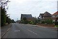
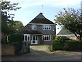
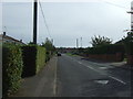
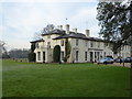
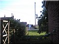
6 photos from this area
Area Information
Key information about the PE32 1AD including its size, population, and administrative classification.
- Area Type
- Postcode
- Area Size
- 32.2 hectares
- Population
- 1237
- Population Density
- 121 people/km²
House Prices in PE32 1AD
36
Properties
£230,817
Average Sold Price
£97,500
Lowest Price
£465,000
Highest Price
Showing 36 properties
| Address | Type | Beds | Baths | Last Sale Price | Last Sale Date | |
|---|---|---|---|---|---|---|
| 94 Lynn Road, Grimston, PE32 1AD | Bungalow | 3 | 2 | £465,000 | Aug 2023 | |
| 82 Lynn Road, Grimston, PE32 1AD | Semi-detached | 4 | 2 | £129,950 | Jul 2004 | |
| Jo-lyn, 70 Lynn Road, Grimston, PE32 1AD | Bungalow | 3 | - | £97,500 | Jan 2000 | |
| Maralinga, 65 Lynn Road, Grimston, PE32 1AD | Bungalow | 3 | 2 | - | - | |
| Shambles, 53 Lynn Road, Grimston, PE32 1AD | Bungalow | 3 | 1 | - | - | |
| Tiffanys, 77 Lynn Road, Grimston, PE32 1AD | Bungalow | 2 | 1 | - | - | |
| Fair View, 78 Lynn Road, Grimston, PE32 1AD | Semi-detached | 2 | 2 | - | - | |
| Cambrian, 57 Lynn Road, Grimston, PE32 1AD | Bungalow | 2 | 1 | - | - | |
| 61 Lynn Road, Grimston, PE32 1AD | Bungalow | 2 | 1 | - | - | |
| 74A Lynn Road, Grimston, PE32 1AD | Cottage | 2 | - | - | - |
Page 1 of 4
Energy Efficiency in PE32 1AD
Amenities
Schools
| Rank | School | Type | Entry gender | Ages |
|---|
Explore more schools in this area
Go to Schools tabDemographics
Household Size
Two person
most common
Accommodation Type
Houses
most common
Tenure
82
majority
Ethnic Group
White
most common
Religion
N/A
most common
Household Composition
N/A
most common
Age
47
median
Adults (30-64 years)
most common
Household Deprivation
N/A
with no deprivation
NS-SEC
31
in Lower managerial occupations
Explore more demographic insights in this area
Go to Demographics tabPlanning
Planning Constraints
- Flood RiskPremium
- Ramsar Wetland SitesPremium
- Area of Outstanding Natural BeautyPremium
- Protected Nature ReservePremium
- Protected WoodlandPremium