Area Overview for PE3 9UJ
Photos of PE3 9UJ
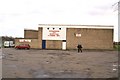
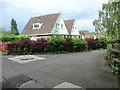
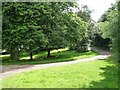
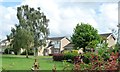
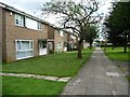
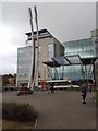
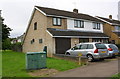
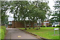
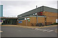

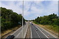

26 photos from this area
Area Information
Key information about the PE3 9UJ including its size, population, and administrative classification.
- Area Type
- Postcode
- Area Size
- 1.8 hectares
- Population
- 1649
- Population Density
- 3242 people/km²
House Prices in PE3 9UJ
29
Properties
£192,738
Average Sold Price
£78,500
Lowest Price
£375,000
Highest Price
Showing 29 properties
| Address | Type | Beds | Baths | Last Sale Price | Last Sale Date | |
|---|---|---|---|---|---|---|
| 128 Atherstone Avenue, Netherton, Peterborough, PE3 9UJ | Semi-detached | 3 | 1 | £320,000 | Feb 2025 | |
| 134 Atherstone Avenue, Netherton, Peterborough, PE3 9UJ | Detached | 4 | 1 | £375,000 | May 2024 | |
| 136 Atherstone Avenue, Netherton, Peterborough, PE3 9UJ | Semi-detached | - | - | £163,000 | Mar 2022 | |
| 121 Atherstone Avenue, Netherton, Peterborough, PE3 9UJ | Semi-detached | 3 | 1 | £280,000 | Jun 2020 | |
| 115 Atherstone Avenue, Netherton, Peterborough, PE3 9UJ | house | - | - | £225,000 | Feb 2017 | |
| 142 Atherstone Avenue, Netherton, Peterborough, PE3 9UJ | Detached | 3 | 1 | £200,000 | Sep 2016 | |
| 127 Atherstone Avenue, Netherton, Peterborough, PE3 9UJ | Detached | 6 | 2 | £343,000 | Sep 2015 | |
| 138 Atherstone Avenue, Netherton, Peterborough, PE3 9UJ | Semi-detached | - | - | £183,000 | Mar 2010 | |
| 105 Atherstone Avenue, Netherton, Peterborough, PE3 9UJ | house | - | - | £195,000 | Nov 2009 | |
| 95 Atherstone Avenue, Netherton, Peterborough, PE3 9UJ | house | - | - | £175,000 | Oct 2007 |
Page 1 of 3
Energy Efficiency in PE3 9UJ
Amenities
Schools
| Rank | School | Type | Entry gender | Ages |
|---|
Explore more schools in this area
Go to Schools tabDemographics
Household Size
Two person
most common
Accommodation Type
Houses
most common
Tenure
88
majority
Ethnic Group
White
most common
Religion
N/A
most common
Household Composition
N/A
most common
Age
47
median
Adults (30-64 years)
most common
Household Deprivation
N/A
with no deprivation
NS-SEC
43
in Lower managerial occupations
Explore more demographic insights in this area
Go to Demographics tabPlanning
Planning Constraints
- Flood RiskPremium
- Ramsar Wetland SitesPremium
- Area of Outstanding Natural BeautyPremium
- Protected Nature ReservePremium
- Protected WoodlandPremium