Area Overview for PE3 9RA
Photos of PE3 9RA
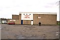
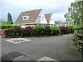
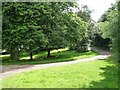
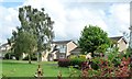
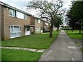
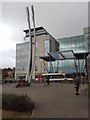
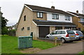
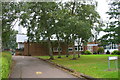


26 photos from this area
Area Information
Key information about the PE3 9RA including its size, population, and administrative classification.
- Area Type
- Postcode
- Area Size
- 2.1 hectares
- Population
- 2014
- Population Density
- 2533 people/km²
House Prices in PE3 9RA
22
Properties
£198,578
Average Sold Price
£57,500
Lowest Price
£445,000
Highest Price
Showing 22 properties
| Address | Type | Beds | Baths | Last Sale Price | Last Sale Date | |
|---|---|---|---|---|---|---|
| 91 Ledbury Road, Netherton, Peterborough, PE3 9RA | Bungalow | 2 | 1 | £255,000 | Oct 2024 | |
| 117 Ledbury Road, Netherton, Peterborough, PE3 9RA | Detached | 4 | 3 | £445,000 | Jun 2023 | |
| 85 Ledbury Road, Netherton, Peterborough, PE3 9RA | Bungalow | - | - | £230,000 | Oct 2022 | |
| 79 Ledbury Road, Netherton, Peterborough, PE3 9RA | Bungalow | 3 | 2 | £193,000 | Jul 2016 | |
| 109 Ledbury Road, Netherton, Peterborough, PE3 9RA | Semi-detached | - | - | £190,000 | Mar 2016 | |
| The School House, 77 Ledbury Road, Netherton, Peterborough, PE3 9RA | Detached | 3 | 1 | £198,250 | Mar 2016 | |
| 103 Ledbury Road, Netherton, Peterborough, PE3 9RA | Detached | 5 | 2 | £240,000 | Mar 2013 | |
| 95 Ledbury Road, Netherton, Peterborough, PE3 9RA | Detached | - | - | £202,500 | Sep 2012 | |
| 99 Ledbury Road, Netherton, Peterborough, PE3 9RA | house | - | - | £165,000 | Dec 2011 | |
| 81 Ledbury Road, Netherton, Peterborough, PE3 9RA | Bungalow | - | - | £130,000 | Dec 2010 |
Page 1 of 3
Energy Efficiency in PE3 9RA
Amenities
Schools
| Rank | School | Type | Entry gender | Ages |
|---|
Explore more schools in this area
Go to Schools tabDemographics
Household Size
Family (3-5 people)
most common
Accommodation Type
Houses
most common
Tenure
74
majority
Ethnic Group
asian_total
most common
Religion
N/A
most common
Household Composition
N/A
most common
Age
47
median
Adults (30-64 years)
most common
Household Deprivation
N/A
with no deprivation
NS-SEC
36
in Lower managerial occupations
Explore more demographic insights in this area
Go to Demographics tabPlanning
Planning Constraints
- Flood RiskPremium
- Ramsar Wetland SitesPremium
- Area of Outstanding Natural BeautyPremium
- Protected Nature ReservePremium
- Protected WoodlandPremium