Area Overview for PE3 6BA
Photos of PE3 6BA
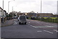
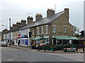

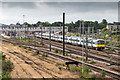

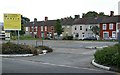
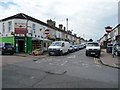
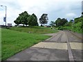
100 photos from this area
Area Information
Key information about the PE3 6BA including its size, population, and administrative classification.
- Area Type
- Postcode
- Area Size
- 1.4 hectares
- Population
- 1685
- Population Density
- 6209 people/km²
House Prices in PE3 6BA
32
Properties
£124,726
Average Sold Price
£34,000
Lowest Price
£192,000
Highest Price
Showing 32 properties
| Address | Type | Beds | Baths | Last Sale Price | Last Sale Date | |
|---|---|---|---|---|---|---|
| 15 Williamson Avenue, West Town, Peterborough, PE3 6BA | Semi-detached | 3 | - | £185,000 | Oct 2022 | |
| 18 Williamson Avenue, West Town, Peterborough, PE3 6BA | house | - | - | £181,000 | Jul 2022 | |
| 42 Williamson Avenue, West Town, Peterborough, PE3 6BA | Semi-detached | 3 | 1 | £185,000 | Sep 2020 | |
| 40 Williamson Avenue, West Town, Peterborough, PE3 6BA | house | 3 | 1 | £170,000 | Sep 2020 | |
| 11 Williamson Avenue, West Town, Peterborough, PE3 6BA | Semi-detached | 3 | 1 | £192,000 | Nov 2018 | |
| 17 Williamson Avenue, West Town, Peterborough, PE3 6BA | Semi-detached | 2 | 1 | £139,000 | Jun 2017 | |
| 9 Williamson Avenue, West Town, Peterborough, PE3 6BA | house | - | - | £140,000 | Jun 2016 | |
| 13 Williamson Avenue, West Town, Peterborough, PE3 6BA | Detached | 3 | - | £168,000 | Apr 2016 | |
| 22 Williamson Avenue, West Town, Peterborough, PE3 6BA | Terraced | 3 | - | £112,000 | Dec 2014 | |
| 6 Williamson Avenue, West Town, Peterborough, PE3 6BA | Terraced | 3 | - | £125,000 | Aug 2013 |
Page 1 of 4
Energy Efficiency in PE3 6BA
Amenities
Schools
| Rank | School | Type | Entry gender | Ages |
|---|
Explore more schools in this area
Go to Schools tabDemographics
Household Size
Family (3-5 people)
most common
Accommodation Type
Houses
most common
Tenure
52
majority
Ethnic Group
asian_total
most common
Religion
N/A
most common
Household Composition
N/A
most common
Age
47
median
Adults (30-64 years)
most common
Household Deprivation
N/A
with no deprivation
NS-SEC
20
in Lower managerial occupations
Explore more demographic insights in this area
Go to Demographics tabPlanning
Planning Constraints
- Flood RiskPremium
- Ramsar Wetland SitesPremium
- Area of Outstanding Natural BeautyPremium
- Protected Nature ReservePremium
- Protected WoodlandPremium