Area Overview for PE3 6ET
Photos of PE3 6ET


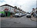
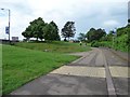
100 photos from this area
Area Information
Key information about the PE3 6ET including its size, population, and administrative classification.
- Area Type
- Postcode
- Area Size
- 5562 m²
- Population
- 1842
- Population Density
- 6850 people/km²
House Prices in PE3 6ET
26
Properties
£118,212
Average Sold Price
£30,000
Lowest Price
£385,000
Highest Price
Showing 26 properties
| Address | Type | Beds | Baths | Last Sale Price | Last Sale Date | |
|---|---|---|---|---|---|---|
| 52 Mayors Walk, West Town, Peterborough, PE3 6ET | house | 1 | 1 | £80,000 | May 2025 | |
| 40 Mayors Walk, West Town, Peterborough, PE3 6ET | Semi-detached | 4 | 2 | £100,000 | May 2024 | |
| 64 Mayors Walk, West Town, Peterborough, PE3 6ET | house | 6 | 6 | £385,000 | May 2023 | |
| 42 Mayors Walk, West Town, Peterborough, PE3 6ET | house | - | - | £225,000 | Jun 2020 | |
| 82A Mayors Walk, West Town, Peterborough, PE3 6ET | Flat | - | - | £100,000 | Aug 2015 | |
| 70 Mayors Walk, West Town, Peterborough, PE3 6ET | house | - | - | £92,750 | Jul 2012 | |
| 78 Mayors Walk, West Town, Peterborough, PE3 6ET | house | - | - | £107,000 | Sep 2011 | |
| 54 Mayors Walk, West Town, Peterborough, PE3 6ET | Semi-detached | - | - | £107,500 | Sep 2004 | |
| 60 Mayors Walk, West Town, Peterborough, PE3 6ET | Flat | - | 1 | £125,000 | Jun 2004 | |
| 56 Mayors Walk, West Town, Peterborough, PE3 6ET | Semi-detached | - | - | £80,000 | Jan 2002 |
Page 1 of 3
Energy Efficiency in PE3 6ET
Amenities
Schools
| Rank | School | Type | Entry gender | Ages |
|---|
Explore more schools in this area
Go to Schools tabDemographics
Household Size
Family (3-5 people)
most common
Accommodation Type
Houses
most common
Tenure
51
majority
Ethnic Group
asian_total
most common
Religion
N/A
most common
Household Composition
N/A
most common
Age
47
median
Adults (30-64 years)
most common
Household Deprivation
N/A
with no deprivation
NS-SEC
19
in Lower managerial occupations
Explore more demographic insights in this area
Go to Demographics tabPlanning
Planning Constraints
- Flood RiskPremium
- Ramsar Wetland SitesPremium
- Area of Outstanding Natural BeautyPremium
- Protected Nature ReservePremium
- Protected WoodlandPremium