Area Overview for PE19 1BU
Photos of PE19 1BU


Area Information
The postcode PE19 1BU covers a specific residential cluster in England, home to 2,034 people across just 4,216 square metres. This compact footprint results in an extremely high population density of 482,450 people per square kilometre, indicating a tightly packed living environment typical of established urban residential zones or high-rise developments. Life in this area revolves around immediate accessibility, with residents relying on proximity to key services rather than sprawling neighbourhoods. The zone functions as a dense node within the wider St Neots region, where daily routines depend on efficient public transport links and local shopping facilities. Current home ownership stands at 43%, suggesting a significant portion of the 2,034 residents rents rather than owns their accommodation. Accommodation types in PE19 are predominantly flats, reflecting the vertical nature of housing in such a constrained physical area. You will find a population where the most common age range lies between 30 and 64 years, creating a community anchored by working-age adults. The predominant ethnic group is White, contributing to a demographically stable environment. Planning constraints like Areas of Outstanding Natural Beauty or Ramsar wetland sites are absent from the immediate vicinity, meaning developers face fewer statutory limits in this small residential pocket. However, the high density and flat-based housing stock define the atmosphere, offering convenience at the cost of space.
- Area Type
- Postcode
- Area Size
- 4216 m²
- Population
- 2034
- Population Density
- 2464 people/km²
The property market in PE19 1BU reflects its unique physical constraints, shaped primarily by the fact that the vast majority of homes are flats. This accommodation type dominates the stock, meaning buyers looking at PE19 1BU will focus on apartments rather than traditional houses. With home ownership at 43%, the market operates with a substantial rental sector running parallel to owner-occupied units. This split often creates distinct sub-markets for landlords seeking rental yields versus individuals looking for investment properties. You will find that inventory is limited due to the tiny 4,216 m² area size covering the whole postcode. Prices and availability in such high-density blocks tend to be sensitive to space premiums and lease terms common in flat living. The high population density of 482,450 people per square kilometre implies that units move quickly when listed, reflecting strong local demand. For homebuyers, the dominant mix of flats means less variety in garden space or footprint compared to other areas in St Neots. Although the breakdown of freehold versus leasehold is not provided, the predominant flat status suggests a leaning towards leasehold structures. This specific housing profile serves the 30 to 64-year-old demographic well, offering lower maintenance than larger houses but requiring careful selection of building management and service charges.
House Prices in PE19 1BU
Showing 12 properties
| Address | Type | Beds | Baths | Last Sale Price | Last Sale Date | |
|---|---|---|---|---|---|---|
| 19C High Street, St Neots, PE19 1BU | Flat | 1 | 1 | - | - | |
| 19B High Street, St Neots, PE19 1BU | Flat | 1 | 1 | - | - | |
| Living Accommodation, 23 High Street, St Neots, PE19 1BU | Land | - | - | - | - | |
| Post Office, 35 High Street, St Neots, PE19 1BU | Retail | - | - | - | - | |
| 13A High Street, St Neots, PE19 1BU | Flat | - | - | - | - | |
| Tower Crane Consultants Limited, 7B High Street, St Neots, PE19 1BU | retail_financial | - | - | - | - | |
| 9A High Street, St Neots, PE19 1BU | Flat | - | - | - | - | |
| 19D High Street, St Neots, PE19 1BU | Flat | - | - | - | - | |
| 9B High Street, St Neots, PE19 1BU | Flat | - | - | - | - | |
| 19A High Street, St Neots, PE19 1BU | Flat | - | - | - | - |
Energy Efficiency in PE19 1BU
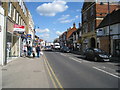
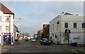
Daily life in PE19 1BU is defined by immediate access to essential retail and services, removing the need for long journeys to town centres. Within practical reach, you have five retail outlets including Morrisons Daily St, Waitrose St, and M&S St Neots SF. These specific venues cater to groceries, household goods, and clothing, supporting the needs of the 2,034 residents living in this dense cluster. The presence of multiple shops means you can resolve most daily shopping requirements without venturing beyond the immediate neighbourhood. Transport options are anchored by a single key facility: St Neots Railway Station. This rail link provides a vital artery for residents who work in Cambridge or London, integrating the flat-based living of PE19 with wider professional hubs. While parks and leisure facilities are not explicitly listed in the immediate amenity data, the high density of housing suggests a reliance on local conveniences over distant recreational ground. The 30 to 64-year-old population benefits from this proximity, balancing work and family life with accessible shops and a good rail connection. Retail diversity is moderate yet functional, featuring major national chains that offer consistency and reliability for weekly runs. For those living in PE19 1BU, lifestyle convenience is driven by the sheer closeness of Morriston, Waitrose, and M&S to your doorstep.
Amenities
Schools
| Rank | School | Type | Entry gender | Ages |
|---|
Explore more schools in this area
Go to Schools tabDemographics
Residents of PE19 1BU form a community largely defined by the working-age demographic. The most common age range is 30 to 64 years, while the median age for the population is 47. This profile suggests a mature but active community, likely comprising professionals, families, and couples managing careers alongside property responsibilities. Home ownership is not the norm, with exactly 43% of households owning their homes. This figure implies that 57% of the population rents, a dynamic that often influences investment decisions and tenant stability in high-density clusters. Accommodation exclusively consists of flats, which dictates the spatial experience for everyone in the 2,034-person population. This uniformity in housing type means you will encounter few terraced houses or detached homes, reinforcing the character of a vertical residential build. The predominant ethnic group is White, though the specific area size of 4,216 m² limits the scope for large-scale demographic shifts compared to broader towns. Deprivation and quality of life factors are tied directly to these housing constraints; with such high density, noise and shared infrastructure management become daily realities for the adults living here. The absence of protected nature reserves or woodlands within the immediate assessment means the local environment is entirely built-up, with no statutory green buffers defining the neighbourhood boundaries.
Household Size
Accommodation Type
Tenure
Ethnic Group
Religion
Household Composition
Age
Household Deprivation
NS-SEC
Explore more demographic insights in this area
Go to Demographics tabPlanning
Planning Constraints
- Flood RiskPremium
- Ramsar Wetland SitesPremium
- Area of Outstanding Natural BeautyPremium
- Protected Nature ReservePremium
- Protected WoodlandPremium