Area Overview for NR9 5RR
Photos of NR9 5RR
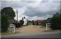
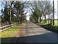
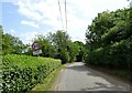
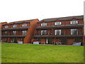
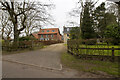
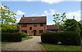
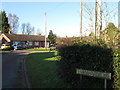
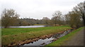
8 photos from this area
Area Information
Key information about the NR9 5RR including its size, population, and administrative classification.
- Area Type
- Postcode
- Area Size
- 10.4 hectares
- Population
- 2468
- Population Density
- 74 people/km²
House Prices in NR9 5RR
33
Properties
£334,929
Average Sold Price
£97,500
Lowest Price
£850,000
Highest Price
Showing 33 properties
| Address | Type | Beds | Baths | Last Sale Price | Last Sale Date | |
|---|---|---|---|---|---|---|
| The Dell, Elsing Road, Lyng, NR9 5RR | Detached | 3 | 1 | £375,000 | Apr 2025 | |
| Nursery Cottage, Elsing Road, Lyng, NR9 5RR | Cottage | 3 | 1 | £345,000 | Jan 2025 | |
| Hedgehog Cottage, Elsing Road, Lyng, NR9 5RR | Bungalow | 4 | 2 | £620,000 | Aug 2024 | |
| Tayberry House, Elsing Road, Lyng, NR9 5RR | Detached | 5 | 4 | £850,000 | Oct 2023 | |
| 7 Elsing Road, Lyng, NR9 5RR | Bungalow | 3 | - | £250,000 | Dec 2022 | |
| 11 Elsing Road, Lyng, NR9 5RR | Bungalow | - | - | £235,000 | Jul 2021 | |
| 1 Elsing Road, Lyng, NR9 5RR | Bungalow | - | - | £250,000 | Dec 2020 | |
| Oakgrove, Elsing Road, Lyng, NR9 5RR | Detached | 6 | - | £690,000 | Dec 2020 | |
| Rose Cottage, Elsing Road, Lyng, NR9 5RR | Detached | 4 | 2 | £205,000 | Jun 2019 | |
| Water End, Elsing Road, Lyng, NR9 5RR | Detached | 5 | 4 | £700,000 | May 2019 |
Page 1 of 4
Energy Efficiency in NR9 5RR
Amenities
Schools
| Rank | School | Type | Entry gender | Ages |
|---|
Explore more schools in this area
Go to Schools tabDemographics
Household Size
Two person
most common
Accommodation Type
Houses
most common
Tenure
78
majority
Ethnic Group
White
most common
Religion
N/A
most common
Household Composition
N/A
most common
Age
47
median
Adults (30-64 years)
most common
Household Deprivation
N/A
with no deprivation
NS-SEC
35
in Lower managerial occupations
Explore more demographic insights in this area
Go to Demographics tabPlanning
Planning Constraints
- Flood RiskPremium
- Ramsar Wetland SitesPremium
- Area of Outstanding Natural BeautyPremium
- Protected Nature ReservePremium
- Protected WoodlandPremium