Area Overview for NR9 5FF
Photos of NR9 5FF
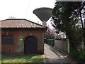
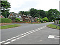
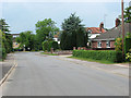
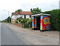
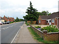
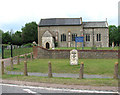
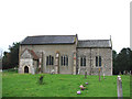
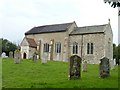
41 photos from this area
Area Information
Key information about the NR9 5FF including its size, population, and administrative classification.
- Area Type
- Postcode
- Area Size
- 1.9 hectares
- Population
- 1436
- Population Density
- 230 people/km²
House Prices in NR9 5FF
34
Properties
£265,943
Average Sold Price
£73,600
Lowest Price
£420,000
Highest Price
Showing 34 properties
| Address | Type | Beds | Baths | Last Sale Price | Last Sale Date | |
|---|---|---|---|---|---|---|
| 17 Wheeler Crescent, Easton, NR9 5FF | Semi-detached | 1 | 1 | £161,000 | Sep 2025 | |
| 6 Wheeler Crescent, Easton, NR9 5FF | Terraced | 1 | 2 | £148,750 | Mar 2024 | |
| 28 Wheeler Crescent, Easton, NR9 5FF | Semi-detached | 4 | 2 | £420,000 | Jul 2023 | |
| 13 Wheeler Crescent, Easton, NR9 5FF | Terraced | 3 | - | £130,000 | Nov 2022 | |
| 22 Wheeler Crescent, Easton, NR9 5FF | house | - | - | £196,000 | Apr 2022 | |
| 4 Wheeler Crescent, Easton, NR9 5FF | house | 4 | - | £390,000 | Jan 2022 | |
| 26 Wheeler Crescent, Easton, NR9 5FF | Detached | 4 | - | £200,000 | Jul 2021 | |
| 19 Wheeler Crescent, Easton, NR9 5FF | house | - | - | £275,000 | Jun 2021 | |
| 27 Wheeler Crescent, Easton, NR9 5FF | Detached | 4 | 2 | £371,000 | Jun 2021 | |
| 16 Wheeler Crescent, Easton, NR9 5FF | Detached | 4 | 1 | £302,500 | Jan 2021 |
Page 1 of 4
Energy Efficiency in NR9 5FF
Amenities
Schools
| Rank | School | Type | Entry gender | Ages |
|---|
Explore more schools in this area
Go to Schools tabDemographics
Household Size
Two person
most common
Accommodation Type
Houses
most common
Tenure
82
majority
Ethnic Group
White
most common
Religion
N/A
most common
Household Composition
N/A
most common
Age
47
median
Adults (30-64 years)
most common
Household Deprivation
N/A
with no deprivation
NS-SEC
33
in Lower managerial occupations
Explore more demographic insights in this area
Go to Demographics tabPlanning
Planning Constraints
- Flood RiskPremium
- Ramsar Wetland SitesPremium
- Area of Outstanding Natural BeautyPremium
- Protected Nature ReservePremium
- Protected WoodlandPremium