Area Overview for NR9 5FB
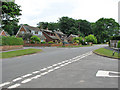
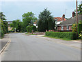
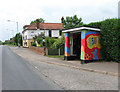
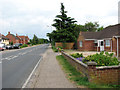
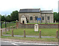
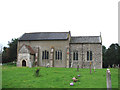
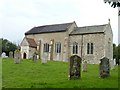
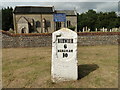
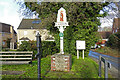
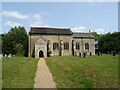
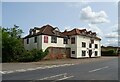
Photos of NR9 5FB

Area Information
Living in NR9 5FB offers a grounded experience within a specific residential cluster spanning 3.5 hectares. This postcode area is defined by its compact nature and close-knitfeel. The population stands at 1436 residents, creating a high degree of local familiarity without the density of a major urban centre. You will find yourself in an environment where neighbours likely know each other, given the area size and resident count. The surroundings combine practicality with a sense of place, positioning you between larger towns and quieter countryside zones. Daily life revolves around a small footprint, ensuring you do not face long commutes for local essentials. The area represents a deliberate choice for those seeking a contained community rather than an sprawling urban landscape. Your daily routine will benefit from the proximity of all necessary services to this specific cluster. The distinct character of NR9 5FB comes from its manageable scale and focused residential nature. This is a place where life moves at a pace dictated by the immediate neighbourhood rather than the wider county. Families and long-term residents appreciate the stability found within these boundaries. The area provides a clear definition of home, offering a predictable and stable environment for settling down.
- Area Type
- Postcode
- Area Size
- 3.5 hectares
- Population
- 1436
- Population Density
- 230 people/km²
Homes in NR9 5FB are characterised by a clear dominance of house types within a small footprint. With 82% of households classified as owner-occupied, the local property market is heavily skewed towards buyer-occupied residences rather than rentals. This high rate of homeownership indicates that the area appeals to those seeking to invest in a permanent home. The accommodation type data confirms that houses are the standard dwelling, suggesting a layout suited for families or individuals who value the space a separate house offers. You are looking at a market where sellers have equity in the majority of properties, often leading to competitive pricing for those ready to buy. The small size of this postcode area, covering only 3.5 hectares, limits the total number of available homes. This scarcity means that opportunities to purchase arise infrequently. For buyers interested in this specific cluster, acting quickly is often necessary when a listing comes to the market. The focus is on established dwellings rather than new builds or temporary housing solutions. This market dynamic suits buyers prioritising security and long-term tenure over investment ownership or rental yields.
House Prices in NR9 5FB
Showing 29 properties
| Address | Type | Beds | Baths | Last Sale Price | Last Sale Date | |
|---|---|---|---|---|---|---|
| 18 Garnett Drive, Easton, NR9 5FB | Semi-detached | 4 | 2 | £395,000 | Mar 2023 | |
| 23 Garnett Drive, Easton, NR9 5FB | Terraced | 3 | 2 | £242,000 | Dec 2020 | |
| 16 Garnett Drive, Easton, NR9 5FB | Detached | 4 | 1 | £305,000 | Oct 2020 | |
| 9 Garnett Drive, Easton, NR9 5FB | Detached | 4 | 2 | £290,000 | May 2020 | |
| 14 Garnett Drive, Easton, NR9 5FB | Terraced | 3 | 2 | £212,000 | Jan 2019 | |
| 25 Garnett Drive, Easton, NR9 5FB | house | 3 | - | £215,000 | May 2018 | |
| 11 Garnett Drive, Easton, NR9 5FB | Semi-detached | 3 | 2 | £207,000 | Dec 2017 | |
| 29 Garnett Drive, Easton, NR9 5FB | Terraced | 3 | 2 | £233,000 | Nov 2017 | |
| 4 Garnett Drive, Easton, NR9 5FB | Terraced | 3 | 1 | £225,000 | Dec 2016 | |
| 22 Garnett Drive, Easton, NR9 5FB | Detached | 4 | 2 | £325,000 | Jan 2016 |
Energy Efficiency in NR9 5FB
Life in NR9 5FB relies on a group of amenities located within practical reach of those residing here. Your shopping needs are met by five retail locations, including M&S Longwater, Iceland Norwich, and Sainsburys Longwater. These venues offer everyday groceries and household essentials without requiring a long journey. For leisure and travel, you have access to Norwich International Airport, facilitating trips for the entire family. The Wymondham Railway Station, often referred to locally near Wymondham Abbey, provides rail access for commuters. These transport and retail nodes create a convenient lifestyle where you can run errands and travel without leaving the county. The proximity of Iceland and Sainsburys means fresh food and daily necessities are always available. You do not need to drive far for routine shopping trips. This cluster of amenities supports the daily rhythm of life for the 1436 residents in your postcode. The area balances a quiet residential existence with easy access to the broader economic centres of Norfolk. Shopping, travel, and daily supplies are integrated into your weekly routine through these specific locations.
Amenities
Schools
Families living in NR9 5FB benefit from a variety of educational establishments located nearby. Your children can attend St Peter's CofE VA Primary School, Easton, which holds an Ofsted rating of good. You also have access to St Peter's CofE Primary Academy, Easton, which is listed as a primary school option. For older children, the area offers sixth-form colleges, including Easton College and Easton & Otley College. These institutions provide further education pathways for the local young population. The Bridge Easton serves as a special school, adding to the educational diversity available to residents with specific needs. This mix of primary, sixth-form, and special provision means you have multiple options depending on your child's age and requirements. You do not need to travel far to access multiple levels of education, from early years through to advanced study. The presence of these specific schools supports the family-oriented nature of the high home-ownership community. Parents in the district can choose between the traditional CofE VA Primary School and the Primary Academy based on their educational philosophy.
| Rank | School | Type | Entry gender | Ages |
|---|
Explore more schools in this area
Go to Schools tabDemographics
The community within NR9 5FB reflects a mature demographic profile with a median age of 47 years. Most residents fall into the adult bracket between 30 and 64 years, indicating a population settled in their family or career lives. Home ownership is a defining feature of the locality, with 82% of households owning their property outright or with a mortgage. This high rate suggests the area attracts buyers looking for stability rather than the transient nature of the private rental sector. The predominant ethnic group is White, mirroring the broader regional composition. Houses form the primary form of accommodation, aligning with the preferences of this age group and ownership rate. You are surrounded by a community that has likely been living in the same homes for extended periods. The high ownership rate of 82% creates a stable social fabric where neighbours often have a shared history. The demographic data paints a picture of a traditional, established neighbourhood where long-term investment and family stability matter most. Residents here have put down roots, and the housing stock reflects a demand for longevity and security.
Household Size
Accommodation Type
Tenure
Ethnic Group
Religion
Household Composition
Age
Household Deprivation
NS-SEC
Explore more demographic insights in this area
Go to Demographics tabPlanning
Planning Constraints
- Flood RiskPremium
- Ramsar Wetland SitesPremium
- Area of Outstanding Natural BeautyPremium
- Protected Nature ReservePremium
- Protected WoodlandPremium