Area Overview for NR9 5BB
Photos of NR9 5BB
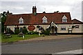
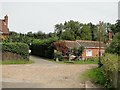
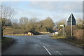
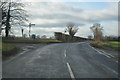
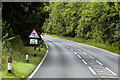
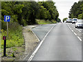
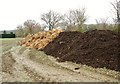
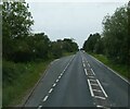
32 photos from this area
Area Information
Key information about the NR9 5BB including its size, population, and administrative classification.
- Area Type
- Postcode
- Area Size
- 11.9 hectares
- Population
- 1462
- Population Density
- 51 people/km²
House Prices in NR9 5BB
15
Properties
£252,667
Average Sold Price
£153,000
Lowest Price
£387,500
Highest Price
Showing 15 properties
| Address | Type | Beds | Baths | Last Sale Price | Last Sale Date | |
|---|---|---|---|---|---|---|
| Hillcrest, Colton Road, Honingham, NR9 5BB | Bungalow | 3 | - | £325,000 | Oct 2022 | |
| Brittons Grove, Colton Road, Honingham, NR9 5BB | house | - | - | £370,000 | Dec 2021 | |
| The Willows, Colton Road, Honingham, NR9 5BB | Bungalow | 3 | 1 | £233,000 | Jul 2019 | |
| Larkspur, Colton Road, Honingham, NR9 5BB | Bungalow | 3 | - | £218,000 | Mar 2017 | |
| Field View, Colton Road, Honingham, NR9 5BB | Detached | 4 | 3 | £387,500 | Apr 2015 | |
| The Honeypot, Colton Road, Honingham, NR9 5BB | Bungalow | 2 | 1 | £190,000 | Apr 2010 | |
| Conifers, Colton Road, Honingham, NR9 5BB | Bungalow | 3 | 2 | £212,500 | Nov 2005 | |
| Tezlan, Colton Road, Honingham, NR9 5BB | Bungalow | 3 | - | £153,000 | Jan 2004 | |
| Breck View, Colton Road, Honingham, NR9 5BB | Detached | - | - | £185,000 | Aug 2002 | |
| Highfield, Colton Road, Honingham, NR9 5BB | house | - | - | - | - |
Page 1 of 2
Energy Efficiency in NR9 5BB
Amenities
Schools
| Rank | School | Type | Entry gender | Ages |
|---|
Explore more schools in this area
Go to Schools tabDemographics
Household Size
Two person
most common
Accommodation Type
Houses
most common
Tenure
75
majority
Ethnic Group
White
most common
Religion
N/A
most common
Household Composition
N/A
most common
Age
47
median
Adults (30-64 years)
most common
Household Deprivation
N/A
with no deprivation
NS-SEC
35
in Lower managerial occupations
Explore more demographic insights in this area
Go to Demographics tabPlanning
Planning Constraints
- Flood RiskPremium
- Ramsar Wetland SitesPremium
- Area of Outstanding Natural BeautyPremium
- Protected Nature ReservePremium
- Protected WoodlandPremium