Area Overview for NR9 4LB
Photos of NR9 4LB
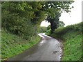
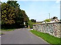
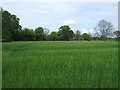
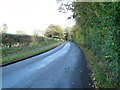
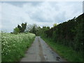
10 photos from this area
Area Information
Key information about the NR9 4LB including its size, population, and administrative classification.
- Area Type
- Postcode
- Area Size
- 15.7 hectares
- Population
- 1619
- Population Density
- 69 people/km²
House Prices in NR9 4LB
37
Properties
£239,416
Average Sold Price
£40,000
Lowest Price
£492,500
Highest Price
Showing 37 properties
| Address | Type | Beds | Baths | Last Sale Price | Last Sale Date | |
|---|---|---|---|---|---|---|
| 2 Hall Moor Road, Hingham, NR9 4LB | Bungalow | 3 | 1 | £315,000 | Mar 2025 | |
| Mill Corner House, 1 Hall Moor Road, Hingham, NR9 4LB | Semi-detached | 3 | 1 | £360,000 | Dec 2020 | |
| 8 Hall Moor Road, Hingham, NR9 4LB | Detached | 4 | 1 | £330,000 | Oct 2020 | |
| 30 Hall Moor Road, Hingham, NR9 4LB | Semi-detached | 3 | - | £170,000 | May 2020 | |
| 32 Hall Moor Road, Hingham, NR9 4LB | Semi-detached | 3 | - | £180,000 | May 2020 | |
| 6 Hall Moor Road, Hingham, NR9 4LB | Bungalow | 3 | - | £220,000 | Aug 2017 | |
| 23 Hall Moor Road, Hingham, NR9 4LB | Detached | 4 | - | £475,000 | Aug 2016 | |
| 14 Hall Moor Road, Hingham, NR9 4LB | Bungalow | 3 | 1 | £277,000 | Jul 2016 | |
| 11 Hall Moor Road, Hingham, NR9 4LB | Bungalow | 3 | - | £230,000 | Apr 2015 | |
| 19 Hall Moor Road, Hingham, NR9 4LB | Detached | 4 | - | £280,000 | Nov 2014 |
Page 1 of 4
Energy Efficiency in NR9 4LB
Amenities
Schools
| Rank | School | Type | Entry gender | Ages |
|---|
Explore more schools in this area
Go to Schools tabDemographics
Household Size
Two person
most common
Accommodation Type
Houses
most common
Tenure
86
majority
Ethnic Group
White
most common
Religion
N/A
most common
Household Composition
N/A
most common
Age
47
median
Adults (30-64 years)
most common
Household Deprivation
N/A
with no deprivation
NS-SEC
40
in Lower managerial occupations
Explore more demographic insights in this area
Go to Demographics tabPlanning
Planning Constraints
- Flood RiskPremium
- Ramsar Wetland SitesPremium
- Area of Outstanding Natural BeautyPremium
- Protected Nature ReservePremium
- Protected WoodlandPremium