Area Overview for NR6 6LB
Photos of NR6 6LB
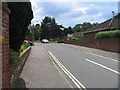
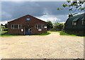
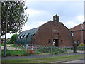
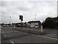
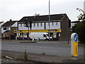
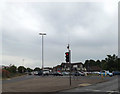
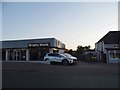
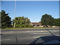
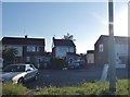

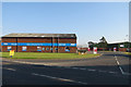
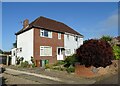
32 photos from this area
Area Information
Key information about the NR6 6LB including its size, population, and administrative classification.
- Area Type
- Postcode
- Area Size
- 7852 m²
- Population
- Not available
- Population Density
- Not available
House Prices in NR6 6LB
12
Properties
£250,455
Average Sold Price
£146,000
Lowest Price
£340,000
Highest Price
Showing 12 properties
| Address | Type | Beds | Baths | Last Sale Price | Last Sale Date | |
|---|---|---|---|---|---|---|
| 69 Hawthorne Avenue, Hellesdon, NR6 6LB | Bungalow | 4 | 1 | £273,000 | Sep 2025 | |
| 102 Hawthorne Avenue, Hellesdon, NR6 6LB | Bungalow | 2 | 1 | £274,000 | Feb 2024 | |
| 98 Hawthorne Avenue, Hellesdon, NR6 6LB | Bungalow | - | - | £240,000 | Sep 2023 | |
| 96 Hawthorne Avenue, Hellesdon, NR6 6LB | Semi-detached | 3 | 2 | £340,000 | Jul 2022 | |
| 61 Hawthorne Avenue, Hellesdon, NR6 6LB | Retail | 3 | 1 | £235,000 | Mar 2022 | |
| 67 Hawthorne Avenue, Hellesdon, NR6 6LB | Semi-detached | 2 | 1 | £228,000 | Jun 2020 | |
| 100 Hawthorne Avenue, Hellesdon, NR6 6LB | Bungalow | - | - | £265,000 | Aug 2019 | |
| 94 Hawthorne Avenue, Hellesdon, NR6 6LB | Bungalow | - | - | £255,000 | Dec 2018 | |
| 59 Hawthorne Avenue, Hellesdon, NR6 6LB | Semi-detached | 2 | 1 | £229,000 | Jul 2018 | |
| 102A Hawthorne Avenue, Hellesdon, NR6 6LB | Bungalow | 2 | 1 | £270,000 | Oct 2017 |
Page 1 of 2
Energy Efficiency in NR6 6LB
Amenities
Schools
| Rank | School | Type | Entry gender | Ages |
|---|
Explore more schools in this area
Go to Schools tabDemographics
Household Size
Two person
most common
Accommodation Type
Houses
most common
Tenure
82
majority
Ethnic Group
White
most common
Religion
N/A
most common
Household Composition
N/A
most common
Age
47
median
Adults (30-64 years)
most common
Household Deprivation
N/A
with no deprivation
NS-SEC
27
in Lower managerial occupations
Explore more demographic insights in this area
Go to Demographics tabPlanning
Planning Constraints
- Flood RiskPremium
- Ramsar Wetland SitesPremium
- Area of Outstanding Natural BeautyPremium
- Protected Nature ReservePremium
- Protected WoodlandPremium