Area Overview for NR6 5NN
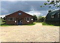
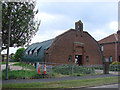
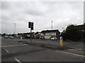
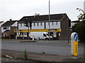
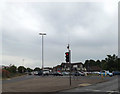
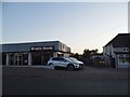
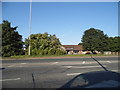
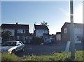
Photos of NR6 5NN


Area Information
Living in the NR6 5NN postcode area defines a specific residential experience within a small, tightly knit cluster. This particular pocket of land spans just 8936 square metres, creating an intimate neighbourhood feel rather than a sprawling district. You likely know many of your neighbours in such a confined space. The area accommodates a population of 1714 people, resulting in a very high density of 191814 people per square kilometre. This concentration means daily interactions are more frequent than in wider suburbs. The setting offers direct access to the surrounding infrastructure of Norwich, yet maintains its own distinct identity. You find yourself in a location where the footprint of the house dominates the landscape. Daily life involves navigating this compact environment while benefiting from proximity to larger amenities. The density suggests a community where resources are shared closely among residents. Your average commute to the city centre starts from this concentrated point. The area serves as a foundational residential zone for those seeking a specific type of engagement with their surroundings. You can expect a neighbourhood where the proximity to services is immediate. This small scale influences everything from local traffic patterns to the speed of news spreading through the community.
- Area Type
- Postcode
- Area Size
- 8936 m²
- Population
- Not available
- Population Density
- Not available
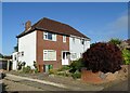
Homes in NR6 5NN present a market defined by stability and ownership rather than investment turnover. The data shows that 82% of residents own their homes, which characterises the local property market as heavily weighted towards owner-occupiers. This statistic suggests that many people have lived in these properties for significant periods. The predominant accommodation type listed is houses, indicating a stock of detached or semi-detached dwellings rather than high-rise blocks or private rentals. You are looking at an area where capital growth may depend on the specific appeal of individual family homes. The small size of the postcode area, covering only 8936 square metres, further concentrates the housing stock. This density means that diversity in housing styles might be limited within the immediate cluster. Buyers here often compete with other owners who value the property deeply. The market does not rely on tenant turnover like a university town might. Instead, transactions often involve sellers moving up or downsizing within the mature demographic. The high ownership percentage implies that regional economic shifts impact many homeowners simultaneously. When considering a purchase, you assess a neighbourhood where residents protect their assets carefully. The scarcity of rental properties also limits short-term lets compared to other urban peripheries.
House Prices in NR6 5NN
Showing 20 properties
| Address | Type | Beds | Baths | Last Sale Price | Last Sale Date | |
|---|---|---|---|---|---|---|
| 24 Meadow Way, Hellesdon, NR6 5NN | Semi-detached | 2 | 1 | £217,500 | Mar 2025 | |
| 23 Meadow Way, Hellesdon, NR6 5NN | Bungalow | 4 | 2 | £427,500 | Sep 2024 | |
| 29 Meadow Way, Hellesdon, NR6 5NN | Bungalow | 3 | - | £350,000 | Aug 2021 | |
| 22 Meadow Way, Hellesdon, NR6 5NN | Semi-detached | 2 | 1 | £230,000 | Dec 2019 | |
| 26 Meadow Way, Hellesdon, NR6 5NN | Bungalow | 2 | 1 | £230,000 | Nov 2019 | |
| 39 Meadow Way, Hellesdon, NR6 5NN | Semi-detached | 2 | - | £200,000 | Oct 2019 | |
| 27 Meadow Way, Hellesdon, NR6 5NN | Semi-detached | 2 | 1 | £210,000 | Dec 2018 | |
| 37 Meadow Way, Hellesdon, NR6 5NN | Detached | 2 | 1 | £190,000 | Dec 2018 | |
| 20 Meadow Way, Hellesdon, NR6 5NN | Semi-detached | 2 | - | £168,000 | Oct 2014 | |
| 31 Meadow Way, Hellesdon, NR6 5NN | Bungalow | - | - | £172,500 | Dec 2009 |
Energy Efficiency in NR6 5NN
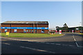
Daily life in NR6 5NN is facilitated by a network of amenities reachable without a lengthy journey. Your nearest retail options include the East of England Co-operative Co, Tesco Norwich, and Asda Norwich, among five notable stores. These three supermarkets provide a wide range of groceries and household necessities within practical distance. If travel is part of your routine, you have access to one airport, Norwich International Airport, for slightly longer trips. For short-distance travel, two railway stations serve the region: Norwich Railway Station and Salhouse Railway Station. These transport hubs connect you to the broader county network. The combination of five retail outlets, one airport, and two rail termini creates a convenient lifestyle where work and leisure are balanced. You do not need to travel far to stock your Cupboard or catch a train. The presence of major chains like Asda and Tesco suggests a mature retail environment catering to the high-density resident base of 1714 people. Your weekly shop and regular commute are both supported by this infrastructure.
Amenities
Schools
Your options for educating children in the vicinity of NR6 5NN include several well-known institutions, though the distance to these schools matters given the small size of your residential cluster. Kinsale Infant School holds a good Ofsted rating and is a primary school. Nearby, you also have access to Firside Junior School and Kinsale Junior School, both primary level institutions without specific Ofsted ratings listed in the current data. Further out, Hellesdon High School operates as a school and specifically holds a satisfactory Ofsted rating as an academy. Hellesdon High School also functions as an academy type establishment. The presence of both infant and junior schools suggests a pathway for local children to remain attached to the Kinsale site until they transition to secondary level. You might consider the travel time from the 8936 square metre domain of NR6 5NN to Hellesdon High School when evaluating the area for a growing family. The mix of providers offers a choice between state sector academies and other primary providers. Parents in this postcode must account for the specific catchment boundaries that determine which of these schools their children can attend.
| Rank | School | Type | Entry gender | Ages |
|---|
Explore more schools in this area
Go to Schools tabDemographics
The community within NR6 5NN reflects a settled and established demographic profile. The median age stands at 47, indicating a mature population that is likely empty-nesters or long-term families. Most common age ranges fall between 30 and 64 years, meaning the area skews towards working-age adults and retirement rather than youthful teenagers. Home ownership is the dominant tenure model, with 82% of residents owning their property outright or with a mortgage. This figure signals a stable community where people have invested in their homes over time. The predominant accommodation type consists of houses, consistent with the older demographic and high ownership rate. White ethnicity comprises the predominant group within the broader population data provided. You should not expect a transient population here; instead, find a neighbourhood where residents have put down roots. The high rate of home ownership alters the transactional nature of local businesses compared to rental-heavy zones. Families with children or older couples forming households create the primary social fabric. The age range suggests a demand for safety, quiet, and established social circles rather than nightlife or rapid development. Your interaction with neighbours will likely involve shared experiences of property maintenance and local governance.
Household Size
Accommodation Type
Tenure
Ethnic Group
Religion
Household Composition
Age
Household Deprivation
NS-SEC
Explore more demographic insights in this area
Go to Demographics tabPlanning
Planning Constraints
- Flood RiskPremium
- Ramsar Wetland SitesPremium
- Area of Outstanding Natural BeautyPremium
- Protected Nature ReservePremium
- Protected WoodlandPremium