Area Overview for NR6 5FA
Photos of NR6 5FA
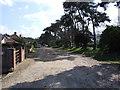
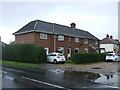
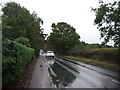

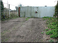


12 photos from this area
Area Information
Key information about the NR6 5FA including its size, population, and administrative classification.
- Area Type
- Postcode
- Area Size
- 22.3 hectares
- Population
- 1572
- Population Density
- 837 people/km²
House Prices in NR6 5FA
10
Properties
£309,753
Average Sold Price
£233,267
Lowest Price
£450,000
Highest Price
Showing 10 properties
| Address | Type | Beds | Baths | Last Sale Price | Last Sale Date | |
|---|---|---|---|---|---|---|
| 2 Carrowbreck Road, Hellesdon, NR6 5FA | Semi-detached | 3 | 1 | £308,000 | Mar 2025 | |
| 1 Carrowbreck Road, Hellesdon, NR6 5FA | Detached | 4 | 3 | £450,000 | Feb 2025 | |
| 6 Carrowbreck Road, Hellesdon, NR6 5FA | Semi-detached | 2 | 1 | £260,000 | Jan 2025 | |
| 3 Carrowbreck Road, Hellesdon, NR6 5FA | Semi-detached | 3 | 1 | £297,500 | Aug 2024 | |
| 4 Carrowbreck Road, Hellesdon, NR6 5FA | Detached | 2 | - | £233,267 | Oct 2016 | |
| 5 Carrowbreck Road, Hellesdon, NR6 5FA | Detached | 2 | 2 | - | - | |
| Broadland Council Training Services, Carrowbreck House, 7 Carrowbreck Road, Hellesdon, NR6 5FA | Office | - | - | - | - | |
| Break Charity, Front Pt Second Floor, Carrowbreck House, 7 Carrowbreck Road, Hellesdon, NR6 5FA | Office | - | - | - | - | |
| Laboratory Media Education Cic, Pt First Floor, Carrowbreck House, 7 Carrowbreck Road, Hellesdon, NR6 5FA | Office | - | - | - | - | |
| Rear Pt Second Floor, Carrowbreck House, 7 Carrowbreck Road, Hellesdon, NR6 5FA | Office | - | - | - | - |
Energy Efficiency in NR6 5FA
Amenities
Schools
| Rank | School | Type | Entry gender | Ages |
|---|
Explore more schools in this area
Go to Schools tabDemographics
Household Size
Two person
most common
Accommodation Type
Houses
most common
Tenure
75
majority
Ethnic Group
White
most common
Religion
N/A
most common
Household Composition
N/A
most common
Age
47
median
Adults (30-64 years)
most common
Household Deprivation
N/A
with no deprivation
NS-SEC
30
in Lower managerial occupations
Explore more demographic insights in this area
Go to Demographics tabPlanning
Planning Constraints
- Flood RiskPremium
- Ramsar Wetland SitesPremium
- Area of Outstanding Natural BeautyPremium
- Protected Nature ReservePremium
- Protected WoodlandPremium