Area Overview for NR6 5BJ
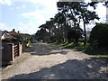
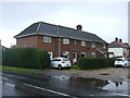
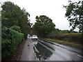
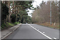
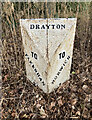
Photos of NR6 5BJ


Area Information
Living in NR6 5BJ offers a distinct residential experience within a very specific postcode coverage. This area defines a small residential cluster covering an area size of just 2.4 hectares. With a population of 1572 people, the settlement remains compact and manageable. The population density stands at 837 people per square kilometre, creating a sense of locality without excessive urban sprawl. Residents here benefit from direct access to essential services, including five retail outlets and two railway stations within practical reach. The Norwich International Airport lies nearby, providing convenient travel links for households. While the area is small in physical extent, it functions as a complete community with its own character. You will find that daily life revolves around these core amenities and the immediate neighbourhood. The layout supports a focused lifestyle where travel times to work and leisure are typically short. This postcode represents a practical choice for those seeking a defined living space rather than a sprawling suburb. The concentration of homes means you will know your neighbours quickly and become integrated into the local fabric of NR6 5BJ. Every resident shares the same limited but well-defined space, fostering a tight-knit environment.
- Area Type
- Postcode
- Area Size
- 2.4 hectares
- Population
- 1572
- Population Density
- 837 people/km²
The property market in NR6 5BJ is dominated by houses, which constitute the main accommodation type found here. With a home ownership rate of 75%, the area functions primarily as an owner-occupied community rather than a rental hotspot. This statistical reality means you will encounter a housing stock where residents have deep roots. The high percentage of ownership suggests stability in the market, as these sellers are often motivated by lifestyle needs rather than investment returns. When viewing homes in NR6 5BJ, you will find that the properties cater to those seeking to settle down. The small area size of 2.4 hectares limits the sheer volume of available homes, potentially creating local competition for listings. Buyers looking at this small area should act decisively when a suitable house becomes available. The dominance of houses over apartments or flats indicates a traditional suburban or semi-rural character. If you are considering buying in NR6 5BJ, understand that the market is driven by homeowner needs. This dynamic creates a predictable environment where property values are closely tied to tenure and local improvements.
House Prices in NR6 5BJ
Showing 2 properties
| Address | Type | Beds | Baths | Last Sale Price | Last Sale Date | |
|---|---|---|---|---|---|---|
| 296 Drayton High Road, Hellesdon, NR6 5BJ | Detached | 3 | - | £296,000 | Jul 2017 | |
| 298 Drayton High Road, Hellesdon, NR6 5BJ | Detached | 4 | 2 | £252,000 | Sep 2014 |
Energy Efficiency in NR6 5BJ
Necessary amenities are within practical reach for anyone living in NR6 5BJ. You will find five key retail locations nearby, including the East of England Co-operative Co, Asda Norwich, and Cook Norwich. These venues provide comprehensive options for shopping and daily essentials. For those requiring wider transportation hubs, two rail stations serve the area effectively. Norwich Railway Station and Salhouse Railway Station offer regular services to major city centres. Travel to Norwich International Airport remains a straightforward option for business or leisure trips. The presence of these specific high-street names indicates a convenient layout. Residents do not need to travel far for groceries or other daily necessities. The proximity of these amenities enhances your independence as a local resident. You can plan your weekly shop near the East of England Co-operative Co without needing a long commute. The availability of Asda Norwich nearby ensures you have access to a large supermarket. This mix of convenience stores and larger retailers defines the commercial landscape surrounding NR6 5BJ.
Amenities
Schools
| Rank | School | Type | Entry gender | Ages |
|---|
Explore more schools in this area
Go to Schools tabDemographics
The community in NR6 5BJ reflects a settled population with clear demographic markers. The median age sits at 47 years, indicating a predominantly middle-aged demographic. Most commonly, adults between 30 and 64 years constitute the core of the population. This age profile suggests stability and families in various stages of their life journey. Home ownership reaches a significant level of 75% within this post code area. Such high rates indicate that most residents have a long-term stake in the locality. Houses form the primary accommodation type, shaping the visual and functional character of the street. The predominant ethnic group is White, consistent with broader national trends in this region. You should expect a largely established community where homeowners are the norm. This demographic makeup influences local spending habits and community engagement levels. The high proportion of owner-occupiers suggests residents are likely to invest in their properties and maintain their surroundings for future value. Understanding that 75% of homes are owned by their occupants helps you gauge the stability of the area. The age range and housing tenure create an environment suited to established families rather than temporary renters.
Household Size
Accommodation Type
Tenure
Ethnic Group
Religion
Household Composition
Age
Household Deprivation
NS-SEC
Explore more demographic insights in this area
Go to Demographics tabPlanning
Planning Constraints
- Flood RiskPremium
- Ramsar Wetland SitesPremium
- Area of Outstanding Natural BeautyPremium
- Protected Nature ReservePremium
- Protected WoodlandPremium