Area Overview for NR5 8EA
Photos of NR5 8EA


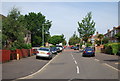
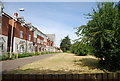

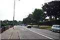
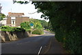
73 photos from this area
Area Information
Key information about the NR5 8EA including its size, population, and administrative classification.
- Area Type
- Postcode
- Area Size
- 3873 m²
- Population
- 2043
- Population Density
- 6025 people/km²
House Prices in NR5 8EA
15
Properties
£129,917
Average Sold Price
£68,000
Lowest Price
£170,000
Highest Price
Showing 15 properties
| Address | Type | Beds | Baths | Last Sale Price | Last Sale Date | |
|---|---|---|---|---|---|---|
| 54 Ranworth Road, Norwich, NR5 8EA | Terraced | - | - | £160,000 | Dec 2022 | |
| 93 Ranworth Road, Norwich, NR5 8EA | Terraced | 3 | 1 | £170,000 | Mar 2021 | |
| 99 Ranworth Road, Norwich, NR5 8EA | Detached | 3 | 1 | £135,000 | Dec 2015 | |
| 89 Ranworth Road, Norwich, NR5 8EA | Semi-detached | 3 | 1 | £140,000 | Dec 2014 | |
| 91 Ranworth Road, Norwich, NR5 8EA | Terraced | 3 | - | £106,500 | May 2013 | |
| 52 Ranworth Road, Norwich, NR5 8EA | Terraced | 3 | 1 | £68,000 | Feb 2010 | |
| 105 Ranworth Road, Norwich, NR5 8EA | Semi-detached | 3 | 1 | - | - | |
| 95 Ranworth Road, Norwich, NR5 8EA | house | - | - | - | - | |
| 97 Ranworth Road, Norwich, NR5 8EA | Terraced | - | - | - | - | |
| 87 Ranworth Road, Norwich, NR5 8EA | house | - | - | - | - |
Page 1 of 2
Energy Efficiency in NR5 8EA
Amenities
Schools
| Rank | School | Type | Entry gender | Ages |
|---|
Explore more schools in this area
Go to Schools tabDemographics
Household Size
Family (3-5 people)
most common
Accommodation Type
Houses
most common
Tenure
20
majority
Ethnic Group
White
most common
Religion
N/A
most common
Household Composition
N/A
most common
Age
22
median
Adults (30-64 years)
most common
Household Deprivation
N/A
with no deprivation
NS-SEC
16
in Lower managerial occupations
Explore more demographic insights in this area
Go to Demographics tabPlanning
Planning Constraints
- Flood RiskPremium
- Ramsar Wetland SitesPremium
- Area of Outstanding Natural BeautyPremium
- Protected Nature ReservePremium
- Protected WoodlandPremium