Area Overview for NR5 8DW
Photos of NR5 8DW


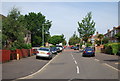
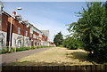
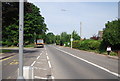
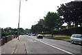
73 photos from this area
Area Information
Key information about the NR5 8DW including its size, population, and administrative classification.
- Area Type
- Postcode
- Area Size
- 6406 m²
- Population
- 2043
- Population Density
- 6025 people/km²
House Prices in NR5 8DW
28
Properties
£83,900
Average Sold Price
£53,000
Lowest Price
£125,000
Highest Price
Showing 28 properties
| Address | Type | Beds | Baths | Last Sale Price | Last Sale Date | |
|---|---|---|---|---|---|---|
| 122 Beverley Road, Norwich, NR5 8DW | Semi-detached | 6 | 3 | £125,000 | Sep 2010 | |
| 140 Beverley Road, Norwich, NR5 8DW | house | - | - | £105,000 | Dec 2005 | |
| 121 Beverley Road, Norwich, NR5 8DW | house | - | - | £82,000 | Jul 2005 | |
| 133 Beverley Road, Norwich, NR5 8DW | Semi-detached | - | - | £54,500 | Aug 2003 | |
| 111 Beverley Road, Norwich, NR5 8DW | house | - | - | £53,000 | Nov 2001 | |
| 111B Beverley Road, Norwich, NR5 8DW | Flat | - | - | - | - | |
| 111A Beverley Road, Norwich, NR5 8DW | Flat | - | - | - | - | |
| 128 Beverley Road, Norwich, NR5 8DW | house | - | - | - | - | |
| 125 Beverley Road, Norwich, NR5 8DW | house | - | - | - | - | |
| 126 Beverley Road, Norwich, NR5 8DW | house | - | - | - | - |
Page 1 of 3
Energy Efficiency in NR5 8DW
Amenities
Schools
| Rank | School | Type | Entry gender | Ages |
|---|
Explore more schools in this area
Go to Schools tabDemographics
Household Size
Family (3-5 people)
most common
Accommodation Type
Houses
most common
Tenure
20
majority
Ethnic Group
White
most common
Religion
N/A
most common
Household Composition
N/A
most common
Age
22
median
Adults (30-64 years)
most common
Household Deprivation
N/A
with no deprivation
NS-SEC
16
in Lower managerial occupations