Area Overview for NR4 6NF
Photos of NR4 6NF

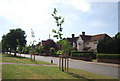
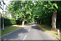
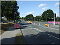
100 photos from this area
Area Information
Key information about the NR4 6NF including its size, population, and administrative classification.
- Area Type
- Postcode
- Area Size
- 2.6 hectares
- Population
- 1883
- Population Density
- 4149 people/km²
House Prices in NR4 6NF
60
Properties
£162,093
Average Sold Price
£65,995
Lowest Price
£222,500
Highest Price
Showing 60 properties
| Address | Type | Beds | Baths | Last Sale Price | Last Sale Date | |
|---|---|---|---|---|---|---|
| 384 Hall Road, Norwich, NR4 6NF | Flat | 2 | 1 | £147,500 | Mar 2024 | |
| 426 Hall Road, Norwich, NR4 6NF | house | 3 | 2 | £222,500 | Feb 2024 | |
| 420 Hall Road, Norwich, NR4 6NF | Terraced | 3 | 2 | £220,000 | Nov 2023 | |
| 432 Hall Road, Norwich, NR4 6NF | house | - | - | £205,000 | Feb 2021 | |
| 346 Hall Road, Norwich, NR4 6NF | Semi-detached | 3 | 1 | £190,000 | Jan 2020 | |
| 400 Hall Road, Norwich, NR4 6NF | house | 3 | 1 | £190,000 | Oct 2019 | |
| 424 Hall Road, Norwich, NR4 6NF | house | - | - | £202,500 | Mar 2019 | |
| 394 Hall Road, Norwich, NR4 6NF | house | 4 | - | £215,000 | Sep 2017 | |
| 356 Hall Road, Norwich, NR4 6NF | Flat | - | - | £100,000 | Mar 2015 | |
| 408 Hall Road, Norwich, NR4 6NF | Terraced | 3 | - | £153,000 | Aug 2014 |
Page 1 of 6
Energy Efficiency in NR4 6NF
Amenities
Schools
| Rank | School | Type | Entry gender | Ages |
|---|
Explore more schools in this area
Go to Schools tabDemographics
Household Size
Family (3-5 people)
most common
Accommodation Type
Houses
most common
Tenure
39
majority
Ethnic Group
White
most common
Religion
N/A
most common
Household Composition
N/A
most common
Age
47
median
Adults (30-64 years)
most common
Household Deprivation
N/A
with no deprivation
NS-SEC
22
in Lower managerial occupations
Explore more demographic insights in this area
Go to Demographics tabPlanning
Planning Constraints
- Flood RiskPremium
- Ramsar Wetland SitesPremium
- Area of Outstanding Natural BeautyPremium
- Protected Nature ReservePremium
- Protected WoodlandPremium