Area Overview for NR35 2HB
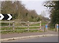
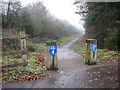
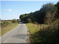
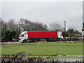
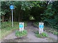
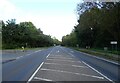
Photos of NR35 2HB

Area Information
Living in NR35 2HB means residing in a small residential cluster defined by the postcode NR35 2HB. This specific area covers just 3.0 hectares, creating a tightly knit environment where residents know their neighbours. With a total population of 1,610 people, the community feels intimate and established. You will find that daily life revolves around local convenience and proximity to key transport links that serve the broader region. The location balances quiet suburban living with practical access to nearby towns and employment centres. The density of 61 people per square kilometre ensures that homes are close enough for local interaction but spaced far enough to maintain privacy. This postcode sits in a setting where the built environment remains distinct from industrial zones, offering a traditional homebuyer experience. Residents value the stability of their immediate surroundings, knowing that the area supports a consistent community of owners and long-term residents. Whether you are commuting to work or visiting local shops, the layout of NR35 2HB prioritises straightforward accessibility. The area avoids the congestion of larger cities while retaining the amenities necessary for a self-sufficient lifestyle. You can expect a straightforward, unpretentious daily routine focused on family life and local stewardship.
- Area Type
- Postcode
- Area Size
- 3.0 hectares
- Population
- 1610
- Population Density
- 61 people/km²
The housing stock in NR35 2HB is overwhelmingly defined by houses, reflecting the accommodation type data for this specific postcode. With a home ownership rate of 76%, the market here is characterised by established owners rather than private landlords or short-term renters. You are looking at an area where the majority of residents have secured their own properties, which often translates to longer tenancies for rented homes if any exist. This dynamic suggests that the property market in NR35 2HB is stable and driven by local needs rather than speculative investment. The predominance of houses over apartments or other dwelling types limits the variety of home layouts available in the immediate vicinity. Buyers here typically compete with other home owners looking to stay in the area or establish a foothold. The high ownership percentage means that sellers often have a strong emotional and financial connection to their homes, which can influence negotiation dynamics. For those considering homes in NR35 2HB, the environment feels secure and free from the volatility often seen in high-turnover rental districts. The focus remains on permanent residences suited to families and adults seeking a quiet retreat.
House Prices in NR35 2HB
Showing 37 properties
| Address | Type | Beds | Baths | Last Sale Price | Last Sale Date | |
|---|---|---|---|---|---|---|
| 2 Lockhart Road, Ellingham, NR35 2HB | Detached | 2 | 1 | - | - | |
| 41 Lockhart Road, Ellingham, NR35 2HB | Bungalow | 3 | 1 | - | - | |
| 27 Lockhart Road, Ellingham, NR35 2HB | Bungalow | 3 | 1 | - | - | |
| 12 Lockhart Road, Ellingham, NR35 2HB | Chalet | 3 | 2 | - | - | |
| 46 Lockhart Road, Ellingham, NR35 2HB | Chalet | 4 | 1 | - | - | |
| 14 Lockhart Road, Ellingham, NR35 2HB | Bungalow | 3 | 1 | - | - | |
| 6 Lockhart Road, Ellingham, NR35 2HB | Bungalow | 4 | 1 | - | - | |
| 5 Lockhart Road, Ellingham, NR35 2HB | Bungalow | 3 | 2 | - | - | |
| 37 Lockhart Road, Ellingham, NR35 2HB | Bungalow | 3 | 1 | - | - | |
| 25 Lockhart Road, Ellingham, NR35 2HB | Bungalow | 2 | 1 | - | - |
Energy Efficiency in NR35 2HB
Daily life in NR35 2HB centres on a few key amenities that form the backbone of your weekly routine. For retail needs, you have access to five outlets, including Co-op Bungay, The Southern Co-operative Co, and Tesco Beccles. These supermarkets provide a comprehensive range of groceries, allowing you to stock up without leaving the immediate region. Transport options are diverse, with two rail stations and the Reedham Ferry North ferry enhancing your mobility for occasional trips or leisure travel. The presence of these specific venues means you do not need to travel far for essential shopping or banking services. You can rely on The Southern Co-operative Co for local provisions and Co-op Bungay for larger purchases. The proximity of Beccles Railway Station offers regular commuter routes, while the ferry provides a scenic alternative for weekend getaways. Residents value this combination of local retail independence and regional connectivity. You will find that daily errands take little effort, as most necessities are clustered within a short distance. This convenient layout supports a lifestyle where you can manage household budgets efficiently while enjoying access to broader coastal or town attractions when desired.
Amenities
Schools
Families considering NR35 2HB have access to a specific selection of educational institutions nearby. Heckingham First School operates as a primary institution for younger children within the local catchment. For children with special educational needs, two key special schools serve the area: Avocet House and Turnstone House School. Ofsted ratings confirm the quality of these special provision settings, with Turnstone House School holding an outstanding rating and Avocet House rated as good. This mix of a primary school and special needs colleges indicates a community that supports diverse learning requirements without relying solely on large secondary complexes. Parents in the area appreciate having special education options locally, reducing the need for travel to distant facilities. The presence of an outstanding-rated school like Turnstone House School is a significant positive for families requiring specialised support. Primary education remains in local hands at Heckingham First School, ensuring continuity for younger students. You will find that the school provision is focused and specialised rather than broad, catering specifically to the educational needs of the 1,610 residents. This targeted approach means resources are concentrated where they are most needed for the local child population.
| Rank | School | Type | Entry gender | Ages |
|---|
Explore more schools in this area
Go to Schools tabDemographics
The community within NR35 2HB reflects a mature, stable demographic profile. The median age of 47 years indicates that the area is dominated by adults rather than young families or retirees. The most common age range comprises adults between 30 and 64 years, suggesting a workforce-heavy population with established careers and families. This age distribution typically points to a neighbourhood where children may be present but the overall energy is one of settled adulthood. Home ownership stands at a high rate of 76%, confirming that this is primarily an area for those who have already purchased their homes. The overwhelming majority of the population lives in houses, meaning you will not find many flats or terraced properties in this specific cluster. Ethnically, the predominant group is White, contributing to the distinct character of the neighbourhood. You should expect neighbours who have likely been in their homes for years, valuing stability over rapid turnover. This demographic makeup means that the community operates with a shared understanding of local rules and conventions. Life here suits those seeking a predictable environment with established social structures and minimal uncertainty about the neighbourhood's future direction.
Household Size
Accommodation Type
Tenure
Ethnic Group
Religion
Household Composition
Age
Household Deprivation
NS-SEC
Explore more demographic insights in this area
Go to Demographics tabPlanning
Planning Constraints
- Flood RiskPremium
- Ramsar Wetland SitesPremium
- Area of Outstanding Natural BeautyPremium
- Protected Nature ReservePremium
- Protected WoodlandPremium