Area Overview for NR35 2PY
Photos of NR35 2PY
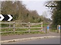
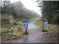
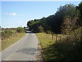
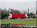

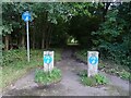

57 photos from this area
Area Information
Key information about the NR35 2PY including its size, population, and administrative classification.
- Area Type
- Postcode
- Area Size
- 20.4 hectares
- Population
- 1464
- Population Density
- 86 people/km²
House Prices in NR35 2PY
50
Properties
£214,677
Average Sold Price
£54,000
Lowest Price
£400,000
Highest Price
Showing 50 properties
| Address | Type | Beds | Baths | Last Sale Price | Last Sale Date | |
|---|---|---|---|---|---|---|
| 60 Mill Road, Ellingham, NR35 2PY | Detached | 3 | 1 | £340,000 | Sep 2025 | |
| 40 Mill Road, Ellingham, NR35 2PY | Bungalow | - | - | £310,000 | Jan 2025 | |
| 22 Mill Road, Ellingham, NR35 2PY | Detached | 1 | 1 | £400,000 | Mar 2023 | |
| 32 Mill Road, Ellingham, NR35 2PY | Bungalow | - | - | £325,000 | Sep 2021 | |
| 51 Mill Road, Ellingham, NR35 2PY | Bungalow | - | - | £290,000 | Aug 2021 | |
| 61 Mill Road, Ellingham, NR35 2PY | Bungalow | - | - | £225,000 | Jan 2021 | |
| 64 Mill Road, Ellingham, NR35 2PY | Bungalow | 3 | 1 | £330,000 | Sep 2020 | |
| 44 Mill Road, Ellingham, NR35 2PY | Bungalow | 3 | - | £255,000 | Sep 2016 | |
| 43 Mill Road, Ellingham, NR35 2PY | Semi-detached | 1 | 1 | £135,000 | May 2016 | |
| 63 Mill Road, Ellingham, NR35 2PY | house | - | - | £180,000 | Oct 2014 |
Page 1 of 5
Energy Efficiency in NR35 2PY
Amenities
Schools
| Rank | School | Type | Entry gender | Ages |
|---|
Explore more schools in this area
Go to Schools tabDemographics
Household Size
Two person
most common
Accommodation Type
Houses
most common
Tenure
76
majority
Ethnic Group
White
most common
Religion
N/A
most common
Household Composition
N/A
most common
Age
47
median
Adults (30-64 years)
most common
Household Deprivation
N/A
with no deprivation
NS-SEC
34
in Lower managerial occupations
Explore more demographic insights in this area
Go to Demographics tabPlanning
Planning Constraints
- Flood RiskPremium
- Ramsar Wetland SitesPremium
- Area of Outstanding Natural BeautyPremium
- Protected Nature ReservePremium
- Protected WoodlandPremium