Area Overview for NR34 7FN
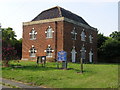
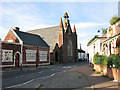
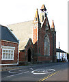
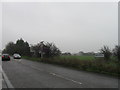
Photos of NR34 7FN
Area Information
Living in NR34 7FN means settling into a specific residential cluster defined by the postcode itself. This area occupies a very small footprint of just 7,146 square metres, creating a tight-knit environment rather than a sprawling suburb. You are part of a local population of 2,346 people, which gives the neighbourhood an intimate scale. The settlement is distinctly residential, with houses forming the core of the accommodation stock. Daily life here revolves around a quiet, community-focused existence. Because the land area is so limited, the sense of place is concentrated. The low population density of 38 people per square kilometre suggests a peaceful setting with minimal noise and congestion. This postcode serves as a base for those prioritising space and calm over urban convenience. You find yourself at the centre of a small, defined community where the local character is shaped by the specific mix of homes and the immediate surroundings. For anyone considering homes in NR34 7FN, the reality is that you are buying into a compact environment with clear boundaries. The area represents a specific slice of coastal Suffolk life, detached from the bustle of larger towns like Bury St Edmunds or Ipswich, though these remain accessible for wider needs. The distinction of this postcode lies in its exclusivity as a designated zone within a larger parish. It is a choice for those who understand the value of a small, manageable living space.
- Area Type
- Postcode
- Area Size
- 7146 m²
- Population
- 2346
- Population Density
- 38 people/km²
The housing market in NR34 7FN is characterised by a strong preference for ownership and a specific property type. With home ownership standing at 68%, the area is firmly established as an owner-occupied zone rather than a renting hub. This high percentage of owners implies that many residents have lived in their homes for extended periods. If you are looking for homes in NR34 7FN, you will likely encounter a stock of properties that show signs of long-term habitation and potential maintenance. The accommodation type is strictly defined as houses. This fact excludes flats, bungalows, or terraced blocks from the primary inventory, though specific house styles may vary across the postcode. The absence of rented sectors suggests that the local supply is driven by sales rather than lettings. For a prospective buyer, this means that competition in the market stems from individuals seeking to purchase dwellings to occupy or invest in for at least a decade. The small area size of 7,146 square metres further constrains the total number of properties available. You cannot find the scale of choice typical in larger towns, but the high ownership rate often reflects well-maintained estates. The market here functions quietly, with properties moving less frequently than in high-density urban centres. Each transaction involves a resident choosing to stay or move within this tight cluster. The data confirms that NR34 7FN is not a transient labour market but a destination for families and professionals seeking to put down roots. This reality simplifies the buying process but requires patience, as inventory turnover will be lower.
House Prices in NR34 7FN
Showing 11 properties
| Address | Type | Beds | Baths | Last Sale Price | Last Sale Date | |
|---|---|---|---|---|---|---|
| 12 Barn Owl Close, Wrentham, NR34 7FN | Bungalow | - | - | £416,500 | May 2024 | |
| 14 Barn Owl Close, Wrentham, NR34 7FN | Bungalow | - | - | £416,500 | May 2024 | |
| 4 Barn Owl Close, Wrentham, NR34 7FN | Terraced | 2 | 1 | - | - | |
| 7 Barn Owl Close, Wrentham, NR34 7FN | Bungalow | 3 | 2 | - | - | |
| 3 Barn Owl Close, Wrentham, NR34 7FN | Bungalow | 3 | 2 | - | - | |
| 6 Barn Owl Close, Wrentham, NR34 7FN | Terraced | 2 | 1 | - | - | |
| 8 Barn Owl Close, Wrentham, NR34 7FN | Terraced | 2 | 1 | - | - | |
| 10 Barn Owl Close, Wrentham, NR34 7FN | Bungalow | - | - | - | - | |
| 5 Barn Owl Close, Wrentham, NR34 7FN | Bungalow | - | - | - | - | |
| 1 Barn Owl Close, Wrentham, NR34 7FN | Bungalow | - | - | - | - |
Energy Efficiency in NR34 7FN
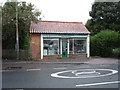
Your daily lifestyle in NR34 7FN is supported by a cluster of practical amenities within easy reach. For everyday shopping needs, five retail outlets serve the local community. Notable among these is the presence of multiple Spar stores, alongside a Co-op Kessingland. These outlets ensure you can access essential groceries and daily provisions without travelling far. The concentration of these specific high-street brands offers a familiar and reliable shopping experience. For those with a keen interest in air travel, Beccles Airport is the primary aviation facility accessible to residents. This proximity is a significant lifestyle feature for those who fly privately. Furthermore, two ferry landing points define the coastal character of the area. You can reach Southwold Ferry Landing and Walberswick Ferry Landing quickly, providing direct access to the Broads and Suffolk coast. These maritime connections transform short trips into feasible excursions for visitors and locals alike. The area also includes five railway entrance points and specific stations like Brampton Railway Station, giving you multiple options for regular train travel. This transport variety supports a lifestyle where commuting to Ipswich or Bury St Edmunds is routine. The presence of these specific named venues confirms that while NR34 7FN is small, its connections are not. You live in a compact postcode but maintain strong links to wider transport and retail networks. The amenities listed are sufficient to support self-containment while allowing easy expansion of your travel radius.
Amenities
Schools
Families considering NR34 7FN have access to a specific mix of educational institutions within practical reach. Two primary options exist for younger children: Brampton CofE Primary School and Brampton Church of England Primary School. Crucially, the latter institution holds an Ofsted rating of good. This specific rating provides verified confirmation of the school's educational standards and is a key data point for parents assessing quality. The school is part of the Church of England tradition, which informs its ethos and curriculum. For those seeking alternative education pathways, The Old School is available as an independent option nearby. This institution offers a fee-paying education model distinct from the state sector. The presence of both primary schools and an independent school indicates that the local area supports diverse academic needs and budgets. You can expect a range of entry points into education system from age three and upwards within close proximity to the postcode. No secondary schools are listed in the immediate vicinity data for NR34 7FN. This means that older children will likely need to travel further for secondary education, a common pattern in rural Suffolk settlements. The availability of multiple primary and independent choices suggests a strong local commitment to early education. Whether you are moving for a primary school persona or finalising your child's education path, the options near NR34 7FN provide a balanced start to their academic journey.
| Rank | School | Type | Entry gender | Ages |
|---|
Explore more schools in this area
Go to Schools tabDemographics
The community within NR34 7FN reflects a mature and stable population. The median age sits at 47 years, confirmed by the fact that adults aged between 30 and 64 form the most common age range. This demographic profile indicates a neighbourhood dominated by middle-aged families and older couples. You will find that the local residents have built their lives and careers, leading to a settled atmosphere with fewer transient populations. This stability is evident in the high rate of home ownership, which stands at 68%. A significant majority of residents in this postcode own their properties outright or with a mortgage. The high ownership percentage suggests a community that prioritises long-term investment and stability over renting. This statistic directly influences the character of the local estate agency and the speed of transactions. The dominance of houses as the predominant accommodation type further reinforces the preference for traditional, standalone living over flats or shared houses. The demographic diversity within the area is notably homogeneous, with the White ethnic group being the predominant ethnic group. This lack of significant ethnic diversity points to a traditional, established settlement where cultural influences are shared across the community. There are no minority groups noted as significant within this specific demographic breakdown. For buyers looking at NR34 7FN, this data confirms a straightforward, non-diverse demographic landscape that appeals to those seeking a uniform community feel. The combination of a mature age profile and high ownership rates creates a predictable and consistent social environment.
Household Size
Accommodation Type
Tenure
Ethnic Group
Religion
Household Composition
Age
Household Deprivation
NS-SEC
Explore more demographic insights in this area
Go to Demographics tabPlanning
Planning Constraints
- Flood RiskPremium
- Ramsar Wetland SitesPremium
- Area of Outstanding Natural BeautyPremium
- Protected Nature ReservePremium
- Protected WoodlandPremium