Area Overview for NR34 7HD
Photos of NR34 7HD
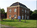
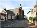
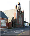
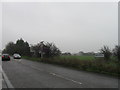
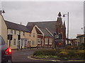
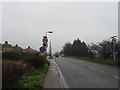
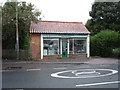
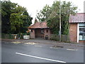
56 photos from this area
Area Information
Key information about the NR34 7HD including its size, population, and administrative classification.
- Area Type
- Postcode
- Area Size
- 2.2 hectares
- Population
- 2346
- Population Density
- 38 people/km²
House Prices in NR34 7HD
21
Properties
£227,111
Average Sold Price
£100,500
Lowest Price
£360,000
Highest Price
Showing 21 properties
| Address | Type | Beds | Baths | Last Sale Price | Last Sale Date | |
|---|---|---|---|---|---|---|
| 19 High Street, Wrentham, NR34 7HD | house | 5 | - | £350,000 | Dec 2024 | |
| 11 High Street, Wrentham, NR34 7HD | Terraced | 2 | 1 | £150,000 | Jun 2021 | |
| 7A High Street, Wrentham, NR34 7HD | Cottage | 2 | 1 | £138,000 | Mar 2018 | |
| 31 High Street, Wrentham, NR34 7HD | Semi-detached | 4 | 3 | £248,000 | Jul 2015 | |
| Wren House, 1 High Street, Wrentham, NR34 7HD | Retail | 3 | - | £360,000 | Feb 2015 | |
| 37 High Street, Wrentham, NR34 7HD | Detached | 3 | - | £270,000 | Jan 2014 | |
| 3 High Street, Wrentham, NR34 7HD | house | 3 | - | £100,500 | Aug 2012 | |
| Ivy Cottage, 11A High Street, Wrentham, NR34 7HD | Terraced | - | - | £162,500 | Sep 2005 | |
| 41 High Street, Wrentham, NR34 7HD | house | - | - | £265,000 | Jul 2005 | |
| 31A High Street, Wrentham, NR34 7HD | Detached | 4 | 4 | - | - |
Page 1 of 3
Energy Efficiency in NR34 7HD
Amenities
Schools
| Rank | School | Type | Entry gender | Ages |
|---|
Explore more schools in this area
Go to Schools tabDemographics
Household Size
Two person
most common
Accommodation Type
Houses
most common
Tenure
68
majority
Ethnic Group
White
most common
Religion
N/A
most common
Household Composition
N/A
most common
Age
47
median
Adults (30-64 years)
most common
Household Deprivation
N/A
with no deprivation
NS-SEC
30
in Lower managerial occupations
Explore more demographic insights in this area
Go to Demographics tabPlanning
Planning Constraints
- Flood RiskPremium
- Ramsar Wetland SitesPremium
- Area of Outstanding Natural BeautyPremium
- Protected Nature ReservePremium
- Protected WoodlandPremium