Area Overview for NR33 9RU
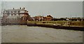
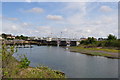
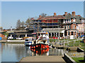
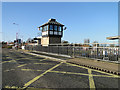
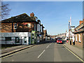
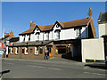
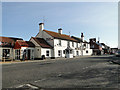
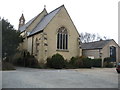
Photos of NR33 9RU


Area Information
Living in NR33 9RU offers a sense of established residential stability within a small, compact cluster. This postcode covers an area of 3,787 square metres and is home to a population of 1,455 people. The density reaches approximately 384,249 people per square kilometre, meaning residents live closely together in a concentrated environment. Daily life here is defined by limited space but high accessibility. The area functions as a tight-knit community rather than a sprawling suburb. You will find that the neighbourhood walls are thin, yet the sense of locality remains strong. Families and adults aged between 30 and 64 years form the backbone of this population. The residential nature of the cluster ensures you hear neighbours without needing to look for reassurance from security lights. It is a place where the household compositions blend quickly due to the sheer closeness of properties.
- Area Type
- Postcode
- Area Size
- 3787 m²
- Population
- 1455
- Population Density
- 3718 people/km²
The housing market in NR33 9RU is characterised by a strong preference for owner-occupied homes. An impressive 84% of properties are owned outright or with a mortgage, leaving only a small proportion in the rental sector. Houses are the main form of accommodation available, meaning you will not find modern apartment blocks or purpose-built flats in this specific cluster. This housing stock appeals to buyers seeking traditional living arrangements rather than urban convenience. The high ownership rate suggests that properties here are often filled by families or individuals who have built equity over time. Small area size of 3,787 square metres limits large-scale new development, preserving the existing character of the street. When looking at homes in NR33 9RU, you are purchasing into a market defined by permanence. The lack of significant rental stock means competition comes primarily from local families looking to expand or update their current residences rather than investors flipping properties.
House Prices in NR33 9RU
Showing 4 properties
| Address | Type | Beds | Baths | Last Sale Price | Last Sale Date | |
|---|---|---|---|---|---|---|
| 4 Skoulding Close, Lowestoft, NR33 9RU | Bungalow | 3 | 1 | £305,000 | Apr 2021 | |
| 1 Skoulding Close, Lowestoft, NR33 9RU | Bungalow | 3 | 2 | £350,000 | Feb 2020 | |
| 3 Skoulding Close, Lowestoft, NR33 9RU | Bungalow | - | - | £302,500 | Jan 2018 | |
| 2 Skoulding Close, Lowestoft, NR33 9RU | Detached | - | - | £74,950 | Feb 1995 |
Energy Efficiency in NR33 9RU
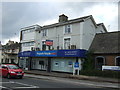
Amenities in NR33 9RU are clustered within practical reach, reducing the need for long daily commutes to town centres. Retail options include Co-op Pinewood, Lidl Oulton, and Tesco Oulton, offering essential shopping needs. These five retail venues provide a mix of general goods and major supermarket services to the residents. For rail-based travellers, Oulton Broad South Railway Station is a notable nearby hub, alongside other entries such as Entrance1 and Entrance3. Beccles Airport stands as the single notable airport amenity accessible to the area. While NR33 9RU is a small residential zone, the proximity of these specific stores means you can pick up weekly groceries without leaving your parish boundaries. The presence of multiple retail locations ensures you do not have to travel far for basic necessities. Dining and leisure options are not explicitly listed in the nearby amenities data, but the concentration of supermarkets and transport links supports a functional daily lifestyle.
Amenities
Schools
Educational provision for families living in NR33 9RU is centred on local facilities with assessed quality standards. Dell Primary School serves the immediate needs of younger children in the area. It is classified as a primary school type and holds an Ofsted rating of good. This rating indicates that the school meets expected standards for education, behaviour, and safeguarding. Because NR33 9RU is a small residential cluster, you will find no secondary schools listed within the immediate vicinity of this specific postcode. Families with older children often look beyond NR33 9RU for secondary education. However, the presence of Dell Primary School with its positive Ofsted rating provides a reliable local option for early years education. The concentration of primary provision reflects the age profile of the neighbourhood, where adults and families with school-aged children form the majority demographic.
| Rank | School | Type | Entry gender | Ages |
|---|
Explore more schools in this area
Go to Schools tabDemographics
The community profile in NR33 9RU reflects a mature and settled population. The median age stands at 47 years, placing the neighbourhood well beyond the typical youthful demographic found in many urban growth zones. Adults aged between 30 and 64 years constitute the most common age range within the area. This age profile suggests a location popular with families once children have started school or with those looking for retirement phases of life. Home ownership is high at 84%, indicating a deep-rooted sense of tenure among residents rather than a transient rental market. Houses are the predominant accommodation type, confirming a landscape built for family living rather than high-density urban flats. The predominant ethnic group is White, consistent with many established areas in this part of England. These demographic features create an environment where long-term residents know their neighbours and where property values often reflect stability and established community standing.
Household Size
Accommodation Type
Tenure
Ethnic Group
Religion
Household Composition
Age
Household Deprivation
NS-SEC
Explore more demographic insights in this area
Go to Demographics tabPlanning
Planning Constraints
- Flood RiskPremium
- Ramsar Wetland SitesPremium
- Area of Outstanding Natural BeautyPremium
- Protected Nature ReservePremium
- Protected WoodlandPremium