Area Overview for NR33 9PR
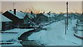
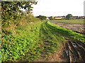
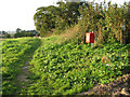
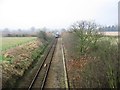
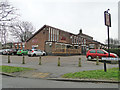
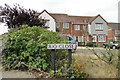
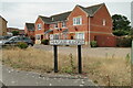
Photos of NR33 9PR
Area Information
NR33 9PR represents a specific residential cluster within the wider postcode system of England. This defined area covers just 1.3 hectares, creating a compact neighbourhood feel within the municipality. You will find a population of 1,462 people residing in this small footprint, which results in extremely high population density figures of 109,863 people per square kilometre when calculated against the limited space. Despite these concentrated statistics, the location functions as a stable community centre rather than a chaotic zone. Residents here navigate a space where every property is likely within walking distance of another, fostering a tight-knit environment. The area feels established and grounded, avoiding the transient nature often found in larger, less dense developments. Daily life revolves around knowing your neighbours, given the sheer number of households packed into such a small geographic boundary. This postcode serves as a distinct residential anchor for those seeking a contained living experience. Potential buyers should appreciate that NR33 9PR offers a defined sense of place without the sprawl associated with broader postcodes. The concentration of homes creates a quiet, manageable atmosphere where the local character remains consistent. You get a neighbourhood that is entirely self-contained yet connected to the wider transport network. This specific cluster provides a homely setting for families and individuals alike. When you look at NR33 9PR, you are looking at a place where modern connectivity meets traditional settlement patterns. The area is built for convenience and proximity, making it a practical choice for those who value location and community over vast open spaces.
- Area Type
- Postcode
- Area Size
- 1.3 hectares
- Population
- 1462
- Population Density
- 109863 people/km²
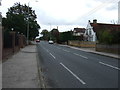
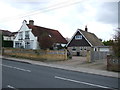
The property market in NR33 9PR is characterised by a near-total dominance of ownership. With 93 per cent of homes owned by residents, the area functions almost entirely as an owner-occupied zone rather than a rental market. This statistic is significant for buyers considering NR33 9PR, as it indicates a community where people stay and invest in their properties over the long term. The accommodation type is strictly houses, confirming that terraced, semi-detached, or apartment living is not an option within this specific postcode. This landscape offers a traditional residential experience typical of established neighbourhoods. When you search for homes in NR33 9PR, you are looking for detached or semi-detached properties designed for families or empty nesters. The absence of flats means noise levels and shared spaces are generally lower than in urban apartment blocks. Buyers looking at this area will find a market governed by owner sentiment rather than landlord requirements. This stability can lead to slower market turnover, meaning properties often remain on the market longer before changing hands. The high ownership percentage also suggests that service charges and local tenancy agreements are irrelevant concerns here; you deal directly with the seller. For those seeking a straightforward purchase where you inherit the property without leasehold complications, this postcode is well suited. The market reflects a desire for substance and permanence. Every home in NR33 9PR aligns with the house-based accommodation type classification. This aligns perfectly with buyers who prioritise land, gardens, and privacy over urban density.
House Prices in NR33 9PR
Showing 11 properties
| Address | Type | Beds | Baths | Last Sale Price | Last Sale Date | |
|---|---|---|---|---|---|---|
| 88 Cotmer Road, Lowestoft, NR33 9PR | Detached | 4 | - | £429,950 | Oct 2013 | |
| 94 Cotmer Road, Lowestoft, NR33 9PR | Bungalow | - | - | £345,000 | Dec 2009 | |
| 96 Cotmer Road, Lowestoft, NR33 9PR | Bungalow | - | - | £345,000 | Dec 2009 | |
| 92 Cotmer Road, Lowestoft, NR33 9PR | Detached | - | - | £249,000 | Jul 2009 | |
| Connel Lodge, 90 Cotmer Road, Lowestoft, NR33 9PR | Detached | - | - | £134,500 | Nov 1995 | |
| Chestnut Lodge, 100 Cotmer Road, Lowestoft, NR33 9PR | Detached | 4 | 1 | - | - | |
| 86 Cotmer Road, Lowestoft, NR33 9PR | Detached | - | - | - | - | |
| Elm Lodge, 84 Cotmer Road, Lowestoft, NR33 9PR | Detached | - | - | - | - | |
| 96A Cotmer Road, Lowestoft, NR33 9PR | Detached | - | - | - | - | |
| 100A Cotmer Road, Lowestoft, NR33 9PR | Detached | - | - | - | - |
Energy Efficiency in NR33 9PR
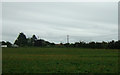
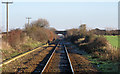
Daily life in NR33 9PR revolves around practical accessibility to key amenities within a short distance. Retail needs are met by five major stores, including the prominent Co-op Carlton, Co-op Pinewood, and Tesco Oulton. These supermarkets ensure you have access to groceries, pharmacy services, and daily essentials without requiring a lengthy journey. For those who need regular deliveries or bulk shopping, the presence of Tesco Oulton is particularly advantageous. Transport options are equally robust, with five nearby railway stations serving as primary gateways. Oulton Broad South Railway Station stands out as a notable hub for train travel, while Entrance3 and Entrance1 provide access to various transport links. These facilities facilitate easy commutes to nearby towns and cities. Beccles Airport, located just one mile away, offers an additional travel option for business or leisure trips. The integration of these transport nodes means you can leave NR33 9PR quickly whether by road or rail. Shopping trips and social visits are convenient, keeping the daily routine balanced between local comfort and wider opportunities. The proximity of these specific venues ensures that you do not have to drive far for necessities. This amenity-rich environment complements the tight-knit residential nature of the postcode. You enjoy the convenience of local services alongside the quiet of a house-based community.
Amenities
Schools
| Rank | School | Type | Entry gender | Ages |
|---|
Explore more schools in this area
Go to Schools tabDemographics
The community within NR33 9PR reflects a mature and settled demographic profile. The median age stands at 47 years, indicating that a significant portion of the population comprises adults in the 30 to 64 years bracket. This age range suggests a neighbourhood dominated by working professionals, retirees, or growing families rather than young singles or students. Homeownership is extremely prevalent, with 93 per cent of residents owning their properties outright or with a mortgage. This figure paints a clear picture of a stable, owner-occupied community where long-term investment is the norm. Accommodation types are exclusively houses, meaning you will not find purpose-built flats or high-rise buildings within this postcode. The ethnic composition is predominantly White, characteristic of many established rural or semi-rural settlements in the region. While the 109,863 people per square kilometre density is high on paper, the actual experience on the ground likely feels more spacious due to the single-detached nature of the housing stock. Childcare needs are met by a family-focused population structure, while the high ownership rate implies lower turnover rates compared to rental-heavy zones. Every claim regarding the area's character stems directly from these concrete statistics. The demographic reality is one of stability and permanence. You are entering a home environment where residents have likely put down roots for decades. The lack of rental properties further distinguishes this area from popular commuter hubs filled with short-term lets. Understanding these demographics helps you gauge the social fabric of NR33 9PR. It is an area defined by longevity and a consistent age profile suited to established householders.
Household Size
Accommodation Type
Tenure
Ethnic Group
Religion
Household Composition
Age
Household Deprivation
NS-SEC
Explore more demographic insights in this area
Go to Demographics tabPlanning
Planning Constraints
- Flood RiskPremium
- Ramsar Wetland SitesPremium
- Area of Outstanding Natural BeautyPremium
- Protected Nature ReservePremium
- Protected WoodlandPremium