Area Overview for NR33 8PW
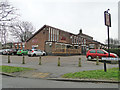
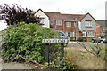
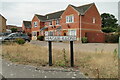
Photos of NR33 8PW
Area Information
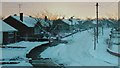
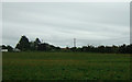
Living in NR33 8PW offers a straightforward experience within a defined residential cluster covering just 1.1 hectares. This specific postcode serves 1,462 people, creating a tightly knit community where residents know their neighbours. You will find this area to be distinctly concentrated, with a population density of 129,277 people per square kilometre. Such high density suggests that streets are closely spaced and local life revolves around immediate proximity. The location falls within England, providing access to national infrastructure while maintaining a focused local identity. Daily life here is characterised by practicality; you do not travel far for essential needs because the community is so compact. The area functions as a self-contained unit where most daily activities happen within walking or short driving distance. You navigate a small footprint where noise and visual activity are naturally contained by the boundaries of the cluster. This setup appeals to those who prefer a predictable environment without the sprawl of larger towns. The residential nature of NR33 8PW ensures that development is limited, preserving the quiet corridors that define home life. As a specific postcode covering a small cluster, it avoids the chaotic fragmentation of larger districts. Residents benefit from a simplified spatial layout where the distance to key destinations remains constant and manageable.
- Area Type
- Postcode
- Area Size
- 1.1 hectares
- Population
- 1462
- Population Density
- 3142 people/km²
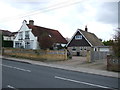
The property market in NR33 8PW is defined by a lack of rental inventory due to extremely high home ownership levels. You are entering a market where 93% of residents own their homes, effectively eliminating the private rental sector for newcomers seeking to buy. This concentration of ownership means you will find properties with established histories and potentially lower turnover rates. Sellers here may be less inclined to move quickly unless they have a local motive for departure. Homes in NR33 8PW are exclusively houses. The absence of flats or apartments creates a uniform housing stock that lacks vertical density. You can expect detached, semi-detached, or terraced houses arranged along low-rise streets. Building heights remain restricted, ensuring light and ventilation are not compromised by neighbouring structures. The dominance of private ownership often correlates with greater maintenance standards, as owners invest directly in the value of their asset. This market structure reduces the competition from institutional landlords chasing yields. For buyers looking at this small area, the primary challenge lies in availability rather than finance. With nearly the entire population invested as owners, finding a specific house type that suits you may require patience. The market operates on mutual agreement between local parties who understand the specific conditions of the neighbourhood. You should anticipate negotiations that respect the long-term commitment of existing residents. The consistent housing type means price variations will likely depend on condition and plot size rather than architectural style. Your search focuses on finding a sound property within a community that values permanence over change.
House Prices in NR33 8PW
Showing 20 properties
| Address | Type | Beds | Baths | Last Sale Price | Last Sale Date | |
|---|---|---|---|---|---|---|
| 15 Plovers Way, Lowestoft, NR33 8PW | Detached | 3 | 2 | £270,000 | Dec 2025 | |
| 12 Plovers Way, Lowestoft, NR33 8PW | house | 5 | 2 | £344,000 | Nov 2023 | |
| 9 Plovers Way, Lowestoft, NR33 8PW | Detached | 2 | 2 | £257,000 | Jul 2023 | |
| 5 Plovers Way, Lowestoft, NR33 8PW | Detached | 3 | 1 | £246,000 | Mar 2020 | |
| 13 Plovers Way, Lowestoft, NR33 8PW | house | - | - | £235,000 | May 2019 | |
| 19 Plovers Way, Lowestoft, NR33 8PW | Detached | 3 | 1 | £235,000 | May 2019 | |
| 2 Plovers Way, Lowestoft, NR33 8PW | house | - | - | £259,000 | Jun 2015 | |
| 27 Plovers Way, Lowestoft, NR33 8PW | house | - | - | £188,000 | May 2015 | |
| 3 Plovers Way, Lowestoft, NR33 8PW | house | - | - | £177,500 | Jul 2014 | |
| 17 Plovers Way, Lowestoft, NR33 8PW | Detached | 4 | - | £180,000 | Mar 2014 |
Energy Efficiency in NR33 8PW
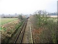
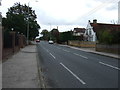
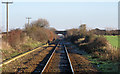
Your daily lifestyle in NR33 8PW is supported by a cluster of amenities within practical reach. Five retail venues operate nearby, including Co-op Carlton, Tesco Oulton, and Co-op Pinewood. These shops allow you to purchase groceries, household essentials, and daily necessities without travelling far. You can plan your weekly shopping at Tesco Oulton or use the Co-op branches for fresh produce and baked goods. The concentration of these five outlets ensures you do not need to venture deep into neighbouring towns for basic supplies. Local transport infrastructure complements your lifestyle with five notable rail entrances and stations nearby. Oulton Broad South Railway Station stands out as a major hub for regional travel. You can reach the station quickly for weekend trips or business meetings, integrating travel seamlessly into your routine. Beccles Airport sits within the vicinity, providing an alternative mode of transport for urgent or leisurely air travel. The presence of rail and air options means you are not isolated from the wider network despite living in a small residential cluster. These amenities create a convenient environment where essential services are never distant. You spend less time commuting to shops and more time engaging with your local surroundings. The proximity of Co-op Carlton and Pinewood allows for impromptu visits or quick errands when time is short. This accessibility supports a balanced life where work, play, and domestic duties overlap efficiently. The variety of retail and transport options ensures that NR33 8PW remains connected to the broader region while maintaining a focused local character.
Amenities
Schools
| Rank | School | Type | Entry gender | Ages |
|---|
Explore more schools in this area
Go to Schools tabDemographics
The community in NR33 8PW is dominated by adults aged between 30 and 64 years, reflecting a mature household base. Your neighbour is likely middle-aged, contributing to a stable social dynamic that values long-term residence. With a median age of 47 years, the demographic skew towards older adults shapes the local rhythm and priorities. This age profile indicates that families with young teenagers or active young adults may find fewer peers of the same generation nearby compared to suburban towns. Home ownership stands at 93%, proving that this is explicitly an owner-occupied sector. Almost every resident owns their property, meaning you will encounter few temporary renters or transient populations. This high rate of ownership fosters a settled environment where long-term investment takes precedence over speculative moves. Hereditary homes and carefully maintained dwellings define the neighbourhood rather than new-build estates or investment portfolios. You can expect a community where residents care deeply for their immediate surroundings because they possess a permanent stake in them. The accommodation type comprises houses exclusively. You will not find flats, bungalows dominated by terraced blocks, or purpose-built rental complexes within NR33 8PW. This uniformity reinforces the traditional character of the settlement. The predominant ethnic group is White, aligning with the broader national statistics for the region. This demographic homogeneity creates a shared cultural background among residents, though it does not preclude a welcoming attitude towards newcomers. The absence of diverse housing stock means the visual landscape remains consistent, with gardens and private plots forming a significant part of the streetscape.
Household Size
Accommodation Type
Tenure
Ethnic Group
Religion
Household Composition
Age
Household Deprivation
NS-SEC
Explore more demographic insights in this area
Go to Demographics tabPlanning
Planning Constraints
- Flood RiskPremium
- Ramsar Wetland SitesPremium
- Area of Outstanding Natural BeautyPremium
- Protected Nature ReservePremium
- Protected WoodlandPremium