Area Overview for NR33 9JE
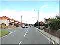
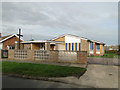
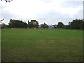
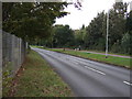
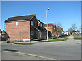
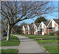
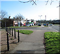
Photos of NR33 9JE

Area Information
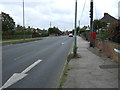
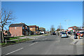
NR33 9JE represents a very specific residential cluster within Norfolk, encompassing just 4,915 square metres of land. You will find 1,416 residents living in this compact space, resulting in a population density of 288,076 people per square kilometre. This figure indicates an exceptionally high concentration of people within a tiny geographical footprint. Living in NR33 9JE means being part of a dense residential environment where properties are closely packed together. The area functions as a small, tightly knit community rather than a sprawling suburb. You can expect daily life to revolve around immediate neighbours and local services that are within practical reach. The postcode area is large enough to host a distinct group of households but small enough that you will rely heavily on nearby towns for broader amenities. Your sense of place here is defined by proximity and the efficient use of limited space. Everyone in NR33 9JE shares the experience of navigating a neighbourhood where land is at a premium. This density creates a self-contained atmosphere where residents rely on each other and local infrastructure to maintain their quality of life.
- Area Type
- Postcode
- Area Size
- 4915 m²
- Population
- 1416
- Population Density
- 3083 people/km²
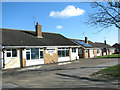
You will find that the property market in NR33 9JE is overwhelmingly dominated by owner-occupied homes. With 92% of residents owning their property, this is not a rental hotspot but a settled residential zone. The accommodation type data confirms that houses are the standard housing stock here. This means you will see traditional family homes built for long-term living rather than investment properties or modern apartment complexes. Looking at homes in NR33 9JE, you are buying into a market where security of tenure is already established. The small size of the area, covering only 4,915 square metres, means there are limited properties available for purchase. Consequently, any sale here will likely attract significant local interest due to the scarcity of individual titles. Buyers approaching this small postcode should be prepared for a competitive environment where each property represents a significant portion of the local stock. The high ownership percentage suggests that landlords present for sale will be rare exceptions to the rule.
House Prices in NR33 9JE
Showing 8 properties
| Address | Type | Beds | Baths | Last Sale Price | Last Sale Date | |
|---|---|---|---|---|---|---|
| 16 Langley Gardens, Lowestoft, NR33 9JE | Bungalow | - | - | £125,000 | Sep 2013 | |
| 8 Langley Gardens, Lowestoft, NR33 9JE | Bungalow | 3 | 2 | £160,000 | Oct 2011 | |
| 2 Langley Gardens, Lowestoft, NR33 9JE | Bungalow | - | - | £132,000 | May 2009 | |
| 10 Langley Gardens, Lowestoft, NR33 9JE | Detached | - | - | £58,995 | Aug 1995 | |
| 14 Langley Gardens, Lowestoft, NR33 9JE | Detached | - | - | - | - | |
| 6 Langley Gardens, Lowestoft, NR33 9JE | Detached | - | - | - | - | |
| 4 Langley Gardens, Lowestoft, NR33 9JE | Bungalow | - | - | - | - | |
| 12 Langley Gardens, Lowestoft, NR33 9JE | Detached | - | - | - | - |
Energy Efficiency in NR33 9JE
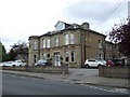
Your daily lifestyle in NR33 9JE revolves around a concise list of nearby amenities. Five retail options are available, including Co-op Pinewood, Co-op Carlton, and Co-op Pakefield. Having three different Co-op locations nearby ensures you have multiple places to shop locally. Five rail access points, including Oulton Broad South Railway Station, provide train links to wider regions. One airport facility, Beccles Airport, is listed as a notable amenity. Consequently, you have access to comprehensive shopping, reliable public transport, and private flight options all within reach. Living in NR33 9JE offers immediate convenience for everyday errands. You can complete most shopping tasks without travelling deep into town centres. The presence of multiple grocery retailers means you have variety in what you can buy locally. While the area itself is small, the network of nearby venues expands your practical reach significantly.
Amenities
Schools
Several educational institutions serve the neighbourhood surrounding NR33 9JE. Elm Tree Community Primary School operates as a local primary option for younger children. Elm Tree Middle School also serves the primary education needs of the catchment area. Finally, Elm Tree Primary School holds a 'good' Ofsted rating, which provides a verified standard of education for parents. This mix of primary and primary-middle institutions means you have two tiers of education within the same named network. The presence of a school with a good rating offers a reliable educational foundation for families living in the area. Living in NR33 9JE means your children can attend these local establishments without needing to look further afield for basic schooling. The concentration of Elm Tree branded schools suggests a coordinated approach to local education. Families here can rely on these specific named schools rather than a random selection of temporary provision.
| Rank | School | Type | Entry gender | Ages |
|---|
Explore more schools in this area
Go to Schools tabDemographics
The community in NR33 9JE is defined by stability and maturity, with a median age of 47 years old. Most residents fall into the adult age range of 30 to 64 years, suggesting a population that has largely settled down. You are looking at an area where long-term residency is the norm rather than transience. Home ownership stands at 92%, which signifies that the vast majority of people in this postcode own their homes outright. This high rate indicates strong community roots and financial stability among the inhabitants. Houses form the predominant type of accommodation, meaning you will encounter mostly detached or semi-detached family dwellings rather than apartments or converted flats. The predominant ethnic group is White, reflecting the traditional demographic profile of this part of Norfolk. With such a high ownership rate and a mature age profile, the area likely appeals to families and empty nesters seeking permanence. The demographic makeup suggests a quiet, established environment where residents have put down deep roots.
Household Size
Accommodation Type
Tenure
Ethnic Group
Religion
Household Composition
Age
Household Deprivation
NS-SEC
Explore more demographic insights in this area
Go to Demographics tabPlanning
Planning Constraints
- Flood RiskPremium
- Ramsar Wetland SitesPremium
- Area of Outstanding Natural BeautyPremium
- Protected Nature ReservePremium
- Protected WoodlandPremium