Area Overview for NR33 9DY
Photos of NR33 9DY

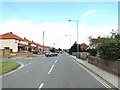
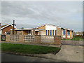
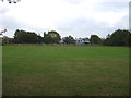
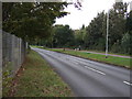
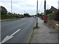

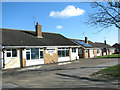
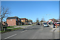
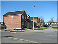
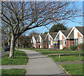
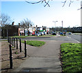
23 photos from this area
Area Information
Key information about the NR33 9DY including its size, population, and administrative classification.
- Area Type
- Postcode
- Area Size
- 1.0 hectares
- Population
- 1377
- Population Density
- 3762 people/km²
House Prices in NR33 9DY
23
Properties
£184,470
Average Sold Price
£44,500
Lowest Price
£280,000
Highest Price
Showing 23 properties
| Address | Type | Beds | Baths | Last Sale Price | Last Sale Date | |
|---|---|---|---|---|---|---|
| 20 Heigham Drive, Lowestoft, NR33 9DY | Semi-detached | 2 | 1 | £212,000 | Apr 2024 | |
| 26 Heigham Drive, Lowestoft, NR33 9DY | Detached | 2 | 1 | £222,000 | Feb 2024 | |
| 15 Heigham Drive, Lowestoft, NR33 9DY | Bungalow | 2 | 1 | £205,000 | Oct 2023 | |
| 30 Heigham Drive, Lowestoft, NR33 9DY | Bungalow | 2 | 1 | £227,000 | Apr 2023 | |
| 11 Heigham Drive, Lowestoft, NR33 9DY | Retail | 2 | 1 | £246,000 | Dec 2022 | |
| 12 Heigham Drive, Lowestoft, NR33 9DY | Semi-detached | 2 | 1 | £250,000 | Oct 2022 | |
| 27 Heigham Drive, Lowestoft, NR33 9DY | Bungalow | 3 | 1 | £280,000 | Oct 2022 | |
| 13 Heigham Drive, Lowestoft, NR33 9DY | Bungalow | 4 | 1 | £260,000 | Sep 2022 | |
| 34 Heigham Drive, Lowestoft, NR33 9DY | Bungalow | - | - | £270,000 | Nov 2021 | |
| 9 Heigham Drive, Lowestoft, NR33 9DY | Bungalow | 2 | 1 | £235,000 | Sep 2021 |
Page 1 of 3
Energy Efficiency in NR33 9DY
Amenities
Schools
| Rank | School | Type | Entry gender | Ages |
|---|
Explore more schools in this area
Go to Schools tabDemographics
Household Size
Two person
most common
Accommodation Type
Houses
most common
Tenure
67
majority
Ethnic Group
White
most common
Religion
N/A
most common
Household Composition
N/A
most common
Age
47
median
Adults (30-64 years)
most common
Household Deprivation
N/A
with no deprivation
NS-SEC
19
in Lower managerial occupations
Explore more demographic insights in this area
Go to Demographics tabPlanning
Planning Constraints
- Flood RiskPremium
- Ramsar Wetland SitesPremium
- Area of Outstanding Natural BeautyPremium
- Protected Nature ReservePremium
- Protected WoodlandPremium