Area Overview for NR33 9BP
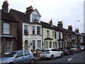
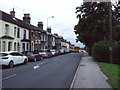
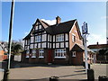
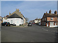
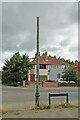
Photos of NR33 9BP
Area Information
NR33 9BP represents a small, tightly defined residential cluster in England, covering a mere 2673 square metres. This limited footprint supports a population of 1473 people, creating a neighbourhood with an exceptionally high population density of 551,070 people per square kilometre according to the recorded figures. You will find this specific postcode area serves as a concentrated living zone rather than a sprawling district. Daily life here involves navigating a compact environment where space is at a premium. The area functions as a distinct pocket within the wider local network, defined by its high concentration of residents within a very small physical boundary. Living in NR33 9BP means being part of a dense community cluster where neighbours are likely only moments away from one another across the small available landmass. The sheer density suggests an environment where public facilities and shared spaces play a critical role in supporting the daily routines of the residents who call this specific postcode home.
- Area Type
- Postcode
- Area Size
- 2673 m²
- Population
- 1473
- Population Density
- 551070 people/km²
The housing market within NR33 9BP is characterised almost entirely by housing stock comprising houses. There are no data entries suggesting the presence of flats or apartments in this specific postcode area. You will find that 55 per cent of the population in NR33 9BP owns their homes, a statistic that signals a market heavily weighted towards owner-occupiers rather than investors or landlords. This high rate of home ownership suggests that properties in the area are generally sought after by buyers looking for security and a permanent foothold in the property ladder. The total accommodation type is strictly houses, meaning the character of the streets within this 2673 square metre area will reflect garden-style living rather than block living. Living in this postcode means dealing with a residential environment where the primary asset type is detached or semi-detached housing. The lack of rental data in the provided profile reinforces the idea that this is a settled community where residents prioritize ownership stability.
House Prices in NR33 9BP
Showing 39 properties
Energy Efficiency in NR33 9BP
Residents of NR33 9BP have access to a defined range of retail and transport infrastructure located within practical reach. The nearby retail options include the Co-op Pinewood, Co-op Kirkley, and the larger Asda Lowestoft superstore, giving you three significant shopping points for your weekly groceries, banking, and larger store purchases. For rail travel, five notable stations serve the surrounding network, including Oulton Broad South Railway Station, Entrance3, and Entrance1, providing accessible links to wider regional networks. Air travel is also supported by Beccles Airport, located nearby for those requiring domestic flights. Living in NR33 9BP means you do not need to travel far for essential amenities. The presence of these specific venues like the Co-op Pinewood and Asda Lowestoft provides the convenience of everyday necessities at your doorstep. These facilities integrate seamlessly into the lifestyle of households in this dense cluster, supporting daily errands without requiring long commutes to urban centres.
Amenities
Schools
| Rank | School | Type | Entry gender | Ages |
|---|
Explore more schools in this area
Go to Schools tabDemographics
The community profile of NR33 9BP centres on established adults, with the median age standing at 47 years. The most common age range among residents spans between 30 and 64 years old, indicating a demographic focused on mid-to-late adulthood rather than young families or retired seniors. Home ownership is a defining feature of the area, with 55 percentage of households owning their property outright or with a mortgage. This majority ownership rate points towards a stable resident base rather than a transient population reliant on the private rental sector. White residents form the predominant ethnic group within this community. All accommodation in this specific cluster consists of houses, confirming the absence of flats or high-rise living in NR33 9BP itself. The demographic data paints a picture of a neighbourhood dominated by home-owning adults living in standalone houses, which shapes the social dynamics and household composition typical of this postcode area.
Household Size
Accommodation Type
Tenure
Ethnic Group
Religion
Household Composition
Age
Household Deprivation
NS-SEC
Explore more demographic insights in this area
Go to Demographics tabPlanning
Planning Constraints
- Flood RiskPremium
- Ramsar Wetland SitesPremium
- Area of Outstanding Natural BeautyPremium
- Protected Nature ReservePremium
- Protected WoodlandPremium