Area Overview for NR33 0NH
Photos of NR33 0NH
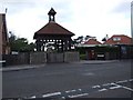
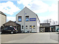
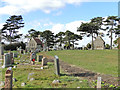
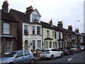
40 photos from this area
Area Information
Key information about the NR33 0NH including its size, population, and administrative classification.
- Area Type
- Postcode
- Area Size
- 3.5 hectares
- Population
- 1538
- Population Density
- 3288 people/km²
House Prices in NR33 0NH
67
Properties
£114,469
Average Sold Price
£17,000
Lowest Price
£241,500
Highest Price
Showing 67 properties
| Address | Type | Beds | Baths | Last Sale Price | Last Sale Date | |
|---|---|---|---|---|---|---|
| 17 Kirkley Run, Lowestoft, NR33 0NH | Semi-detached | 3 | 1 | £216,000 | Oct 2025 | |
| 43 Kirkley Run, Lowestoft, NR33 0NH | Terraced | 3 | 1 | £149,995 | May 2025 | |
| 3 Kirkley Run, Lowestoft, NR33 0NH | Semi-detached | 3 | 2 | £241,500 | Oct 2023 | |
| 45 Kirkley Run, Lowestoft, NR33 0NH | house | - | - | £120,000 | Jul 2023 | |
| 111 Kirkley Run, Lowestoft, NR33 0NH | Bungalow | - | - | £196,666 | Dec 2022 | |
| 19 Kirkley Run, Lowestoft, NR33 0NH | Semi-detached | 2 | 1 | £190,000 | Sep 2022 | |
| 37 Kirkley Run, Lowestoft, NR33 0NH | Terraced | 3 | 1 | £165,000 | Sep 2022 | |
| 105 Kirkley Run, Lowestoft, NR33 0NH | Semi-detached | 2 | 1 | £195,000 | Aug 2022 | |
| 91 Kirkley Run, Lowestoft, NR33 0NH | Terraced | 3 | 1 | £212,500 | Jun 2022 | |
| 113 Kirkley Run, Lowestoft, NR33 0NH | Semi-detached | 3 | 1 | £165,000 | Sep 2021 |
Page 1 of 7
Energy Efficiency in NR33 0NH
Amenities
Schools
| Rank | School | Type | Entry gender | Ages |
|---|
Explore more schools in this area
Go to Schools tabDemographics
Household Size
Two person
most common
Accommodation Type
Houses
most common
Tenure
68
majority
Ethnic Group
White
most common
Religion
N/A
most common
Household Composition
N/A
most common
Age
47
median
Adults (30-64 years)
most common
Household Deprivation
N/A
with no deprivation
NS-SEC
22
in Lower managerial occupations
Explore more demographic insights in this area
Go to Demographics tabPlanning
Planning Constraints
- Flood RiskPremium
- Ramsar Wetland SitesPremium
- Area of Outstanding Natural BeautyPremium
- Protected Nature ReservePremium
- Protected WoodlandPremium