Area Overview for NR33 9AW
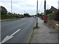
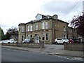
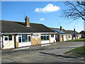
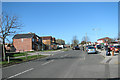
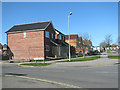
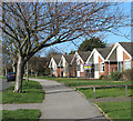
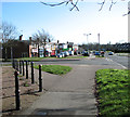
Photos of NR33 9AW

Area Information
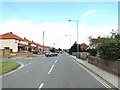
Living in NR33 9AW means residing in a tightly defined residential cluster across exactly 1.5 hectares of land. This small postcode covers a population of 1,473 residents, creating a density of 96,692 people per square kilometre. The layout is compact and focused, offering a sense of proximity where neighbours are rarely far away. Daily life revolves around this concentrated community, where interactions are frequent and the local character is shaped by a shared, small-scale environment. The area functions as a self-contained neighbourhood within Norfolk, England. Its size dictates a quiet existence away from the sprawl of larger urban centres. You will find homes situated close to one another, fostering a熟人式 atmosphere where residents know each other's routines. The location is specifically defined by the NR33 9AW postcode, which acts as the primary identifier for property searches in this zone. It is a place where the scale of the settlement remains manageable, avoiding the anonymity often found in bigger towns. The community feels distinct because of its limited geographical footprint, ensuring that everyone lives within a short walking or cycling distance of the central points of interest. The area is characterised by its residential nature, with little development beyond housing within these boundaries. This focus on living spaces means that the streets are primarily designed for domestic life. For those considering NR33 9AW as a home, the experience is defined by this concentrated settlement. It is a straightforward choice for individuals seeking a specific postcode area with a known, small population base. The location offers a clear picture of what home ownership entails here, wrapped in the familiarity of a compact English village or estate.
- Area Type
- Postcode
- Area Size
- 1.5 hectares
- Population
- 1473
- Population Density
- 5567 people/km²
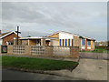
The property market in NR33 9AW is heavily skewed towards owner-occupiers, with 55% of residents owning their homes. This statistic paints a clear picture of the housing stock as a collection of privately held dwellings rather than a rental-heavy zone. Houses are the standard accommodation type found throughout the NR33 9AW postcode, eliminating the presence of flats or apartments from the local offer. Buyers looking at homes in this area should expect traditional structures that cater to families or individuals seeking a house on a plot of land. The small size of the area, spanning just 1.5 hectares, limits the sheer volume of properties available for purchase. This scarcity creates a niche market where specific properties can command attention within a tight cluster. The high home ownership percentage suggests that most current listings would result in a trade of existing owners rather than new investment units coming onto the market. For those considering NR33 9AW, the investment potential lies in acquiring a house that fits the established character of the neighbourhood. You will not find the typical high-rise or apartment developments here. The housing stock is consistent with the demographic profile of adults aged 30 to 64 years, who typically require standalone houses. This means that buyers looking for terraced houses or semi-detached homes should verify availability within the 1,473 resident count, though specific street-level data is not provided. The market reflects a stable environment where price fluctuations are often driven by the specific attributes of individual houses rather than the volatility of the rental sector. A property here is viewed as a permanent home base, aligning with the area's low population turnover.
House Prices in NR33 9AW
Showing 23 properties
| Address | Type | Beds | Baths | Last Sale Price | Last Sale Date | |
|---|---|---|---|---|---|---|
| 22 Fenlands Crescent, Lowestoft, NR33 9AW | Semi-detached | 2 | 1 | £205,000 | Jun 2024 | |
| 10 Fenlands Crescent, Lowestoft, NR33 9AW | Bungalow | - | - | £272,500 | May 2022 | |
| 3 Fenlands Crescent, Lowestoft, NR33 9AW | Bungalow | - | - | £260,000 | Nov 2020 | |
| 14 Fenlands Crescent, Lowestoft, NR33 9AW | Semi-detached | 2 | 1 | £206,000 | Jan 2020 | |
| 11 Fenlands Crescent, Lowestoft, NR33 9AW | Semi-detached | 2 | 1 | £155,000 | Aug 2017 | |
| 18 Fenlands Crescent, Lowestoft, NR33 9AW | Bungalow | 2 | - | £141,500 | Mar 2016 | |
| 4 Fenlands Crescent, Lowestoft, NR33 9AW | Detached | 3 | - | £168,000 | Apr 2013 | |
| 8 Fenlands Crescent, Lowestoft, NR33 9AW | Bungalow | 2 | - | £106,000 | Jul 2009 | |
| 21 Fenlands Crescent, Lowestoft, NR33 9AW | Semi-detached | - | - | £120,000 | Jan 2006 | |
| 17 Fenlands Crescent, Lowestoft, NR33 9AW | Bungalow | - | - | £59,995 | May 2001 |
Energy Efficiency in NR33 9AW
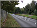
Your lifestyle in NR33 9AW is anchored by a selection of amenities that sit just outside the immediate residential cluster. For local shopping needs, you have access to several fixed retail points, including Co-op Pinewood, Co-op Carlton, and Tesco Oulton. These locations provide a practical selection of groceries and daily essentials, allowing you to complete weekly shopping runs with minimal travel time. The presence of these named chains ensures consistent service standards and familiar product ranges for all residents. Transport options extend beyond the local shops, with five rail stations offering significant connectivity. Oulton Broad South Railway Station is a notable landmark, providing a direct route for those looking to travel further afield. Less significant access points like Entrance3 and Entrance1 also contribute to the network, ensuring multiple pathways for commuters. For aviation needs or cargo transport, Beccles Airport stands as the only airport facility in the vicinity, adding a layer of logistical convenience to the area. Living in NR33 9AW offers a balance of isolation and access because amenities are clearly defined and located within practical reach. There must be no assumption of hidden services; the five retail outlets and five railway stations are your primary lifelines for the outside world. The residential density of 96,692 people per square kilometre ensures that these amenities serve a concentrated group of users efficiently. For families, the combination of Co-op shops and rail access creates a functional base for daily errands. You receive exactly what you pay for in this postcode: direct access to named facilities without the clutter of unnecessary commercial development within the 1.5 hectares.
Amenities
Schools
| Rank | School | Type | Entry gender | Ages |
|---|
Explore more schools in this area
Go to Schools tabDemographics
The community in NR33 9AW is defined by a mature and stable age profile. The median age stands at 47 years, indicating that the majority of residents fall into the 30 to 64 year old bracket. This demographic structure suggests a neighbourhood dominated by adults who have likely settled down over decades rather than transient young professionals or families in temporary housing. With 55% of the population owning their homes, the area reflects a strong culture of long-term residency. Half of the residents have achieved homeownership, while the remaining half live in rented accommodation. Houses are the predominant form of accommodation across these 1.5 hectares. This means that flats and apartments are absent from the stock, offering privacy and traditional living spaces for everyone. The population consists largely of White residents, according to available data on predominant ethnic groups. This homogeneity contributes to a cohesive community where shared cultural backgrounds likely influence local traditions and social interactions. The high ownership rate aligns with the age profile, as older generations often prefer the stability of a freehold property in a small postcode. Living here offers a demographic environment suited for established residents rather than those seeking a dynamic, multi-generational mix. The lack of significant youth or elderly extremes in the data points suggests a balanced workforce and family unit. Deprivation data is not included in the current records, but the high home ownership rate often correlates with financial stability among the population. You can expect a community where residents have put down roots, creating an environment where neighbours tend to stay in touch for extended periods.
Household Size
Accommodation Type
Tenure
Ethnic Group
Religion
Household Composition
Age
Household Deprivation
NS-SEC
Explore more demographic insights in this area
Go to Demographics tabPlanning
Planning Constraints
- Flood RiskPremium
- Ramsar Wetland SitesPremium
- Area of Outstanding Natural BeautyPremium
- Protected Nature ReservePremium
- Protected WoodlandPremium