Area Overview for NR33 8RB
Photos of NR33 8RB
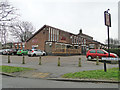
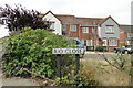
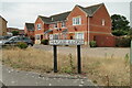
62 photos from this area
Area Information
Key information about the NR33 8RB including its size, population, and administrative classification.
- Area Type
- Postcode
- Area Size
- 1.1 hectares
- Population
- 1552
- Population Density
- 146581 people/km²
House Prices in NR33 8RB
21
Properties
£111,130
Average Sold Price
£26,500
Lowest Price
£195,000
Highest Price
Showing 21 properties
| Address | Type | Beds | Baths | Last Sale Price | Last Sale Date | |
|---|---|---|---|---|---|---|
| 9 Lucerne Close, Lowestoft, NR33 8RB | house | 2 | 1 | £195,000 | Aug 2022 | |
| 10 Lucerne Close, Lowestoft, NR33 8RB | house | - | - | £135,000 | Mar 2022 | |
| 29 Lucerne Close, Lowestoft, NR33 8RB | house | - | - | £185,000 | Sep 2021 | |
| 8 Lucerne Close, Lowestoft, NR33 8RB | house | - | - | £135,000 | Jun 2021 | |
| 15 Lucerne Close, Lowestoft, NR33 8RB | house | - | - | £147,000 | Jun 2020 | |
| 14 Lucerne Close, Lowestoft, NR33 8RB | Terraced | 2 | 1 | £145,000 | Mar 2020 | |
| 27 Lucerne Close, Lowestoft, NR33 8RB | Terraced | 2 | 1 | £129,950 | Jul 2017 | |
| 17 Lucerne Close, Lowestoft, NR33 8RB | house | - | - | £124,000 | May 2015 | |
| 5 Lucerne Close, Lowestoft, NR33 8RB | Terraced | 3 | - | £130,000 | Apr 2014 | |
| 11 Lucerne Close, Lowestoft, NR33 8RB | Flat | - | - | £85,000 | Sep 2013 |
Page 1 of 3
Energy Efficiency in NR33 8RB
Amenities
Schools
| Rank | School | Type | Entry gender | Ages |
|---|
Explore more schools in this area
Go to Schools tabDemographics
Household Size
N/A
most common
Accommodation Type
N/A
most common
Tenure
N/A
majority
Ethnic Group
N/A
most common
Religion
N/A
most common
Household Composition
N/A
most common
Age
N/A
median
N/A
most common
Household Deprivation
N/A
with no deprivation
NS-SEC
N/A
in Lower managerial occupations
Explore more demographic insights in this area
Go to Demographics tabPlanning
Planning Constraints
- Flood RiskPremium
- Ramsar Wetland SitesPremium
- Area of Outstanding Natural BeautyPremium
- Protected Nature ReservePremium
- Protected WoodlandPremium