Area Overview for NR33 8PQ
Photos of NR33 8PQ
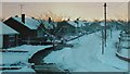
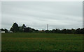
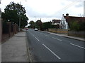
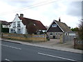
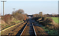
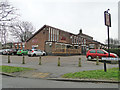
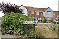
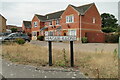
62 photos from this area
Area Information
Key information about the NR33 8PQ including its size, population, and administrative classification.
- Area Type
- Postcode
- Area Size
- 6074 m²
- Population
- 1496
- Population Density
- 1542 people/km²
House Prices in NR33 8PQ
14
Properties
£157,768
Average Sold Price
£68,000
Lowest Price
£296,000
Highest Price
Showing 14 properties
| Address | Type | Beds | Baths | Last Sale Price | Last Sale Date | |
|---|---|---|---|---|---|---|
| 2 Osprey Green, Lowestoft, NR33 8PQ | Detached | 4 | 1 | £230,000 | Mar 2025 | |
| 13 Osprey Green, Lowestoft, NR33 8PQ | house | - | - | £296,000 | Oct 2021 | |
| 12 Osprey Green, Lowestoft, NR33 8PQ | Detached | 3 | 1 | £215,000 | Jan 2021 | |
| 10 Osprey Green, Lowestoft, NR33 8PQ | Detached | 3 | 1 | £215,000 | Dec 2019 | |
| 6 Osprey Green, Lowestoft, NR33 8PQ | Terraced | 3 | 2 | £154,000 | Apr 2016 | |
| 1 Osprey Green, Lowestoft, NR33 8PQ | Terraced | 3 | - | £174,000 | Dec 2015 | |
| 7 Osprey Green, Lowestoft, NR33 8PQ | Semi-detached | 3 | - | £135,000 | Oct 2014 | |
| 5 Osprey Green, Lowestoft, NR33 8PQ | house | 3 | 1 | £139,000 | Aug 2013 | |
| 8 Osprey Green, Lowestoft, NR33 8PQ | Terraced | 3 | - | £119,000 | Aug 2013 | |
| 14 Osprey Green, Lowestoft, NR33 8PQ | house | 3 | - | £130,000 | Oct 2011 |
Page 1 of 2
Energy Efficiency in NR33 8PQ
Amenities
Schools
| Rank | School | Type | Entry gender | Ages |
|---|
Explore more schools in this area
Go to Schools tabDemographics
Household Size
Two person
most common
Accommodation Type
Houses
most common
Tenure
84
majority
Ethnic Group
White
most common
Religion
N/A
most common
Household Composition
N/A
most common
Age
47
median
Adults (30-64 years)
most common
Household Deprivation
N/A
with no deprivation
NS-SEC
28
in Lower managerial occupations
Explore more demographic insights in this area
Go to Demographics tabPlanning
Planning Constraints
- Flood RiskPremium
- Ramsar Wetland SitesPremium
- Area of Outstanding Natural BeautyPremium
- Protected Nature ReservePremium
- Protected WoodlandPremium