Area Overview for NR33 8NN
Photos of NR33 8NN
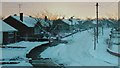
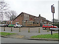
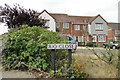
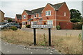
62 photos from this area
Area Information
Key information about the NR33 8NN including its size, population, and administrative classification.
- Area Type
- Postcode
- Area Size
- 4873 m²
- Population
- 1552
- Population Density
- 318498 people/km²
House Prices in NR33 8NN
20
Properties
£118,565
Average Sold Price
£19,500
Lowest Price
£225,000
Highest Price
Showing 20 properties
| Address | Type | Beds | Baths | Last Sale Price | Last Sale Date | |
|---|---|---|---|---|---|---|
| 16 Lily Way, Lowestoft, NR33 8NN | house | 3 | 2 | £225,000 | Feb 2025 | |
| 3 Lily Way, Lowestoft, NR33 8NN | Retail | 3 | 1 | £215,000 | Dec 2022 | |
| 8 Lily Way, Lowestoft, NR33 8NN | Terraced | 3 | - | £188,500 | Jul 2021 | |
| 4 Lily Way, Lowestoft, NR33 8NN | Semi-detached | 3 | 1 | £165,000 | Nov 2019 | |
| 9 Lily Way, Lowestoft, NR33 8NN | Semi-detached | 3 | - | £130,000 | Jun 2017 | |
| 11 Lily Way, Lowestoft, NR33 8NN | Semi-detached | 3 | 1 | £149,995 | Aug 2016 | |
| 20 Lily Way, Lowestoft, NR33 8NN | house | - | - | £107,500 | May 2010 | |
| 14 Lily Way, Lowestoft, NR33 8NN | house | - | - | £136,995 | Aug 2007 | |
| 1 Lily Way, Lowestoft, NR33 8NN | Terraced | - | - | £131,000 | Apr 2007 | |
| 10 Lily Way, Lowestoft, NR33 8NN | Terraced | - | - | £117,000 | Jun 2006 |
Page 1 of 2
Energy Efficiency in NR33 8NN
Amenities
Schools
| Rank | School | Type | Entry gender | Ages |
|---|
Explore more schools in this area
Go to Schools tabDemographics
Household Size
N/A
most common
Accommodation Type
N/A
most common
Tenure
N/A
majority
Ethnic Group
N/A
most common
Religion
N/A
most common
Household Composition
N/A
most common
Age
N/A
median
N/A
most common
Household Deprivation
N/A
with no deprivation
NS-SEC
N/A
in Lower managerial occupations
Explore more demographic insights in this area
Go to Demographics tabPlanning
Planning Constraints
- Flood RiskPremium
- Ramsar Wetland SitesPremium
- Area of Outstanding Natural BeautyPremium
- Protected Nature ReservePremium
- Protected WoodlandPremium