Area Overview for NR33 8EG
Photos of NR33 8EG
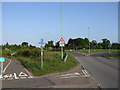
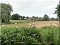
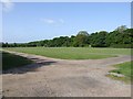
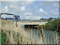
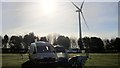
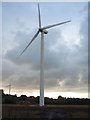
35 photos from this area
Area Information
Key information about the NR33 8EG including its size, population, and administrative classification.
- Area Type
- Postcode
- Area Size
- 14.8 hectares
- Population
- 1704
- Population Density
- 278 people/km²
House Prices in NR33 8EG
19
Properties
£175,300
Average Sold Price
£72,500
Lowest Price
£325,000
Highest Price
Showing 19 properties
| Address | Type | Beds | Baths | Last Sale Price | Last Sale Date | |
|---|---|---|---|---|---|---|
| Meadow Lea, Black Street, Gisleham, NR33 8EG | Detached | 3 | 1 | £305,000 | Mar 2014 | |
| 4, The Paddocks, Black Street, Gisleham, NR33 8EG | Detached | - | - | £325,000 | Nov 2003 | |
| Garden House, Black Street, Gisleham, NR33 8EG | house | - | - | £94,000 | Jun 2001 | |
| Rosemary Cottage, Black Street, Gisleham, NR33 8EG | Detached | - | - | £80,000 | Jul 1997 | |
| Blacksmith Cottage, Black Street, Gisleham, NR33 8EG | Bungalow | 3 | - | £72,500 | Nov 1996 | |
| Millstone, 2 Black Street, Gisleham, NR33 8EG | Detached | 4 | 2 | - | - | |
| The Hollies, Black Street, Gisleham, NR33 8EG | Lodge | 2 | 1 | - | - | |
| Millstone, Black Street, Gisleham, NR33 8EG | undefined | - | - | - | - | |
| Former Lilac Cottage, Black Street, Gisleham, NR33 8EG | Semi-detached | - | - | - | - | |
| Former Wayside Cottage, Black Street, Gisleham, NR33 8EG | Detached | - | - | - | - |
Page 1 of 2
Energy Efficiency in NR33 8EG
Amenities
Schools
| Rank | School | Type | Entry gender | Ages |
|---|
Explore more schools in this area
Go to Schools tabDemographics
Household Size
Two person
most common
Accommodation Type
Houses
most common
Tenure
78
majority
Ethnic Group
White
most common
Religion
N/A
most common
Household Composition
N/A
most common
Age
47
median
Elderly (65+ years)
most common
Household Deprivation
N/A
with no deprivation
NS-SEC
26
in Lower managerial occupations
Explore more demographic insights in this area
Go to Demographics tabPlanning
Planning Constraints
- Flood RiskPremium
- Ramsar Wetland SitesPremium
- Area of Outstanding Natural BeautyPremium
- Protected Nature ReservePremium
- Protected WoodlandPremium