Area Overview for NR33 7UR
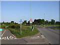
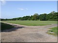
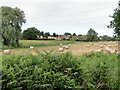
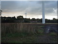
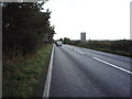
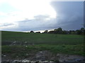
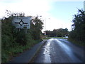
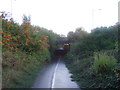
Photos of NR33 7UR


Area Information
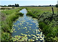
Living in NR33 7UR offers a distinctly tranquil experience within a small residential cluster covering just 1.5 hectares. This specific postcode area accommodates a population of 1704 residents, resulting in a density of 278 people per square kilometre. Such low density means streets are quiet and spaces between properties are generous compared to larger towns. The location sits in rural England, providing a escape from the urban grind while maintaining essential access to services. You will find that daily life here revolves around local community interaction and access to the surrounding countryside rather than city-centre throng. The area is defined by its selective nature, appealing primarily to those seeking a slower pace of living without complete isolation. Homes here stand in a setting where privacy is the norm and neighbourly ties tend to be longstanding. This is a place where the rhythm of the clock is set by the sun rather than a rush-hour timetable. For buyers looking at this specific cluster, the scarcity of space reinforces a sense of exclusivity that does not come cheap.
- Area Type
- Postcode
- Area Size
- 1.5 hectares
- Population
- 1704
- Population Density
- 278 people/km²
The property market in NR33 7UR is characterised by a dominance of owner-occupied homes. With a home ownership rate of 78 per cent, fewer than four out of every ten households are likely renting. This statistic paints a clear picture of a buying market rather than a letting market. All accommodation types recorded for this area are houses, confirming that the development landscape lacks any multi-storey residential blocks or converted flats. Buyers looking at this small area should expect a stock defined by traditional detached or semi-detached family homes. The low population density of 278 people per square kilometre further implies that properties have reasonable acreage or generous front gardens. There is no evidence of high-density regeneration projects or new-build conversions disrupting the existing street patterns. This consistency means you can trust that any property you view will match the established character of the street. Competition in this market is often driven by familial needs rather than investor portfolios. Prices here reflect the premium residents pay for this level of space and ownership security within such a compact geographical footprint.
House Prices in NR33 7UR
Showing 11 properties
| Address | Type | Beds | Baths | Last Sale Price | Last Sale Date | |
|---|---|---|---|---|---|---|
| Grove View, 3 Ark Close, Kessingland, NR33 7UR | Bungalow | 3 | - | £370,000 | Jul 2022 | |
| 10 Ark Close, Kessingland, NR33 7UR | Bungalow | 3 | 1 | £197,500 | Oct 2016 | |
| 8 Ark Close, Kessingland, NR33 7UR | Detached | 4 | 2 | £275,000 | Oct 2015 | |
| 4 Ark Close, Kessingland, NR33 7UR | Detached | 4 | 2 | £199,995 | Jan 2013 | |
| 2 Ark Close, Kessingland, NR33 7UR | Detached | 4 | 3 | £225,000 | Aug 2007 | |
| 6 Ark Close, Kessingland, NR33 7UR | Detached | - | - | £215,000 | Nov 2005 | |
| 1 Ark Close, Kessingland, NR33 7UR | Detached | - | - | £129,950 | May 2001 | |
| 5 Ark Close, Kessingland, NR33 7UR | Detached | - | - | £124,950 | Feb 2001 | |
| 9 Ark Close, Kessingland, NR33 7UR | Detached | - | - | £94,950 | Dec 2000 | |
| 7 Ark Close, Kessingland, NR33 7UR | Bungalow | - | - | £89,950 | Sep 2000 |
Energy Efficiency in NR33 7UR
Your daily life in NR33 7UR revolves around a curated list of amenities within practical reach. Five retail options sit just moments away, including Spar, Co-op Kessingland, and Morrisons Pakefield, providing all the groceries and essentials you need. For those who prefer rail travel, five station locations lie nearby, with Oulton Broad South Railway Station being the most significant hub. If you require air travel, Beccles Airport is a convenient option located in the immediate vicinity. These amenities cluster closely to reduce walking distances and car dependency. You can pick up weekly shop from the Co-op or Morrisons before heading out for the day. The presence of multiple high-street retailers ensures you do not need to travel far for basic goods or baked treats. Dining options are likely centred around the village centres associated with these shops, though specific restaurant names are not detailed in the immediate data. Leisure and parks may exist but are not specifically named in this dataset. You receive everything required for a self-sufficient life without requiring long commutes to the high street.
Amenities
Schools
Families considering NR33 7UR have access to a specific mix of educational institutions nearby. Carlton Colville Primary School operates in the area and holds an outstanding Ofsted rating, representing the highest standard of academic performance. For junior education, you can choose between Kessingland Church of England Voluntary Controlled Primary School and Kessingland Church of England Primary Academy, which carries a good rating. Gisleham Middle School also serves the catchment, filling the crucial gap between the early years and secondary education. This combination of primary and middle schooling allows children to remain within the local community for their first fifteen years of formal education. The presence of an outstanding-rated school like Carlton Colville Primary School is a significant asset for parents evaluating this location. You do not need to look beyond this immediate vicinity to find good educational provision. The variety of options ensures that families can select institutions based on their specific religious or pedagogical preferences without travelling to larger towns. Each school listed serves a defined function within the local education landscape.
| Rank | School | Type | Entry gender | Ages |
|---|
Explore more schools in this area
Go to Schools tabDemographics
The demographic profile of NR33 7UR reflects a settled, mature community. The median age is 47 years, indicating that a significant portion of the neighbourhood is composed of middle-aged adults. Elderly residents form the most common age group, specifically those over the age of 65. This age structure suggests a static population where families have likely settled permanently over many years rather than cycling through frequently. Home ownership is exceptionally high at 78 per cent, meaning the vast majority of households own their properties outright or with a significant mortgage balance. Almost the entire accommodation stock consists of houses, with no apartments or flats recorded within this specific postcode. The predominant ethnic group is White, aligning with the broader rural demographic patterns of the region. This homogeneity contributes to a familiar and predictable social environment. You will not find large transient student populations or young professional enclaves in this area. The community is built on established roots where residents value stability and long-term presence. Deprivation is not a factor here given the high rates of ownership and the mature age profile of the dwellers.
Household Size
Accommodation Type
Tenure
Ethnic Group
Religion
Household Composition
Age
Household Deprivation
NS-SEC
Explore more demographic insights in this area
Go to Demographics tabPlanning
Planning Constraints
- Flood RiskPremium
- Ramsar Wetland SitesPremium
- Area of Outstanding Natural BeautyPremium
- Protected Nature ReservePremium
- Protected WoodlandPremium