Area Overview for NR33 8DS
Photos of NR33 8DS
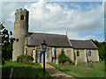
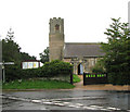
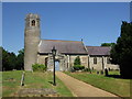
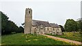
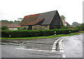
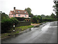
34 photos from this area
Area Information
Key information about the NR33 8DS including its size, population, and administrative classification.
- Area Type
- Postcode
- Area Size
- 87.0 hectares
- Population
- 1704
- Population Density
- 278 people/km²
House Prices in NR33 8DS
8
Properties
£274,875
Average Sold Price
£180,000
Lowest Price
£337,000
Highest Price
Showing 8 properties
| Address | Type | Beds | Baths | Last Sale Price | Last Sale Date | |
|---|---|---|---|---|---|---|
| Trinity Barn, Church Road, Gisleham, NR33 8DS | Detached | - | - | £317,500 | Jul 2021 | |
| Wild Hearts Cottage, 5 Church Road, Gisleham, NR33 8DS | house | - | - | £337,000 | Sep 2007 | |
| 1 Church Road, Gisleham, NR33 8DS | Detached | - | - | £265,000 | Jun 2007 | |
| The Bungalow, Church Road, Gisleham, NR33 8DS | Detached | - | - | £180,000 | Nov 2000 | |
| 3 Church Road, Gisleham, NR33 8DS | Semi-detached | - | - | - | - | |
| Part Land North Of, Holy Trinity Church, Church Road, Gisleham, NR33 8DS | commercial | - | - | - | - | |
| The Old Rectory, Church Road, Gisleham, NR33 8DS | Detached | - | - | - | - | |
| The Homestead, Gisleham Road, Gisleham, NR33 8DS | Detached | - | - | - | - |
Energy Efficiency in NR33 8DS
Amenities
Schools
| Rank | School | Type | Entry gender | Ages |
|---|
Explore more schools in this area
Go to Schools tabDemographics
Household Size
Two person
most common
Accommodation Type
Houses
most common
Tenure
78
majority
Ethnic Group
White
most common
Religion
N/A
most common
Household Composition
N/A
most common
Age
47
median
Elderly (65+ years)
most common
Household Deprivation
N/A
with no deprivation
NS-SEC
26
in Lower managerial occupations
Explore more demographic insights in this area
Go to Demographics tabPlanning
Planning Constraints
- Flood RiskPremium
- Ramsar Wetland SitesPremium
- Area of Outstanding Natural BeautyPremium
- Protected Nature ReservePremium
- Protected WoodlandPremium