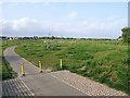
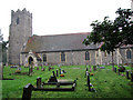
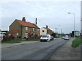
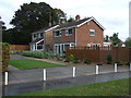
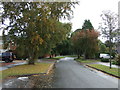
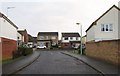
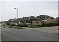
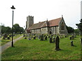
Area Overview for NR33 8AN
Photos of NR33 8AN


Area Information
Living in NR33 8AN offers a distinct residential experience within a very compact cluster. This specific postcode covers only 5902 square metres, creating an intimate living environment. Despite its small physical footprint, the area supports a population of 1861 people. This results in a high population density of 315342 people per square kilometre, meaning neighbours are close by and the community feels connected. The location sits in England, providing access to the wider national network while maintaining a localised feel. Daily life here revolves around proximity, as the sheer size of the area ensures that residents rarely have to travel far for their immediate needs. You will find that the community is built on shared space rather than sprawling distances. This density allows for a neighbourhood where interactions are frequent and local knowledge is readily available. For anyone considering homes in NR33 8AN, the high population density suggests a very reachable and supportive environment. The scale of the postcode means that the local character is defined by the people who choose to live there, rather than by large open spaces. It is a place where the street itself plays a central role in community life.
- Area Type
- Postcode
- Area Size
- 5902 m²
- Population
- 1861
- Population Density
- 2432 people/km²
The property market in NR33 8AN is defined by a strong owner-occupied sector. With 68% of households classified as owner-occupied, the area is dominated by people who have purchased their dwellings rather than renting short-term units. This statistic highlights a stable market where residents view their homes as long-term investments. Houses constitute the main accommodation type, meaning the housing stock consists of detached or semi-detached properties rather than flats or high-density blocks. This preference for houses aligns perfectly with the high home ownership rate, as families and older couples often prefer standalone structures. Buyers looking at homes in this postcode should expect a stock that caters to families and established professionals. The high prevalence of ownership suggests that the local economy supports significant mortgage equity or substantial savings. You will find fewer Landlord tenancies and live-work estates than you might in a town centre or university town. The market reflects a traditional English suburb where quality of life and personal space are priorities. This makes the area attractive to those seeking to buy for their own occupation rather than for investment or rental yields.
House Prices in NR33 8AN
Showing 6 properties
| Address | Type | Beds | Baths | Last Sale Price | Last Sale Date | |
|---|---|---|---|---|---|---|
| 2 Colville Way, Carlton Colville, NR33 8AN | Bungalow | - | - | £40,000 | Oct 1996 | |
| 5 Colville Way, Carlton Colville, NR33 8AN | Semi-detached | 3 | 1 | - | - | |
| 6 Colville Way, Carlton Colville, NR33 8AN | Semi-detached | - | - | - | - | |
| 1 Colville Way, Carlton Colville, NR33 8AN | Bungalow | - | - | - | - | |
| 3 Colville Way, Carlton Colville, NR33 8AN | Semi-detached | - | - | - | - | |
| 4 Colville Way, Carlton Colville, NR33 8AN | Semi-detached | - | - | - | - |
Energy Efficiency in NR33 8AN
Your daily lifestyle in NR33 8AN benefits from several practical amenities within easy reach. Retail options are supported by five nearby stores, including Co-op Carlton, Tesco Oulton, and Co-op Pinewood. These venues provide you with everything needed for daily groceries and household supplies. Convenience shopping means you do not have to travel far for essentials. Transport connections are similarly well supported with five rail-related amenities nearby. Notable locations include Entrance3, Oulton Broad South Railway Station, and Entrance1, which simplify your commute to other destinations. Additionally, Beccles Airport provides air travel options for those looking to fly regionally or nationally. The presence of these specific venues reduces travel time and increases flexibility for your weekly routine. You have access to diverse retail grids and transport hubs that fit into a busy schedule. Dining and leisure options are supported by these clustered services, which serve the residential population effectively. The combination of retail variety and transport access creates a convenient lived experience. Living in this area means your weekly shop and your weekend trip are both logistically simple.
Amenities
Schools
| Rank | School | Type | Entry gender | Ages |
|---|
Explore more schools in this area
Go to Schools tabDemographics
The community in NR33 8AN reflects a mature and established demographic profile. The median age is 47, indicating that the area attracts or retains adults who are well into their middle years. Most residents fall into the adult age range of 30 to 64 years, suggesting a workforce that values stability and local roots. This age group often brings significant financial resources and a desire for permanent housing rather than transient living arrangements. Social diversity centres predominantly on the White ethnic group, which forms the majority of the local population. Home ownership stands at a robust 68%, showing that two-thirds of households own their property outright or with a mortgage. This high ownership rate typically correlates with long-term residents who have invested heavily in their local environment. Houses remain the primary accommodation type, confirming that the area is designed for families or individuals seeking standalone living spaces. You are not looking at a student rental hotspot or a transient youth area. Instead, the population suggests a settled community where people plan to stay. The age profile and home ownership data paint a picture of a neighbourhood built on permanence and local attachment.
Household Size
Accommodation Type
Tenure
Ethnic Group
Religion
Household Composition
Age
Household Deprivation
NS-SEC
Explore more demographic insights in this area
Go to Demographics tabPlanning
Planning Constraints
- Flood RiskPremium
- Ramsar Wetland SitesPremium
- Area of Outstanding Natural BeautyPremium
- Protected Nature ReservePremium
- Protected WoodlandPremium