Area Overview for NR33 8AL
Photos of NR33 8AL


Area Information
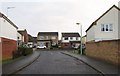
Living in NR33 8AL means settling into a defined residential cluster within England that spans just 3421 square metres. This specific postcode area accommodates 1861 people, resulting in a population density of 544072 people per square kilometre when calculated across its boundaries. You will find this location characterised by its compact footprint, which concentrates a significant number of households into a small geographic space. The setting offers a focused environment where daily life revolves around the immediate neighbourhood and its proximate services. Residents here experience a distinct rhythm shaped by the density of the homes surrounding them. While the area remains largely residential, the high population count relative to the physical size suggests a vibrant, close-knit community. Composed primarily of houses, the locality provides a familiar domestic setting rather than high-rise or apartment living. The profile of the area indicates a stable society where most property owners reside in their own homes. This static housing stock contributes to a sense of established permanence. For you as a prospective buyer, NR33 8AL represents a specific postcode address that offers access to wider regional networks while maintaining a defined local identity. The mix of retail outlets and transport links nearby ensures that essential needs are within practical reach. You gain access to established shopping areas and rail connections without moving far from your doorstep. This balance between local containment and regional connectivity defines the experience of owning property in this sector.
- Area Type
- Postcode
- Area Size
- 3421 m²
- Population
- 1861
- Population Density
- 2432 people/km²
The property market in NR33 8AL is defined by a strong preference for owner-occupied housing. With 68% home ownership, this area functions distinctly as a residential sector rather than a rental hub. Most residents have secured title to their properties, suggesting a market that has seen significant purchase activity historically. This high ownership rate often stabilises values compared to areas with heavy student or short-term let presence. Homes in NR33 8AL are predominantly houses, providing detached, semi-detached, or terraced options typical of the region. You will not find apartment blocks or flat complexes within this specific postcode cluster. The architecture reflects the broader local housing stock, catering to families and individuals seeking single-family living arrangements. The lack of high-density housing types indicates limited demand for urban-style, low-cost accommodation in this immediate zone. For buyers evaluating this area, the dominance of owner-occupied homes suggests long-term residents who value their location. This dynamic creates a market responsive to quality of life improvements such as garden space and parking. The specifics of NR33 8AL mean that new developments must align with the existing character of these house types. You are entering a market where established values prevail and the housing stock remains consistent with the national average for house ownership. Investors should note that the 3421 square metre size of the postcode limits large-scale redevelopment possibilities within the immediate boundary.
House Prices in NR33 8AL
Showing 6 properties
| Address | Type | Beds | Baths | Last Sale Price | Last Sale Date | |
|---|---|---|---|---|---|---|
| 5 Woodside Close, Carlton Colville, NR33 8AL | Detached | 3 | 1 | £345,000 | Aug 2025 | |
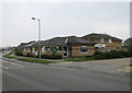
| 4 Woodside Close, Carlton Colville, NR33 8AL | Bungalow | - | - | £227,000 | May 2025 | |
| 6 Woodside Close, Carlton Colville, NR33 8AL | Bungalow | - | - | £200,000 | Jan 2021 | |
| 2 Woodside Close, Carlton Colville, NR33 8AL | Semi-detached | - | - | £94,995 | Nov 2001 | |
| 1 Woodside Close, Carlton Colville, NR33 8AL | Semi-detached | - | - | - | - | |
| 3 Woodside Close, Carlton Colville, NR33 8AL | Semi-detached | - | - | - | - |
Energy Efficiency in NR33 8AL
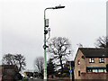
Daily life in NR33 8AL benefits from a cluster of retail and transport amenities within practical reach. Five notable retail locations serve the community, including Co-op Carlton, Tesco Oulton, and Co-op Pinewood. These outlets provide essential groceries, household goods, and daily necessities without requiring long travel times. You can complete your weekly shop and pick up regular items with ease. Transport connectivity is supported by five nearby rail entrances and stations, including Entrance3, Entrance1, and Oulton Broad South Railway Station. This network facilitates regional travel and commute options. Additionally, Beccles Airport sits nearby, offering potential flight connections for residents planning wider travel. These facilities ensure that NR33 8AL remains linked to major cities and regional hubs. The presence of multiple Co-op branches and the Tesco supermarket means you do not need to travel far for shopping. The rail options near Oulton Broad South provide access to broader networks without significant detours. You gain a level of convenience that fits well with the local house-based lifestyle. Walking distance to these key services enhances the appeal of homes in this postcode. The combination of local shops and transport nodes creates a self-sufficient neighbourhood environment.
Amenities
Schools
| Rank | School | Type | Entry gender | Ages |
|---|
Explore more schools in this area
Go to Schools tabDemographics
The community within NR33 8AL displays a clear age profile, with a median age of 47 years. The most common age range consists of adults between 30 and 64 years, indicating that working-age adults and those approaching retirement form the bulk of the population. This demographic skew suggests a neighbourhood where families with older children or empty nesters likely play a significant role. You are looking at an area where life stages tend towards stability rather than rapid change. Home ownership stands as a dominant feature of this locality, with 68% of residents owning their outright property. This high level of ownership implies a settled community less influenced by transient rental markets. The remaining 32% of homes fall under different tenancy arrangements, but the majority of dwellings are tied to long-term residents. This stability often correlates with higher investment in property maintenance and local amenities. The accommodation type in NR33 8AL consists almost exclusively of houses, offering a traditional English residential experience. There are no high-rise blocks or purpose-built flats within this postcode sector. Furthermore, the predominant ethnic group is White, reflecting the broader statistical trends of the region. This demographic homogeneity often contributes to a predictable community culture. You will find a population that has likely invested deeply in the local infrastructure, driving demand for reliable schools and local services suitable for their specific life stage.
Household Size
Accommodation Type
Tenure
Ethnic Group
Religion
Household Composition
Age
Household Deprivation
NS-SEC
Explore more demographic insights in this area
Go to Demographics tabPlanning
Planning Constraints
- Flood RiskPremium
- Ramsar Wetland SitesPremium
- Area of Outstanding Natural BeautyPremium
- Protected Nature ReservePremium
- Protected WoodlandPremium