Area Overview for NR33 7LX
Photos of NR33 7LX
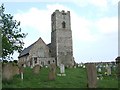
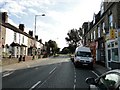
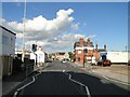
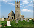
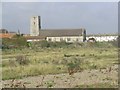
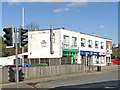
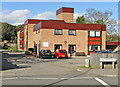
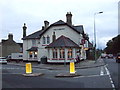
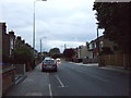
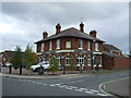
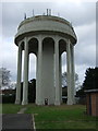
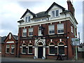
88 photos from this area
Area Information
Key information about the NR33 7LX including its size, population, and administrative classification.
- Area Type
- Postcode
- Area Size
- 6.1 hectares
- Population
- 1201
- Population Density
- 2525 people/km²
House Prices in NR33 7LX
35
Properties
£254,091
Average Sold Price
£101,000
Lowest Price
£485,000
Highest Price
Showing 35 properties
| Address | Type | Beds | Baths | Last Sale Price | Last Sale Date | |
|---|---|---|---|---|---|---|
| 36 Silverwood Close, Lowestoft, NR33 7LX | Bungalow | - | - | £485,000 | Jan 2023 | |
| 6 Silverwood Close, Lowestoft, NR33 7LX | Retail | 5 | 2 | £445,000 | May 2022 | |
| 16 Silverwood Close, Lowestoft, NR33 7LX | Retail | 4 | 2 | £477,000 | Mar 2022 | |
| 1 Silverwood Close, Lowestoft, NR33 7LX | Bungalow | 3 | 1 | £405,000 | Aug 2021 | |
| 28 Silverwood Close, Lowestoft, NR33 7LX | Detached | 5 | 2 | £370,000 | Dec 2019 | |
| 30 Silverwood Close, Lowestoft, NR33 7LX | Bungalow | 2 | 1 | £275,000 | Jul 2018 | |
| 34 Silverwood Close, Lowestoft, NR33 7LX | Detached | 5 | 1 | £345,000 | Jun 2017 | |
| 14 Silverwood Close, Lowestoft, NR33 7LX | Detached | 4 | 1 | £317,500 | Feb 2017 | |
| 40 Silverwood Close, Lowestoft, NR33 7LX | Bungalow | 3 | 2 | £310,000 | May 2016 | |
| 2 Silverwood Close, Lowestoft, NR33 7LX | Bungalow | 2 | - | £265,000 | May 2014 |
Page 1 of 4
Energy Efficiency in NR33 7LX
Amenities
Schools
| Rank | School | Type | Entry gender | Ages |
|---|
Explore more schools in this area
Go to Schools tabDemographics
Household Size
One person
most common
Accommodation Type
Houses
most common
Tenure
38
majority
Ethnic Group
White
most common
Religion
N/A
most common
Household Composition
N/A
most common
Age
47
median
Adults (30-64 years)
most common
Household Deprivation
N/A
with no deprivation
NS-SEC
20
in Lower managerial occupations
Explore more demographic insights in this area
Go to Demographics tabPlanning
Planning Constraints
- Flood RiskPremium
- Ramsar Wetland SitesPremium
- Area of Outstanding Natural BeautyPremium
- Protected Nature ReservePremium
- Protected WoodlandPremium