Area Overview for NR33 7JW
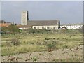
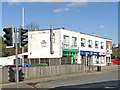
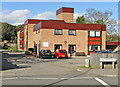
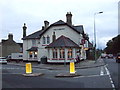
Photos of NR33 7JW
Area Information
Living in NR33 7JW means residing within a compact residential cluster defined by the NR33 postcode, covering just 2.4 hectares. This small footprint supports a population of 1,201 people, creating a neighbourhood where residents are likely to know their neighbours. The environment centres on Houses as the primary accommodation type, offering a settlement that prioritises private living space over density. You will find this area falls squarely within the adults demographic, specifically those between 30 and 64 years of age. The locality balances a sense of community intimacy with straightforward access to essential services. Its classification as a specific postcode area covering a small residential cluster ensures that daily life revolves around a shared immediate environment rather than sprawling suburbs. This concentration allows for efficient management of local resources while maintaining a distinct character separate from larger urban centres. The area remains a stable part of the Norfolk landscape, suitable for those seeking a grounded home environment without the chaotic pace of major cities. ### The community in NR33 7JW reflects a mature profile dominated by Adults aged between 30 and 64 years. This age range represents the most common group among the 1,201 residents recorded in this 2.4-hectare zone. The median age stands at 47, indicating a steady settlement rather than a transient population. Home ownership levels sit at 38%, meaning slightly more than one-third of the residents own their homes outright or with a mortgage. The remaining households include long-term renters, contributing to a mixed but stable financial base. Houses constitute the overwhelming majority of accommodation types, consistent with the area's low-density design. The predominant ethnic group is White, aligning with the broader demographic trends of rural Norfolk. With a population density of 50,463 people per square kilometre calculated for this small footprint, the area maintains a tight-knit feel. There is no dispersed character; instead, the housing stock is concentrated. This specific composition suggests a neighbourhood built for stability and family continuity. Buyers here should expect a community defined by these clear statistical parameters rather than shifting trends. ### The housing market in NR33 7JW is defined by a stock that consists almost entirely of Houses. This accommodation type reflects the area's development pattern and planning history over the years. Only 38% of residents own their homes, a figure that places this location in a minority of owner-occupied areas for its specific postcode cluster. The lower ownership rate suggests a market with significant rental components or shared ownership schemes integrated within the Houses. Living in NR33 7JW involves navigating a small residential cluster where inventory moves steadily but does not dominate the wider regional market. The area's size, limited to 2.4 hectares, constrains the volume of properties available for sale at any one time. For buyers, this scarcity creates a premium on specific listings while limiting volume shopping. The mix of 38% ownership implies that purchasing here may offer good value or entry points compared to high-demand mainline stations, though supply remains restricted. You will find a lower volume of transactions typical of a small postcode area rather than a high-traffic zone. The data points to a quiet, specialised market driven by local demand for Houses within the NR33 boundaries. ### Digital connectivity in NR33 7JW supports remote working and modern lifestyle requirements effectively. Fixed broadband quality scores 93 out of 100, classifying the connection as excellent. This high score ensures reliable speeds for video calls, large file transfers, and streaming without interruption. Residents can expect their home internet to function at a top tier for daily use. Mobile coverage scores 79 out of 100, rated as good. This level of signal strength allows for consistent communication and safe navigation throughout most of the neighbourhood. You will experience dependable performance on smartphones and tablets while walking or working from home. The combination of excellent fixed lines and good mobile networks means you are well connected regardless of your activity. Living in this area provides the technological infrastructure necessary for a digital-first routine. The 93 broadband figure specifically supports heavy users who rely on cloud computing or high-resolution uploads. The 79 mobile score ensures that gaps in signal are rare. For those who need to stay online while away from a desk, the mobile network offers solid, practical reliability across the 2.4-hectare cluster. ### Daily life in NR33 7JW benefits from a tight-knit selection of amenities accessible within practical reach. Five retail locations serve the immediate needs of residents, including Co-op Pakefield, Co-op Pinewood, and Aldi Gateway. These supermarkets handle everyday shopping, food provisioning, and household essentials without requiring long commutes. Five rail facilities sit nearby, notably Oulton Broad South Railway Station and the smaller access points of Entrance3 and Entrance1. This network provides straightforward travel links for journeys further afield. Beccles Airport stands as the nearest aviation facility, offering an alternative for quick regional travel or private flights. The presence of these five retail and five rail sites ensures that convenience remains central to the living experience. You do not need to venture far to find goods or transit options. The area of stores and stations supports a lifestyle where time spent travelling to basics is minimised. Living in NR33 integrates these services seamlessly into your routine, making the small footprint of the neighbourhood manageable. The specific mention of Co-op and Aldi names grounds the daily experience in familiar commercial brands. This accessible mix of retail, rail, and air transport defines the practical rhythm of life for households in this postcode. ### Safety and environmental factors in NR33 7JW present a picture of low risk and minimal planning constraints. Flood risk assessment shows a Pass level with a score of 0, indicating low flood risk coverage and no immediate threat from rising water levels. Ramsar Wetland Sites, Areas of Outstanding Natural Beauty, Protected Nature Reserves, and Protected Woodlands all register at Pass with scores of 0. This means the area has no Ramsar wetland coverage, no AONB coverage, no protected nature reserve coverage, and no protected woodland. Consequently, development pressure from environmental restrictions is low. Crime risk records a Pass level with a score of 67, indicating a below-average crime rate. This safety score of 67 out of 100 reflects a safer neighbourhood compared to broader regional averages. You can live in NR33 7JW with confidence that the physical environment will not be hampered by conservation laws where they typically limit building changes or extensions. The absence of flood or nature reserve designations simplifies the outlook for future modifications to your property. Living here avoids the regulatory hurdles common in greener, protected zones. The low crime environment further reinforces the security of the residential cluster. ### Who typically lives in NR33 7JW and what is the community feel like?The community in NR33 7JW is dominated by Adults aged between 30 and 64 years, with a median age of 47. With a total population of 1,201 spread across 2.4 hectares, the area maintains a close-knit character. Houses make up the primary accommodation type, supporting families and individuals seeking a stable home environment rather than high-rise living. How are broadband and mobile connectivity in this postcode area?Residents benefit from excellent fixed broadband with a quality score of 93 out of 100, ideal for working from home. Mobile coverage is rated good with a score of 79 out of 100. These figures ensure reliable internet access for streaming, communication, and digital tasks throughout the neighbourhood. Is NR33 7JW a safe place to live regarding crime and environmental risks?The area has a Pass rating for safety with a crime risk score of 67, indicating below-average crime rates. Environmental assessments also show a Pass with scores of 0 for flood risk, Ramsar sites, and protected nature reserves, meaning there are no significant planning constraints or environmental hazards affecting daily life. What retail and transport options are available to me living in this area?Five retail outlets including Co-op Pakefield, Co-op Pinewood, and Aldi Gateway are within practical reach.附近的 transport includes five rail facilities such as Oulton Broad South Railway Station and Beccles Airport, ensuring easy access to shops and travel for residents in NR33 7JW.
- Area Type
- Postcode
- Area Size
- 2.4 hectares
- Population
- 1201
- Population Density
- 2525 people/km²
The housing market in NR33 7JW is defined by a stock that consists almost entirely of Houses. This accommodation type reflects the area's development pattern and planning history over the years. Only 38% of residents own their homes, a figure that places this location in a minority of owner-occupied areas for its specific postcode cluster. The lower ownership rate suggests a market with significant rental components or shared ownership schemes integrated within the Houses. Living in NR33 7JW involves navigating a small residential cluster where inventory moves steadily but does not dominate the wider regional market. The area's size, limited to 2.4 hectares, constrains the volume of properties available for sale at any one time. For buyers, this scarcity creates a premium on specific listings while limiting volume shopping. The mix of 38% ownership implies that purchasing here may offer good value or entry points compared to high-demand mainline stations, though supply remains restricted. You will find a lower volume of transactions typical of a small postcode area rather than a high-traffic zone. The data points to a quiet, specialised market driven by local demand for Houses within the NR33 boundaries. ### Digital connectivity in NR33 7JW supports remote working and modern lifestyle requirements effectively. Fixed broadband quality scores 93 out of 100, classifying the connection as excellent. This high score ensures reliable speeds for video calls, large file transfers, and streaming without interruption. Residents can expect their home internet to function at a top tier for daily use. Mobile coverage scores 79 out of 100, rated as good. This level of signal strength allows for consistent communication and safe navigation throughout most of the neighbourhood. You will experience dependable performance on smartphones and tablets while walking or working from home. The combination of excellent fixed lines and good mobile networks means you are well connected regardless of your activity. Living in this area provides the technological infrastructure necessary for a digital-first routine. The 93 broadband figure specifically supports heavy users who rely on cloud computing or high-resolution uploads. The 79 mobile score ensures that gaps in signal are rare. For those who need to stay online while away from a desk, the mobile network offers solid, practical reliability across the 2.4-hectare cluster. ### Daily life in NR33 7JW benefits from a tight-knit selection of amenities accessible within practical reach. Five retail locations serve the immediate needs of residents, including Co-op Pakefield, Co-op Pinewood, and Aldi Gateway. These supermarkets handle everyday shopping, food provisioning, and household essentials without requiring long commutes. Five rail facilities sit nearby, notably Oulton Broad South Railway Station and the smaller access points of Entrance3 and Entrance1. This network provides straightforward travel links for journeys further afield. Beccles Airport stands as the nearest aviation facility, offering an alternative for quick regional travel or private flights. The presence of these five retail and five rail sites ensures that convenience remains central to the living experience. You do not need to venture far to find goods or transit options. The area of stores and stations supports a lifestyle where time spent travelling to basics is minimised. Living in NR33 integrates these services seamlessly into your routine, making the small footprint of the neighbourhood manageable. The specific mention of Co-op and Aldi names grounds the daily experience in familiar commercial brands. This accessible mix of retail, rail, and air transport defines the practical rhythm of life for households in this postcode. ### Safety and environmental factors in NR33 7JW present a picture of low risk and minimal planning constraints. Flood risk assessment shows a Pass level with a score of 0, indicating low flood risk coverage and no immediate threat from rising water levels. Ramsar Wetland Sites, Areas of Outstanding Natural Beauty, Protected Nature Reserves, and Protected Woodlands all register at Pass with scores of 0. This means the area has no Ramsar wetland coverage, no AONB coverage, no protected nature reserve coverage, and no protected woodland. Consequently, development pressure from environmental restrictions is low. Crime risk records a Pass level with a score of 67, indicating a below-average crime rate. This safety score of 67 out of 100 reflects a safer neighbourhood compared to broader regional averages. You can live in NR33 7JW with confidence that the physical environment will not be hampered by conservation laws where they typically limit building changes or extensions. The absence of flood or nature reserve designations simplifies the outlook for future modifications to your property. Living here avoids the regulatory hurdles common in greener, protected zones. The low crime environment further reinforces the security of the residential cluster. ### Who typically lives in NR33 7JW and what is the community feel like?The community in NR33 7JW is dominated by Adults aged between 30 and 64 years, with a median age of 47. With a total population of 1,201 spread across 2.4 hectares, the area maintains a close-knit character. Houses make up the primary accommodation type, supporting families and individuals seeking a stable home environment rather than high-rise living. How are broadband and mobile connectivity in this postcode area?Residents benefit from excellent fixed broadband with a quality score of 93 out of 100, ideal for working from home. Mobile coverage is rated good with a score of 79 out of 100. These figures ensure reliable internet access for streaming, communication, and digital tasks throughout the neighbourhood. Is NR33 7JW a safe place to live regarding crime and environmental risks?The area has a Pass rating for safety with a crime risk score of 67, indicating below-average crime rates. Environmental assessments also show a Pass with scores of 0 for flood risk, Ramsar sites, and protected nature reserves, meaning there are no significant planning constraints or environmental hazards affecting daily life. What retail and transport options are available to me living in this area?Five retail outlets including Co-op Pakefield, Co-op Pinewood, and Aldi Gateway are within practical reach.附近的 transport includes five rail facilities such as Oulton Broad South Railway Station and Beccles Airport, ensuring easy access to shops and travel for residents in NR33 7JW.
House Prices in NR33 7JW
Showing 63 properties
| Address | Type | Beds | Baths | Last Sale Price | Last Sale Date | |
|---|---|---|---|---|---|---|
| 81 Green Drive, Lowestoft, NR33 7JW | undefined | - | - | - | - | |
| 83 Green Drive, Lowestoft, NR33 7JW | undefined | - | - | - | - | |
| 87 Green Drive, Lowestoft, NR33 7JW | undefined | - | - | - | - | |
| 85 Green Drive, Lowestoft, NR33 7JW | undefined | - | - | - | - | |
| 103, Swain Court, Green Drive, Lowestoft, NR33 7JW | Flat | - | - | - | - | |
| 151, Swain Court, Green Drive, Lowestoft, NR33 7JW | Flat | - | - | - | - | |
| 193, Swain Court, Green Drive, Lowestoft, NR33 7JW | Flat | - | - | - | - | |
| 197, Swain Court, Green Drive, Lowestoft, NR33 7JW | Flat | - | - | - | - | |
| 173, Swain Court, Green Drive, Lowestoft, NR33 7JW | Flat | - | - | - | - | |
| 149, Swain Court, Green Drive, Lowestoft, NR33 7JW | Flat | - | - | - | - |
Energy Efficiency in NR33 7JW
Daily life in NR33 7JW benefits from a tight-knit selection of amenities accessible within practical reach. Five retail locations serve the immediate needs of residents, including Co-op Pakefield, Co-op Pinewood, and Aldi Gateway. These supermarkets handle everyday shopping, food provisioning, and household essentials without requiring long commutes. Five rail facilities sit nearby, notably Oulton Broad South Railway Station and the smaller access points of Entrance3 and Entrance1. This network provides straightforward travel links for journeys further afield. Beccles Airport stands as the nearest aviation facility, offering an alternative for quick regional travel or private flights. The presence of these five retail and five rail sites ensures that convenience remains central to the living experience. You do not need to venture far to find goods or transit options. The area of stores and stations supports a lifestyle where time spent travelling to basics is minimised. Living in NR33 integrates these services seamlessly into your routine, making the small footprint of the neighbourhood manageable. The specific mention of Co-op and Aldi names grounds the daily experience in familiar commercial brands. This accessible mix of retail, rail, and air transport defines the practical rhythm of life for households in this postcode. ### Safety and environmental factors in NR33 7JW present a picture of low risk and minimal planning constraints. Flood risk assessment shows a Pass level with a score of 0, indicating low flood risk coverage and no immediate threat from rising water levels. Ramsar Wetland Sites, Areas of Outstanding Natural Beauty, Protected Nature Reserves, and Protected Woodlands all register at Pass with scores of 0. This means the area has no Ramsar wetland coverage, no AONB coverage, no protected nature reserve coverage, and no protected woodland. Consequently, development pressure from environmental restrictions is low. Crime risk records a Pass level with a score of 67, indicating a below-average crime rate. This safety score of 67 out of 100 reflects a safer neighbourhood compared to broader regional averages. You can live in NR33 7JW with confidence that the physical environment will not be hampered by conservation laws where they typically limit building changes or extensions. The absence of flood or nature reserve designations simplifies the outlook for future modifications to your property. Living here avoids the regulatory hurdles common in greener, protected zones. The low crime environment further reinforces the security of the residential cluster. ### Who typically lives in NR33 7JW and what is the community feel like?The community in NR33 7JW is dominated by Adults aged between 30 and 64 years, with a median age of 47. With a total population of 1,201 spread across 2.4 hectares, the area maintains a close-knit character. Houses make up the primary accommodation type, supporting families and individuals seeking a stable home environment rather than high-rise living. How are broadband and mobile connectivity in this postcode area?Residents benefit from excellent fixed broadband with a quality score of 93 out of 100, ideal for working from home. Mobile coverage is rated good with a score of 79 out of 100. These figures ensure reliable internet access for streaming, communication, and digital tasks throughout the neighbourhood. Is NR33 7JW a safe place to live regarding crime and environmental risks?The area has a Pass rating for safety with a crime risk score of 67, indicating below-average crime rates. Environmental assessments also show a Pass with scores of 0 for flood risk, Ramsar sites, and protected nature reserves, meaning there are no significant planning constraints or environmental hazards affecting daily life. What retail and transport options are available to me living in this area?Five retail outlets including Co-op Pakefield, Co-op Pinewood, and Aldi Gateway are within practical reach.附近的 transport includes five rail facilities such as Oulton Broad South Railway Station and Beccles Airport, ensuring easy access to shops and travel for residents in NR33 7JW.
Amenities
Schools
| Rank | School | Type | Entry gender | Ages |
|---|
Explore more schools in this area
Go to Schools tabDemographics
The community in NR33 7JW reflects a mature profile dominated by Adults aged between 30 and 64 years. This age range represents the most common group among the 1,201 residents recorded in this 2.4-hectare zone. The median age stands at 47, indicating a steady settlement rather than a transient population. Home ownership levels sit at 38%, meaning slightly more than one-third of the residents own their homes outright or with a mortgage. The remaining households include long-term renters, contributing to a mixed but stable financial base. Houses constitute the overwhelming majority of accommodation types, consistent with the area's low-density design. The predominant ethnic group is White, aligning with the broader demographic trends of rural Norfolk. With a population density of 50,463 people per square kilometre calculated for this small footprint, the area maintains a tight-knit feel. There is no dispersed character; instead, the housing stock is concentrated. This specific composition suggests a neighbourhood built for stability and family continuity. Buyers here should expect a community defined by these clear statistical parameters rather than shifting trends. ### The housing market in NR33 7JW is defined by a stock that consists almost entirely of Houses. This accommodation type reflects the area's development pattern and planning history over the years. Only 38% of residents own their homes, a figure that places this location in a minority of owner-occupied areas for its specific postcode cluster. The lower ownership rate suggests a market with significant rental components or shared ownership schemes integrated within the Houses. Living in NR33 7JW involves navigating a small residential cluster where inventory moves steadily but does not dominate the wider regional market. The area's size, limited to 2.4 hectares, constrains the volume of properties available for sale at any one time. For buyers, this scarcity creates a premium on specific listings while limiting volume shopping. The mix of 38% ownership implies that purchasing here may offer good value or entry points compared to high-demand mainline stations, though supply remains restricted. You will find a lower volume of transactions typical of a small postcode area rather than a high-traffic zone. The data points to a quiet, specialised market driven by local demand for Houses within the NR33 boundaries. ### Digital connectivity in NR33 7JW supports remote working and modern lifestyle requirements effectively. Fixed broadband quality scores 93 out of 100, classifying the connection as excellent. This high score ensures reliable speeds for video calls, large file transfers, and streaming without interruption. Residents can expect their home internet to function at a top tier for daily use. Mobile coverage scores 79 out of 100, rated as good. This level of signal strength allows for consistent communication and safe navigation throughout most of the neighbourhood. You will experience dependable performance on smartphones and tablets while walking or working from home. The combination of excellent fixed lines and good mobile networks means you are well connected regardless of your activity. Living in this area provides the technological infrastructure necessary for a digital-first routine. The 93 broadband figure specifically supports heavy users who rely on cloud computing or high-resolution uploads. The 79 mobile score ensures that gaps in signal are rare. For those who need to stay online while away from a desk, the mobile network offers solid, practical reliability across the 2.4-hectare cluster. ### Daily life in NR33 7JW benefits from a tight-knit selection of amenities accessible within practical reach. Five retail locations serve the immediate needs of residents, including Co-op Pakefield, Co-op Pinewood, and Aldi Gateway. These supermarkets handle everyday shopping, food provisioning, and household essentials without requiring long commutes. Five rail facilities sit nearby, notably Oulton Broad South Railway Station and the smaller access points of Entrance3 and Entrance1. This network provides straightforward travel links for journeys further afield. Beccles Airport stands as the nearest aviation facility, offering an alternative for quick regional travel or private flights. The presence of these five retail and five rail sites ensures that convenience remains central to the living experience. You do not need to venture far to find goods or transit options. The area of stores and stations supports a lifestyle where time spent travelling to basics is minimised. Living in NR33 integrates these services seamlessly into your routine, making the small footprint of the neighbourhood manageable. The specific mention of Co-op and Aldi names grounds the daily experience in familiar commercial brands. This accessible mix of retail, rail, and air transport defines the practical rhythm of life for households in this postcode. ### Safety and environmental factors in NR33 7JW present a picture of low risk and minimal planning constraints. Flood risk assessment shows a Pass level with a score of 0, indicating low flood risk coverage and no immediate threat from rising water levels. Ramsar Wetland Sites, Areas of Outstanding Natural Beauty, Protected Nature Reserves, and Protected Woodlands all register at Pass with scores of 0. This means the area has no Ramsar wetland coverage, no AONB coverage, no protected nature reserve coverage, and no protected woodland. Consequently, development pressure from environmental restrictions is low. Crime risk records a Pass level with a score of 67, indicating a below-average crime rate. This safety score of 67 out of 100 reflects a safer neighbourhood compared to broader regional averages. You can live in NR33 7JW with confidence that the physical environment will not be hampered by conservation laws where they typically limit building changes or extensions. The absence of flood or nature reserve designations simplifies the outlook for future modifications to your property. Living here avoids the regulatory hurdles common in greener, protected zones. The low crime environment further reinforces the security of the residential cluster. ### Who typically lives in NR33 7JW and what is the community feel like?The community in NR33 7JW is dominated by Adults aged between 30 and 64 years, with a median age of 47. With a total population of 1,201 spread across 2.4 hectares, the area maintains a close-knit character. Houses make up the primary accommodation type, supporting families and individuals seeking a stable home environment rather than high-rise living. How are broadband and mobile connectivity in this postcode area?Residents benefit from excellent fixed broadband with a quality score of 93 out of 100, ideal for working from home. Mobile coverage is rated good with a score of 79 out of 100. These figures ensure reliable internet access for streaming, communication, and digital tasks throughout the neighbourhood. Is NR33 7JW a safe place to live regarding crime and environmental risks?The area has a Pass rating for safety with a crime risk score of 67, indicating below-average crime rates. Environmental assessments also show a Pass with scores of 0 for flood risk, Ramsar sites, and protected nature reserves, meaning there are no significant planning constraints or environmental hazards affecting daily life. What retail and transport options are available to me living in this area?Five retail outlets including Co-op Pakefield, Co-op Pinewood, and Aldi Gateway are within practical reach.附近的 transport includes five rail facilities such as Oulton Broad South Railway Station and Beccles Airport, ensuring easy access to shops and travel for residents in NR33 7JW.
Household Size
Accommodation Type
Tenure
Ethnic Group
Religion
Household Composition
Age
Household Deprivation
NS-SEC
Explore more demographic insights in this area
Go to Demographics tabPlanning
Planning Constraints
- Flood RiskPremium
- Ramsar Wetland SitesPremium
- Area of Outstanding Natural BeautyPremium
- Protected Nature ReservePremium
- Protected WoodlandPremium