Area Overview for NR33 7JH
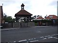
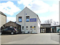
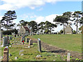
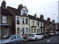
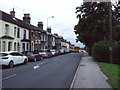
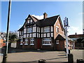
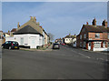
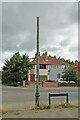
Photos of NR33 7JH
Area Information
Living in NR33 7JH means residing in a compact residential cluster defined by a specific postcode area covering 3.9 hectares. This small footprint supports a population of 1152 people, resulting in a very high population density of 29285 people per square kilometre. The area functions as a tight-knit housing zone where properties are closely packed, creating an immediate sense of community proximity. Daily life here is characterised by direct access to shared spaces and neighbours, typical of clusters this size in England. You will find yourself surrounded by a concentrated group of homeowners rather than sprawling suburban developments. This high density suggests a neighbourhood where streets are active and residents interact frequently. The location offers a practical living arrangement for those who prioritise proximity to amenities over large private gardens.
- Area Type
- Postcode
- Area Size
- 3.9 hectares
- Population
- 1152
- Population Density
- 29285 people/km²
The property market in NR33 7JH is overwhelmingly characterised by owner-occupation, with 80% of residents having purchased their homes. Houses serve as the main accommodation type, suggesting a stock focused on traditional family living rather than flats or purpose-built rentals. This high level of ownership implies that the area is well-established, with empty homes likely being rare. Buyers looking at this postcode area will find a market driven by settled homeowners rather than investors or landlords. The concentration of houses indicates a preference for detached or semi-detached living arrangements common in the East of England. When considering homes in this cluster, you are entering a market where selling prices are often influenced by the desirability of the location and the size of the garden rather than rental yields. The compact nature of the 3.9 hectare site means every available property represents a significant opportunity for a resident.
House Prices in NR33 7JH
Showing 32 properties
| Address | Type | Beds | Baths | Last Sale Price | Last Sale Date | |
|---|---|---|---|---|---|---|
| 110 Blackheath Road, Lowestoft, NR33 7JH | Detached | 2 | 1 | £220,000 | May 2024 | |
| 154 Blackheath Road, Lowestoft, NR33 7JH | Semi-detached | 2 | 1 | £180,000 | Jan 2024 | |
| 134 Blackheath Road, Lowestoft, NR33 7JH | Bungalow | 3 | 2 | £210,000 | Oct 2023 | |
| 96 Blackheath Road, Lowestoft, NR33 7JH | Bungalow | 2 | 1 | £220,000 | May 2023 | |
| 112 Blackheath Road, Lowestoft, NR33 7JH | Semi-detached | 3 | 1 | £245,000 | Feb 2023 | |
| 138 Blackheath Road, Lowestoft, NR33 7JH | Semi-detached | 3 | 1 | £292,500 | Oct 2022 | |
| The Ivys, 132 Blackheath Road, Lowestoft, NR33 7JH | Bungalow | - | - | £276,000 | May 2021 | |
| 104 Blackheath Road, Lowestoft, NR33 7JH | house | - | - | £230,000 | Jan 2021 | |
| 128 Blackheath Road, Lowestoft, NR33 7JH | Bungalow | 2 | 1 | £188,500 | Apr 2020 | |
| 150 Blackheath Road, Lowestoft, NR33 7JH | Semi-detached | 2 | - | £169,000 | Dec 2016 |
Energy Efficiency in NR33 7JH
Residents of NR33 7JH enjoy convenient access to a narrow selection of nearby amenities within practical reach. Three Co-op stores are located close by, including branches at Pinewood, Pakefield, and Kirkley, ensuring daily shopping needs are met without long travel. Five railway stations are identified as being within practical distance, with Oulton Broad South Railway Station serving as a primary hub for commuters. Entrance3 and Entrance1 also provide additional rail access points, increasing flexibility for daily travel. Beccles Airport is another facility within reach, offering options for occasional flights despite the area's remote location. Shopping is notably concentrated around the Co-op locations, which act as the main retail nodes. When living in NR33 7JH, you have immediate access to essential goods and transport links without needing to travel far beyond the immediate vicinity.
Amenities
Schools
| Rank | School | Type | Entry gender | Ages |
|---|
Explore more schools in this area
Go to Schools tabDemographics
The community in NR33 7JH is predominantly composed of adults aged between 30 and 64 years, reflecting a mature demographic profile. The median age across the area stands at 47, indicating a population with significant life experience and established routines. Eighty per cent of residents own their homes, a figure that defines the character of the neighbourhood as a stable, owner-occupied zone. Houses form the primary accommodation type, meaning detached or semi-detached properties dominate the housing stock. The predominant ethnic group is White, which aligns with the broader demographic trends found across much of England. With 80% home ownership, the area naturally attracts long-term residents rather than transient tenants. This demographic consistency often translates into a quiet, predictable environment where families and retirees seek stability. You can expect a neighbourhood where neighbours have lived for many years, fostering a strong local network.
Household Size
Accommodation Type
Tenure
Ethnic Group
Religion
Household Composition
Age
Household Deprivation
NS-SEC
Explore more demographic insights in this area
Go to Demographics tabPlanning
Planning Constraints
- Flood RiskPremium
- Ramsar Wetland SitesPremium
- Area of Outstanding Natural BeautyPremium
- Protected Nature ReservePremium
- Protected WoodlandPremium