Area Overview for NR33 7EX
Photos of NR33 7EX
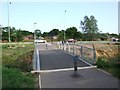
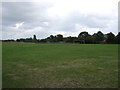
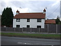
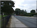
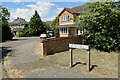
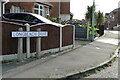
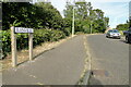
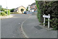
43 photos from this area
Area Information
Key information about the NR33 7EX including its size, population, and administrative classification.
- Area Type
- Postcode
- Area Size
- 2.7 hectares
- Population
- 1456
- Population Density
- 3135 people/km²
House Prices in NR33 7EX
41
Properties
£174,607
Average Sold Price
£55,950
Lowest Price
£400,000
Highest Price
Showing 41 properties
| Address | Type | Beds | Baths | Last Sale Price | Last Sale Date | |
|---|---|---|---|---|---|---|
| 31 Cranleigh Road, Lowestoft, NR33 7EX | Bungalow | 3 | 1 | £265,000 | Dec 2024 | |
| 40 Cranleigh Road, Lowestoft, NR33 7EX | Bungalow | 2 | - | £135,000 | Nov 2023 | |
| 28 Cranleigh Road, Lowestoft, NR33 7EX | Bungalow | 3 | 1 | £260,000 | Mar 2023 | |
| 6 Cranleigh Road, Lowestoft, NR33 7EX | house | - | - | £400,000 | Oct 2022 | |
| 36 Cranleigh Road, Lowestoft, NR33 7EX | Retail | 3 | 2 | £265,000 | Aug 2022 | |
| 23 Cranleigh Road, Lowestoft, NR33 7EX | Bungalow | - | - | £215,000 | Sep 2021 | |
| 4 Cranleigh Road, Lowestoft, NR33 7EX | house | - | - | £270,000 | Jan 2021 | |
| 41 Cranleigh Road, Lowestoft, NR33 7EX | Bungalow | 3 | 1 | £162,000 | Oct 2019 | |
| 10 Cranleigh Road, Lowestoft, NR33 7EX | house | - | - | £256,000 | Oct 2018 | |
| 24 Cranleigh Road, Lowestoft, NR33 7EX | Semi-detached | 2 | - | £159,950 | Mar 2016 |
Page 1 of 5
Energy Efficiency in NR33 7EX
Amenities
Schools
| Rank | School | Type | Entry gender | Ages |
|---|
Explore more schools in this area
Go to Schools tabDemographics
Household Size
Two person
most common
Accommodation Type
Houses
most common
Tenure
85
majority
Ethnic Group
White
most common
Religion
N/A
most common
Household Composition
N/A
most common
Age
47
median
Elderly (65+ years)
most common
Household Deprivation
N/A
with no deprivation
NS-SEC
23
in Lower managerial occupations
Explore more demographic insights in this area
Go to Demographics tabPlanning
Planning Constraints
- Flood RiskPremium
- Ramsar Wetland SitesPremium
- Area of Outstanding Natural BeautyPremium
- Protected Nature ReservePremium
- Protected WoodlandPremium