Area Overview for NR33 7ED
Photos of NR33 7ED
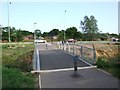
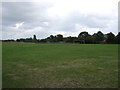
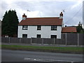
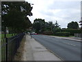
43 photos from this area
Area Information
Key information about the NR33 7ED including its size, population, and administrative classification.
- Area Type
- Postcode
- Area Size
- 6458 m²
- Population
- 1456
- Population Density
- 3135 people/km²
House Prices in NR33 7ED
17
Properties
£130,614
Average Sold Price
£36,750
Lowest Price
£255,000
Highest Price
Showing 17 properties
| Address | Type | Beds | Baths | Last Sale Price | Last Sale Date | |
|---|---|---|---|---|---|---|
| 32 Cranesbill Road, Lowestoft, NR33 7ED | Bungalow | 2 | 1 | £197,500 | May 2025 | |
| 26 Cranesbill Road, Lowestoft, NR33 7ED | Bungalow | 2 | 1 | £255,000 | Sep 2023 | |
| 42 Cranesbill Road, Lowestoft, NR33 7ED | Bungalow | - | - | £191,000 | Sep 2021 | |
| 44 Cranesbill Road, Lowestoft, NR33 7ED | Semi-detached | 2 | 1 | £175,000 | Jan 2020 | |
| 22 Cranesbill Road, Lowestoft, NR33 7ED | Bungalow | 3 | - | £185,000 | Nov 2016 | |
| 46 Cranesbill Road, Lowestoft, NR33 7ED | Bungalow | - | - | £112,000 | Nov 2010 | |
| 24 Cranesbill Road, Lowestoft, NR33 7ED | Bungalow | 2 | 1 | £62,139 | Dec 2003 | |
| 34 Cranesbill Road, Lowestoft, NR33 7ED | Detached | - | - | £45,000 | Nov 1998 | |
| 40 Cranesbill Road, Lowestoft, NR33 7ED | Detached | 2 | 1 | £36,750 | Sep 1997 | |
| 28 Cranesbill Road, Lowestoft, NR33 7ED | Detached | - | - | £46,750 | Apr 1996 |
Page 1 of 2
Energy Efficiency in NR33 7ED
Amenities
Schools
| Rank | School | Type | Entry gender | Ages |
|---|
Explore more schools in this area
Go to Schools tabDemographics
Household Size
Two person
most common
Accommodation Type
Houses
most common
Tenure
85
majority
Ethnic Group
White
most common
Religion
N/A
most common
Household Composition
N/A
most common
Age
47
median
Elderly (65+ years)
most common
Household Deprivation
N/A
with no deprivation
NS-SEC
23
in Lower managerial occupations
Explore more demographic insights in this area
Go to Demographics tabPlanning
Planning Constraints
- Flood RiskPremium
- Ramsar Wetland SitesPremium
- Area of Outstanding Natural BeautyPremium
- Protected Nature ReservePremium
- Protected WoodlandPremium