Area Overview for NR33 7AY
Photos of NR33 7AY

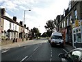
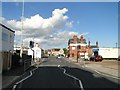

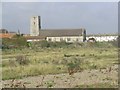
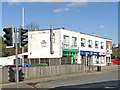
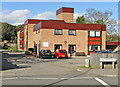
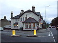
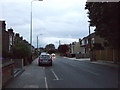

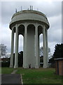

88 photos from this area
Area Information
Key information about the NR33 7AY including its size, population, and administrative classification.
- Area Type
- Postcode
- Area Size
- 6.3 hectares
- Population
- 1547
- Population Density
- 2276 people/km²
House Prices in NR33 7AY
32
Properties
£288,175
Average Sold Price
£115,000
Lowest Price
£525,000
Highest Price
Showing 32 properties
| Address | Type | Beds | Baths | Last Sale Price | Last Sale Date | |
|---|---|---|---|---|---|---|
| 5 Cliftonville Road, Lowestoft, NR33 7AY | Semi-detached | 3 | 1 | £325,000 | Feb 2024 | |
| 24 Cliftonville Road, Lowestoft, NR33 7AY | house | - | - | £433,500 | Feb 2023 | |
| 25 Cliftonville Road, Lowestoft, NR33 7AY | Retail | 4 | 1 | £425,000 | Apr 2022 | |
| Serenity House, 28 Cliftonville Road, Lowestoft, NR33 7AY | Detached | 4 | 3 | £525,000 | Oct 2020 | |
| 20 Cliftonville Road, Lowestoft, NR33 7AY | Detached | 3 | 2 | £435,000 | Aug 2020 | |
| St Julians, 13 Cliftonville Road, Lowestoft, NR33 7AY | Semi-detached | 3 | 1 | £285,000 | Feb 2020 | |
| 12 Cliftonville Road, Lowestoft, NR33 7AY | Detached | 3 | 1 | £333,000 | Oct 2017 | |
| 6 Cliftonville Road, Lowestoft, NR33 7AY | Detached | 3 | 3 | £357,000 | Mar 2017 | |
| 8 Cliftonville Road, Lowestoft, NR33 7AY | house | 4 | 1 | £317,500 | Mar 2017 | |
| 27A Cliftonville Road, Lowestoft, NR33 7AY | house | - | - | £229,000 | Jun 2015 |
Page 1 of 4
Energy Efficiency in NR33 7AY
Amenities
Schools
| Rank | School | Type | Entry gender | Ages |
|---|
Explore more schools in this area
Go to Schools tabDemographics
Household Size
Two person
most common
Accommodation Type
Houses
most common
Tenure
79
majority
Ethnic Group
White
most common
Religion
N/A
most common
Household Composition
N/A
most common
Age
47
median
Adults (30-64 years)
most common
Household Deprivation
N/A
with no deprivation
NS-SEC
28
in Lower managerial occupations
Explore more demographic insights in this area
Go to Demographics tabPlanning
Planning Constraints
- Flood RiskPremium
- Ramsar Wetland SitesPremium
- Area of Outstanding Natural BeautyPremium
- Protected Nature ReservePremium
- Protected WoodlandPremium