Area Overview for NR33 0HB
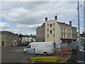
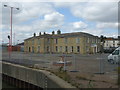
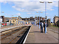
Photos of NR33 0HB

Area Information
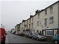
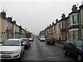
Living in NR33 0HB offers residency within a very specific residential cluster defined by postcode NR33 0HB. This small area covers just 3,708 square metres and houses a population of 1,408 residents. The density here is exceptionally high at 379,753 people per square kilometre, indicating a tightly packed living situation typical of urban cores or highly developed settlements. You will find that daily life centres around immediate proximity to neighbours and local infrastructure rather than expansive green spaces within the immediate boundaries. The character of this postcode is defined by its compact nature, where every household is relatively close to another. For those considering NR33 0HB, the environment is strictly residential with a focus on domestic living alongside essential infrastructure. The small footprint means that the area functions as a distinct pocket within the wider Norfolk network. You can expect a setting where practicality overrides spaciousness, and community interaction happens frequently due to the close quarters. The area serves as a concentrated node for the 1,408 people who call this specific cluster home, creating an atmosphere where local integration is natural given the small population size and limited physical space.
- Area Type
- Postcode
- Area Size
- 3708 m²
- Population
- 1408
- Population Density
- 8539 people/km²
The property market in NR33 0HB is defined by a clear preference for private ownership. With 51% of residents owning their homes, this area leans heavily towards an owner-occupied model rather than a rental landscape. This statistic signals a stable community where long-term investment is the norm, as the majority of households are either mortgage-free or have significant equity. You will find that the housing stock consists entirely of Houses, which caters to buyers seeking traditional domestic properties rather than flats or bungalows. Your options when looking at homes in NR33 0HB are limited by the small physical size of the postcode, covering only 3,708 square metres. This constraint means you must buy within a very specific, high-density cluster rather than searching across a broad suburb. The 100% presence of Houses suggests a market tailored to families or individuals who require single-family dwellings. For buyers entering the NR33 0HB market, the dominance of owner-occupation implies that homes here have often been lived in for years, potentially offering character rather than new-build efficiency. There is no rental sector data provided for this specific cluster, so the visible market is one of established ownership.
House Prices in NR33 0HB
Showing 15 properties
| Address | Type | Beds | Baths | Last Sale Price | Last Sale Date | |
|---|---|---|---|---|---|---|
| 13 Salisbury Road, Lowestoft, NR33 0HB | Terraced | 3 | 2 | £175,000 | Jun 2024 | |
| 10 Salisbury Road, Lowestoft, NR33 0HB | Terraced | 3 | 2 | £145,000 | Dec 2023 | |
| 5 Salisbury Road, Lowestoft, NR33 0HB | house | 3 | 1 | £154,000 | Apr 2022 | |
| 9 Salisbury Road, Lowestoft, NR33 0HB | house | - | - | £140,000 | Nov 2021 | |
| 8 Salisbury Road, Lowestoft, NR33 0HB | Terraced | 3 | 1 | £127,500 | Oct 2018 | |
| 4 Salisbury Road, Lowestoft, NR33 0HB | Terraced | 3 | 1 | £94,995 | Oct 2010 | |
| 15 Salisbury Road, Lowestoft, NR33 0HB | house | - | - | £118,000 | Aug 2007 | |
| 14 Salisbury Road, Lowestoft, NR33 0HB | Terraced | - | - | £70,000 | Sep 2003 | |
| 7 Salisbury Road, Lowestoft, NR33 0HB | house | - | - | £84,995 | Feb 2003 | |
| 12 Salisbury Road, Lowestoft, NR33 0HB | Terraced | 3 | - | £43,250 | Oct 2001 |
Energy Efficiency in NR33 0HB
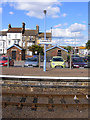
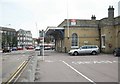
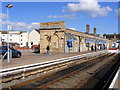
Your daily lifestyle in NR33 0HB is supported by a network of essential amenities located within practical reach. Retail options include Co-op Kirkley, Asda Lowestoft, and Iceland Lowestoft, providing access to groceries, household necessities, and larger supermarket shopping trips within a reasonable journey. Public transport is facilitated by five nearby rail connections, with Lowestoft Railway Station, Entrance, and Oulton Broad North Railway Station serving as key hubs for commuters. There is also one airport facility, Beccles Airport, offering additional air travel options for travel needs. Living in NR33 0HB means placing convenience first, as all these services are sufficiently close to avoid lengthy travel for routine tasks. The presence of major retailers like Asda and Co-op supports a self-sufficient lifestyle where you can manage shopping needs without ventures into distant centres. Rail access allows for easy connections to broader regions, making NR33 0HB viable for commuters who work outside the immediate vicinity. While the area itself is small at 3,708 square metres, the surrounding infrastructure ensures that daily life remains functional and connected. You will find that the balance of local housing and accessible external amenities creates a practical environment for everyday living.
Amenities
Schools
Families considering NR33 0HB have access to three primary educational institutions which serve the local community. Fen Park Community Primary School stands as a dedicated primary facility nearby. Kirkley Middle School also operates as a primary school for the region. Red Oak Primary School is the third option and holds a good Ofsted rating, indicating a standard of education recognised by the regulatory body. All three schools listed are primary level institutions, meaning there are no secondary schools or academies mentioned in this specific dataset for the immediate vicinity. This concentration of elementary schools suggests that many children in NR33 0HB will transition from local primary education to secondary schools outside this immediate postcode area. The presence of Red Oak Primary School, specifically noted for its good rating, provides a reliable educational foundation for local families. However, the absence of secondary education options in the provided list means residents must plan for school runs that extend beyond this small residential cluster. You are choosing homes in NR33 0HB with the knowledge that initial schooling will be local, but further education requires travel.
| Rank | School | Type | Entry gender | Ages |
|---|
Explore more schools in this area
Go to Schools tabDemographics
The community in NR33 0HB is mature and predominantly White, reflecting a settled residential history. The median age for residents is 47, which falls squarely within the Adults category spanning 30 to 64 years. This age profile suggests the population consists largely of established families, empty nesters, or career-focused individuals who have remained in the area for an extended period. Half of all residents, representing exactly 51%, own their homes outright or with a mortgage, indicating strong stability and a deep root in the locality. The accommodation stock is exclusively Houses, meaning you will not find flats or purpose-built apartment blocks within this specific postcode. This housing type aligns with the demographic tendency towards family living and long-term ownership. The ethnic makeup is overwhelmingly White, which contributes to a homogenous community dynamic. When you look at the 1,408 people who live here, the consistency in age and housing type creates a neighbourhood where residents share similar life stages and property commitments. This lack of diversity in housing form means the area caters specifically to those seeking standalone domestic properties rather than shared living arrangements.
Household Size
Accommodation Type
Tenure
Ethnic Group
Religion
Household Composition
Age
Household Deprivation
NS-SEC
Explore more demographic insights in this area
Go to Demographics tabPlanning
Planning Constraints
- Flood RiskPremium
- Ramsar Wetland SitesPremium
- Area of Outstanding Natural BeautyPremium
- Protected Nature ReservePremium
- Protected WoodlandPremium