Area Overview for NR32 2LT
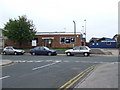
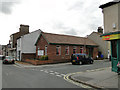
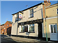
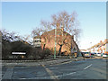
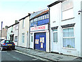
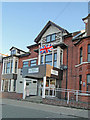
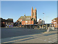
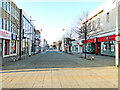
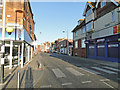
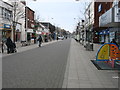
Photos of NR32 2LT


Area Information
NR32 2LT is a compact residential cluster covering 2.2 hectares with a population of 1,412. This postcode represents a specific, contained community where daily life revolves around immediate neighbours rather than distant suburbs. The area is situated in England, offering a setting defined by its small scale and density. With a population density of 63,660 people per square kilometre, the space is tightly packed, reflecting the nature of a residential cluster rather than a sprawling district. Living in NR32 2LT means engaging with a defined group of residents who share the same immediate environment. The area functions as a distinct unit within the wider Lowestoft region, separated from the broader city landscape by precise postal boundaries. You are buying into a specific slice of property that prioritises proximity over expansion. The high density suggests easy access to fellow residents but implies limited green space within the immediate postal zone. This postcode serves as the primary identifier for this small neighbourhood, ensuring that all infrastructure and services centre around these 1,412 households. The character of the area is shaped completely by these population figures and the physical constraints of the land.
- Area Type
- Postcode
- Area Size
- 2.2 hectares
- Population
- 1412
- Population Density
- 63660 people/km²
The property market in NR32 2LT is characterised by traditional housing stock with houses as the predominant accommodation type. With a home ownership rate of 54%, the area leans slightly towards owner-occupied households rather than being a pure rental estate. This balance means that while investors may find opportunities, most transactions involve people buying into homes where they intend to live. The 2.2-hectare size of the postcode dictates that there are limited listings available at any given time compared to larger urban postcodes. Buyers looking at NR32 2LT should anticipate a market where properties hold specific character rather than being part of a large-scale development scheme. The 54% ownership figure suggests that a significant portion of the housing stock is already committed to current families, which can stabilise prices but may reduce the volume of available sales. When viewing homes in NR32 2LT, you are evaluating a community where secure tenures are the norm. The density of 63,660 people per square kilometre indicates that land is valued highly, potentially influencing the price per square metre of the available houses.
House Prices in NR32 2LT
Showing 36 properties
| Address | Type | Beds | Baths | Last Sale Price | Last Sale Date | |
|---|---|---|---|---|---|---|
| 225 St Peters Street, Lowestoft, NR32 2LT | house | - | - | £99,500 | May 2025 | |
| 237 St Peters Street, Lowestoft, NR32 2LT | Semi-detached | 3 | 1 | £188,000 | Aug 2023 | |
| 227 St Peters Street, Lowestoft, NR32 2LT | Terraced | 2 | 1 | £138,000 | Apr 2023 | |
| 205 St Peters Street, Lowestoft, NR32 2LT | house | - | - | £113,000 | Jun 2021 | |
| 197 St Peters Street, Lowestoft, NR32 2LT | house | - | - | £67,000 | Apr 2021 | |
| 223 St Peters Street, Lowestoft, NR32 2LT | Terraced | 2 | 1 | £116,500 | Jan 2021 | |
| 191 St Peters Street, Lowestoft, NR32 2LT | Terraced | 2 | 1 | £125,000 | Nov 2020 | |
| 201 St Peters Street, Lowestoft, NR32 2LT | Terraced | - | - | £95,000 | Sep 2018 | |
| 189 St Peters Street, Lowestoft, NR32 2LT | house | - | - | £104,950 | Feb 2016 | |
| 181 St Peters Street, Lowestoft, NR32 2LT | house | 3 | - | £110,000 | Jan 2015 |
Energy Efficiency in NR32 2LT
Residents of NR32 2LT enjoy immediate access to key amenities within a short drive or walk. Retail options are well represented, with Iceland Lowestoft, Tesco Lowestoft, and M&S Lowestoft all located nearby. These supermarkets provide a convenient range of groceries and everyday essentials without requiring a long journey. There are five retail venues nearby, ensuring you can complete most shopping lists without leaving the region. Transportation links are equally accessible, with five rail connections available close to the area. Lowestoft Railway Station, Entrance, and Oulton Broad North Railway Station serve as your main gateways for rail travel. These stations facilitate daily commuting to wider parts of England and provide access to broader leisure destinations. The combination of major supermarkets and multiple railway stations creates a lifestyle where daily errands and weekly trips are manageable. You can shop at Tesco Lowestoft in the morning and catch a train from Lowestoft Railway Station in the afternoon. This integration of retail and transport makes living in NR32 2LT practical for those who value convenience.
Amenities
Schools
Families living in NR32 2LT have access to several primary schools within practical reach. St Margaret's Community Primary School serves the local community of children. The Harris Middle School also operates as a primary institution nearby. St Margaret's Primary Academy holds a 'good' Ofsted rating, confirming its quality for parents seeking an education that meets national standards. You will find three distinct primary options immediately surrounding the postcode area. The mix of schools includes multiple institutions named St Margaret's, suggesting either aschiedular name preservation or a local naming convention. There are no secondary schools listed in the immediate vicinity of NR32 2LT, meaning older children will require travel to find their education. Parents should plan ahead regarding transport logistics once their children outgrow these primary institutions. The presence of a school with a 'good' rating provides a reliable educational foundation for younger residents. When assessing schools near NR32 2LT, the data confirms a focus on primary education with verified quality standards at St Margaret's Primary Academy.
| Rank | School | Type | Entry gender | Ages |
|---|
Explore more schools in this area
Go to Schools tabDemographics
The community in NR32 2LT is dominated by adults between the ages of 30 and 64 years. This age range constitutes the most common demographic, indicating that families and settled workers form the core of the neighbourhood. Life onset statistics show a median age of 47, which suggests a population that has moved beyond early adulthood into established family life or retirement planning. There are no statistics provided for children or young adults under 16, meaning the area may see fewer young families actively settling down compared to zones with lower median ages. Home ownership stands at 54%, placing NR32 2LT just above the national average for property speculation and stability. This figure implies that nearly half of the residents own their homes outright, while the remaining residents are likely renting privately or through housing associations. The predominant ethnic group is White, reflecting a demographic homogeneity typical of many established postcodes in this region. Houses constitute the primary accommodation type, ruling out the possibility of finding flats or maisonettes within this specific cluster. The data paints a picture of an area defined by traditional family homes rather than high-density urban living. You should expect to encounter long-term residents who have chosen to downsize or settle permanently as the population ages.
Household Size
Accommodation Type
Tenure
Ethnic Group
Religion
Household Composition
Age
Household Deprivation
NS-SEC
Explore more demographic insights in this area
Go to Demographics tabPlanning
Planning Constraints
- Flood RiskPremium
- Ramsar Wetland SitesPremium
- Area of Outstanding Natural BeautyPremium
- Protected Nature ReservePremium
- Protected WoodlandPremium