Area Overview for NR32 1UB
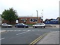
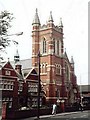
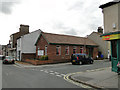
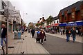
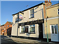
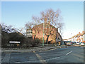
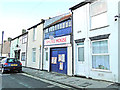
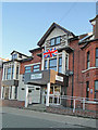
Photos of NR32 1UB
Area Information
Living in NR32 1UB means settling into a compact, densely populated residential cluster. This specific postcode covers a mere 2048 m², yet it contains a population of 1412 people. Such a high concentration suggests a built-up environment where residents live in close proximity to one another. The location is situated within England and serves as a defined residential zone rather than a sprawling suburb. Daily life here is characterised by the immediacy of neighbouring properties and the familiarity of a tight-knit local environment. The area attracts those seeking a defined address within a specific cluster rather than a broad neighbourhood with varying character zones. For anyone considering this spot, the reality is a focused living space where the boundaries of your immediate world are clearly defined by the postcode itself.
- Area Type
- Postcode
- Area Size
- 2048 m²
- Population
- 1412
- Population Density
- 7880 people/km²
The property market in NR32 1UB is defined by a dominance of houses and a mixed tenure structure. Houses are the primary accommodation type, suggesting traditional family dwellings or standalone homes suited to the local density. A total of 54% of residents are homeowners, which implies a market where ownership rather than renting is the norm for many occupants. Conversely, the remaining 46% likely rents or does not own their home, indicating a substantial private rental or second-home sector within this small footprint. Buyers looking at this postcode should anticipate a landscape of houses rather than apartment blocks. The high home ownership percentage often correlates with a stable investment area where properties change hands less frequently than in high-turnover rental districts. This mix offers opportunities for both first-time buyers seeking homes and landlords looking for house-specific rental demands.
House Prices in NR32 1UB
Showing 25 properties
| Address | Type | Beds | Baths | Last Sale Price | Last Sale Date | |
|---|---|---|---|---|---|---|
| 145 St Peters Street, Lowestoft, NR32 1UB | Terraced | 5 | - | £180,000 | Mar 2023 | |
| 151 St Peters Street, Lowestoft, NR32 1UB | Terraced | 3 | - | £138,000 | Aug 2022 | |
| 141 St Peters Street, Lowestoft, NR32 1UB | house | - | - | £220,000 | Nov 2020 | |
| 147 St Peters Street, Lowestoft, NR32 1UB | Terraced | 4 | 1 | £85,000 | May 2015 | |
| 149 St Peters Street, Lowestoft, NR32 1UB | house | - | - | £101,000 | May 2014 | |
| 153 St Peters Street, Lowestoft, NR32 1UB | Terraced | - | - | £34,000 | Aug 1997 | |
| Rear Of, 155 St Peters Street, Lowestoft, NR32 1UB | undefined | - | - | - | - | |
| Flat 3, 133 St Peters Street, Lowestoft, NR32 1UB | Flat | - | - | - | - | |
| Flat 7, 137 St Peters Street, Lowestoft, NR32 1UB | Flat | - | - | - | - | |
| Flat 1, 133 St Peters Street, Lowestoft, NR32 1UB | Flat | - | - | - | - |
Energy Efficiency in NR32 1UB
Residents of NR32 1UB enjoy convenient access to essential retail and transport hubs. Five major retailers operate within practical reach, including Tesco Lowestoft, Iceland Lowestoft, and M&S Lowestoft. These venues provide for all daily shopping needs from groceries to clothing without requiring a long journey. Transport links are robust, offering access to five railway points such as Lowestoft Railway Station and Entrance stations. This variety ensures flexibility in commuting patterns, whether travelling to Lowestoft town centre or beyond. The combination of these amenities creates a practical lifestyle where daily errands and work commutes are manageable. Living here involves a straightforward relationship with local town centres and national retail chains. The focus remains on utility and accessibility rather than exclusive leisure destinations or dense urban nightlife.
Amenities
Schools
Primary and secondary education options for residents of NR32 1UB are limited to three specific primary institutions. St Margaret's Community Primary School is available to families in the immediate catchment. The Harris Middle School also operates as a primary provider within close reach. St Margaret's Primary Academy offers another choice, distinguished by its Ofsted rating of good, which validates its educational standards. There are no secondary schools listed in the immediate vicinity of this postcode, meaning older pupils would likely need to travel for high school education. The presence of these primary academies supports young families who can access local education without long commutes. The variety of names suggests a choice between community-run or academy structures, giving families different educational philosophies to consider when placing children in the local system.
| Rank | School | Type | Entry gender | Ages |
|---|
Explore more schools in this area
Go to Schools tabDemographics
The demographic profile of NR32 1UB reveals a mature and stable community. The median age stands at 47 years, with the most common age range falling between 30 and 64 years of age. This indicates a household composition likely to include families with older children or couples without young dependents. Ethnic diversity shows that the predominant group is White, aligning with broader regional patterns. Home ownership is a significant feature of this community, with 54% of residents owning their properties outright or with a mortgage. The vast majority of homes are houses, meaning there is a distinct lack of flats or high-rise apartments in this specific cluster. These figures paint a picture of a settled area where long-term residents have established roots rather than a transit point for short-term renters.
Household Size
Accommodation Type
Tenure
Ethnic Group
Religion
Household Composition
Age
Household Deprivation
NS-SEC
Explore more demographic insights in this area
Go to Demographics tabPlanning
Planning Constraints
- Flood RiskPremium
- Ramsar Wetland SitesPremium
- Area of Outstanding Natural BeautyPremium
- Protected Nature ReservePremium
- Protected WoodlandPremium