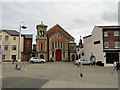
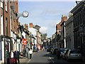
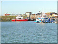
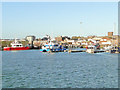
Area Overview for NR32 1HL
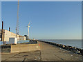
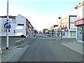
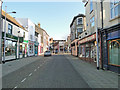
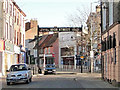
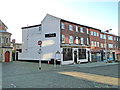
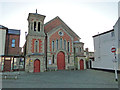
Photos of NR32 1HL


Area Information
Living in the NR32 1HL postcode cluster offers a specific residential experience defined by its compact footprint and high density. This area covers a small stretch of land measuring 919 square metres, yet it supports a population of 1,892 people. When you compare the figures, the population density reaches an extraordinary 2,059,774 people per square kilometre. This indicates a very concentrated cluster of housing where residents live in close proximity to one another. You will find that this neighbourhood functions as a tight-knit unit within the wider Lowestoft region. The sheer size of the resident population relative to the land area suggests that daily life revolves around the immediate surroundings. There are no large open spaces or sprawling suburbs within these specific boundaries. Instead, the character of NR32 1HL is shaped by maximising the use of available ground on a small scale. Residents rely heavily on local services and neighbouring clusters for their needs. The area represents a specific slice of the town where space is at a premium. Understanding this density is crucial for anyone considering homes in this specific postcode.
- Area Type
- Postcode
- Area Size
- 919 m²
- Population
- 1892
- Population Density
- 2059774 people/km²
Your options for purchasing property in NR32 1HL are heavily influenced by the high proportion of rental housing. With only 16% of houses owned, the area functions primarily as a rental hub. The stock is predominantly composed of flats, which differs significantly from areas where terraced Victorian homes or detached bungalows sit on individual plots. This concentration of flats means you should expect to find multi-unit buildings rather than single-family properties when browsing homes in this postcode. The scarcity of owner-occupied homes suggests that investment properties make up a large share of the total housing stock. You may encounter landlords managing several units or individual investors seeking a steady return from this dense cluster. If you are a first-time buyer looking in NR32 1HL, you are likely to rent rather than buy given the low ownership rate. However, the flat-based inventory offers a specific lifestyle with shared walls and communal areas. This market structure means prices might remain competitive for investors, but capital growth could be tied to rental yields rather than resale values of individual bricks and mortar.
House Prices in NR32 1HL
Showing 10 properties
| Address | Type | Beds | Baths | Last Sale Price | Last Sale Date | |
|---|---|---|---|---|---|---|
| Flat 8, Logun Court, Gun Lane, Lowestoft, NR32 1HL | Flat | 2 | 1 | - | - | |
| Flat 3, Logun Court, Gun Lane, Lowestoft, NR32 1HL | Flat | - | - | - | - | |
| Flat 2, Logun Court, Gun Lane, Lowestoft, NR32 1HL | Flat | - | - | - | - | |
| Flat 1, Logun Court, Gun Lane, Lowestoft, NR32 1HL | Flat | - | - | - | - | |
| Flat 6, Logun Court, Gun Lane, Lowestoft, NR32 1HL | Flat | 2 | - | - | - | |
| Flat 5, Logun Court, Gun Lane, Lowestoft, NR32 1HL | Flat | 2 | 1 | - | - | |
| Flat 9, Logun Court, Gun Lane, Lowestoft, NR32 1HL | Flat | - | - | - | - | |
| Flat 7, Logun Court, Gun Lane, Lowestoft, NR32 1HL | Flat | - | - | - | - | |
| Flat 4, Logun Court, Gun Lane, Lowestoft, NR32 1HL | Flat | 1 | - | - | - | |
| Flat 10, Logun Court, Gun Lane, Lowestoft, NR32 1HL | Flat | 2 | 1 | - | - |
Energy Efficiency in NR32 1HL
Your daily life in NR32 1HL is facilitated by a convenient array of amenities located just outside the immediate cluster. You have access to five retail locations, including Tesco Lowestoft, Iceland Lowestoft, and M&S Lowestoft for your grocery and shopping needs. The area also benefits from five nearby railway connections, such as Entrance, Lowestoft Railway Station, and Oulton Broad North Railway Station. These stations provide the primary method for getting around Shouldford or travelling further afield. When you plan your weekly shop or commute, these specific venues are within practical reach. The presence of these major retailers ensures you can stock up on essentials without a long car journey. The rail links offer a direct route to the town centre and beyond. You do not need to travel far for basic necessities or to catch a train. This integration of retail and rail transport means the area functions efficiently as a residential base for commuters and shoppers alike.
Amenities
Schools
Families living in NR32 1HL have access to the Anglican Academy of Arts, which stands as the primary educational institution listed for this specific postcode. This is an independent school, offering a distinct alternative to the state sector. While the data confirms the presence of this facility, the location suggests that residents rely on local independent provision for their children's education. You do not have a broad mix of comprehensive schools or academies within the immediate vicinity based on the provided information. Parents considering schools near NR32 1HL need to factor in the distance to this independent option, which may involve a commute for younger students. The choice of an independent setting implies a different curriculum and fee structure compared to local state schools. There is no data on other state primary or secondary institutions in the immediate coverage area, so the Anglican Academy of Arts remains the clear focal point for education. Families often look at the broader Lowestoft area for more schooling options, but this specific postcode is defined by proximity to this single named institution.
| Rank | School | Type | Entry gender | Ages |
|---|
Explore more schools in this area
Go to Schools tabDemographics
The community in NR32 1HL has a distinct demographic profile focused on middle-aged adults. The median age for residents is 47 years, and the most common age range spans from 30 to 64 years old. This indicates that the area attracts families with children who have moved away or professionals nearing the end of their working lives. Currently, 16% of households in this location own their homes outright, meaning you are looking at a market dominated by tenants. The predominant form of accommodation consists of flats, which aligns with the high-density nature of the cluster. While White residents make up the predominant ethnic group within this specific tree, the data confirms other groups reside here as well. The combination of flat-based living and a significant rental proportion (84% if 16% own) creates a environment typical of urban infill developments. This age structure suggests a stable community where long-term residents form the backbone. You will find that the population relies on services suitable for adults and families rather than younger students. The demographic makeup ensures that the local amenities cater to established households rather than transient populations.
Household Size
Accommodation Type
Tenure
Ethnic Group
Religion
Household Composition
Age
Household Deprivation
NS-SEC
Explore more demographic insights in this area
Go to Demographics tabPlanning
Planning Constraints
- Flood RiskPremium
- Ramsar Wetland SitesPremium
- Area of Outstanding Natural BeautyPremium
- Protected Nature ReservePremium
- Protected WoodlandPremium