Area Overview for NR32 1JD
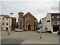
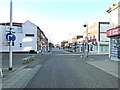
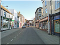
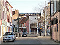
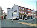
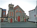
Photos of NR32 1JD


Area Information
NR32 1JD is a specific postcode area centred in Lowestoft, England. It comprises a small residential cluster within a settlement of 1892 people. This compact footprint defines a close-knit environment where neighbours likely know one another. The area serves as a practical residential hub rather than a sprawling district. It offers immediate access to the town centre while maintaining a contained scale. Residents appreciate the proximity to key local services without needing a long daily commute. You will find this specific location appeals to those who prefer a defined community over a vast urban sprawl. The population density and small size mean that local facilities are distributed efficiently. Public transport links and retail outlets are all within walking or cycling distance. Living in NR32 1JD means experiencing a functional part of Lowestoft that gets the basics right. The area avoids unnecessary complexity, focusing instead on straightforward access to home and work. Its distinct identity comes from being a residential pocket nestled near major transport arteries. You gain a residence that is integrated into the wider town but retains its own character. This postcode represents a pragmatic choice for those seeking simplicity and direct connectivity.
- Area Type
- Postcode
- Area Size
- Not available
- Population
- 1892
- Population Density
- Not available
The property market in NR32 1JD is defined by a 16% home ownership rate. This low figure signals a predominantly rental sector where tenants occupy the majority of the housing stock. Flats dominate the local housing typology, indicating a design focus on efficient urban living spaces rather than detached family homes. You will find few houses and large gardens within this specific postcode. The market caters primarily to renters seeking hassle-free accommodation without the burden of maintenance or mortgages. For buyers in the immediate surroundings, this suggests a mix of second-hand flats and purpose-built rental developments. The concentration of flats points to an area favoured by couples, singles, and small households who prioritise convenience over space. Residents here experience a monthly tenancy model rather than long-term property equity building. This market structure means supply is driven by investor portfolios and local housing associations rather than owner-occupier transactions. When considering homes in NR32 1JD, expect open-plan living and compact storage solutions typical of flat architecture. The area suits professionals and those moving from the countryside who prefer low-maintenance interiors. Ownership scarcity may drive higher rental yields for investors, but it limits the choice for buyers wanting a traditional garden home. The housing stock remains consistent with the demographic reality of a mature, mobile, and tenant-heavy locality.
House Prices in NR32 1JD
No properties found in this postcode.
Energy Efficiency in NR32 1JD
Daily life in NR32 1JD centres around practical access to essential retail and transport hubs. Five retail venues operate within practical reach, including Tesco Lowestoft, Iceland Lowestoft, and M&S Lowestoft. You can purchase fresh groceries, household goods, and clothing without needing a car for routine errands. These major chains anchor the local economy and provide consistent service standards. Transport links are equally accessible, with five railway stations nearby. The closest options are Lowestoft Railway Station, Entrance, and Oulton Broad North Railway Station. Commuters can reach London and surrounding regions quickly from this residential cluster. You do not need a personal vehicle to get to work or leisure activities. Dining options and shopping complexes are integrated into the town centre facilities mentioned above. This connectivity makes NR32 1JD a viable base for remote workers who also need to leave the house occasionally. The combination of indoor retail and rail access creates a self-sufficient urban lifestyle. Residents benefit from reduced travel time and increased flexibility in their weekly schedules.
Amenities
Schools
Education options near NR32 1JD are anchored by the Anglican Academy of Arts. This independent school offers secondary education for families seeking a faith-based curriculum and private tuition outside the state system. No state-maintained primary or secondary schools are listed within the immediate reach of this postcode. The presence of an independent school indicates a demand for alternative educational philosophies or a desire for smaller class sizes. Families with children will likely need to travel to nearby towns for comprehensive state school choices. The school mix is limited, reflecting the small population size of 1892 people in this cluster. You must verify travel times to other educational institutions if the Anglican Academy does not suit your needs. Parents considering this area should factor commute times into their lifestyle planning. The availability of one named institution suggests a reliance on external educational infrastructure for primary education. Local amenities do not include a comprehensive school within walking distance for younger children. This educational landscape requires proactive planning for your children's academic and social development.
| Rank | School | Type | Entry gender | Ages |
|---|
Explore more schools in this area
Go to Schools tabDemographics
The community profile in NR32 1JD reflects a mature household structure with a median age of 47 years. Most residents fall into the 30 to 64 year age range, indicating a population of working adults and families in their prime earning years. Home ownership stands at a regulated 16%, meaning the vast majority of accommodation is let rather than owned. This high rental proportion suggests the area attracts tenants who value flexibility or are navigating the property ladder. Flats serve as the predominant form of accommodation, suiting compact lifestyles and urban living preferences. White residents form the largest ethnic group within this demographic mix. These statistics outline a neighbourhood characterised by established, likely professional, renters rather than a traditional owner-occupied family suburb. A median age of 47 implies residents are past the teen years and establishing long-term routines. The low ownership rate means fewer homeowners compared to detached house suburbs. You are buying into a market where landlords hold significant sway over tenant selection and property management. The accommodation type aligns with the age profile, offering single-storey solutions for older adults or compact living for younger professionals. This demographic snapshot reveals a stable, adult-focused community centred on rental stability rather than property investment.
Household Size
Accommodation Type
Tenure
Ethnic Group
Religion
Household Composition
Age
Household Deprivation
NS-SEC
Explore more demographic insights in this area
Go to Demographics tabPlanning
Planning Constraints
- Flood RiskPremium
- Ramsar Wetland SitesPremium
- Area of Outstanding Natural BeautyPremium
- Protected Nature ReservePremium
- Protected WoodlandPremium